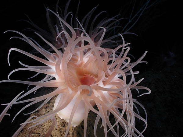
View a slide show of images from the Expedition to the Deep Slope 2007. This exploration discovered what may be new marine species in one of the world's most biologically diverse regions.
![]() Click
image to view a slide show.
Click
image to view a slide show.
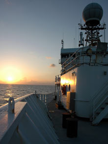
A beautiful sunset reflects off the NOAA research vessel Ronald H. Brown.
Mission Summary
Bob Carney
Louisiana State University
The Expedition to the Deep Slope 2007 completed exploration begun during the 2006 Deep Slope cruise . Spending a month at sea on NOAA’s research vessel (R/V) Ronald H. Brown, the explorers carried out extensive investigations using the remotely operated vehicle (ROV) Jason to revisit known sites and explore never-before visited locations. While each team of investigators sought answers to many specific questions, the central theme of the expedition was to discover and better understand special deep habitats where geology and biology interact to create atypical sea-floor ecologies.
The extreme likelihood of finding new sea-floor habitats in the Gulf of Mexico is a consequence of an unusual history. The slopes of the North American continent within the United States EEZ (exclusive economic zone) contain examples of almost every type of continental margin. This diversity of form and geological process provides ocean scientists with many opportunities to discover and to understand habitats in which biology and geology interact in unanticipated ways. The slope of the Gulf of Mexico is unique within our EEZ. Increasingly industrialized by the offshore oil and gas industry, the Gulf is an ancient basin.
Of particular interest to the explorers on the Deep Slope expedition is the unusually thick layer of sediments in the northern Gulf. Contained within these layers is the history of erosion and river transport from the Appalachians, the Rockies, and smaller mountain ranges formed and worn away on the North American continent. Also within these layers are oil and methane gas arising from the high primary productivity in the ancient Gulf. Rather than simply being trapped, these hydrocarbons and other chemicals (normally locked deep within formations) actively seep to and through the sea floor along faults caused by movements of a thick layer of mineral salt, deposited early in the Gulf’s complex history. At these sites of seepage a unique biota develops in response to the unique geochemistry.
The pace and mode of operations centering around the ROV Jason ![]()
![]() proved quite different than the 2006 experience with a human-occupied vehicle (HOV), the submersible Alvin
proved quite different than the 2006 experience with a human-occupied vehicle (HOV), the submersible Alvin ![]()
![]() . Gone were the morning launch, afternoon recovery, and extensive briefings, when each scientist tried to communicate his or her highest-priority needs to the three people who would actually make the dive. In contrast, the unmanned Jason is lowered to the sea floor, where it can operate for days without resurfacing. Shifts of three Jason crew members attend to all the operational details, while scientists take turns logging activities or carrying out specific tasks one after the other around the clock. This all takes place in a control van strapped to the deck of the R/V Ronald Brown. Illuminated only by the light of instruments and monitors, up to ten people would crowd into the heavily air-conditioned room to watch progress over the sea floor.
. Gone were the morning launch, afternoon recovery, and extensive briefings, when each scientist tried to communicate his or her highest-priority needs to the three people who would actually make the dive. In contrast, the unmanned Jason is lowered to the sea floor, where it can operate for days without resurfacing. Shifts of three Jason crew members attend to all the operational details, while scientists take turns logging activities or carrying out specific tasks one after the other around the clock. This all takes place in a control van strapped to the deck of the R/V Ronald Brown. Illuminated only by the light of instruments and monitors, up to ten people would crowd into the heavily air-conditioned room to watch progress over the sea floor.
Beginning June 7, 15 successful Jason descents were executed with a maximum duration of 42 hours and 41 minutes. Ten separate areas were explored, with the shallowest at 1,014 meters (m) and the deepest at 2,750 m. The tasks executed on most descents included an initial acoustic mapping of the sea floor to define the area of investigation, sediment sampling, faunal sampling, imaging surveying, and detection of dissolved chemicals with an underwater mass spectrometer. Analysis of these samples will require up to two years in the labs of the explorers. When final results emerge, we will have the most detailed description ever developed of chemosynthetic communities from east to west and from upper slope to abyss.
While final results will require time to develop, we can already be certain about a few things. Our methods of exploration have proven sound. Especially effective is the targeting of general deployment areas in advance based on the examination of seismic survey data collected by the offshore industry and archived by the Minerals Management Service. All seeps have a distinct seismic signature. Once in a target area, initial bathymetric survey using the Jason's acoustic systems enabled us to develop high-resolution sea-floor maps. These required several hours of bottom time and data analysis, but they provided an invaluable guide to subsequent bottom activities. We were also successful in adjusting our shipboard lab work to accommodate Jason's schedule, through the use of elevators which brought samples to the surface for timely analyses. This was especially important for the microbiologists who had to work for many hours on the freshest of samples.
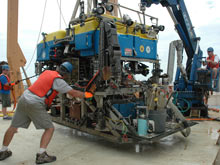
Jason team members James Pelowski, Casey Agee, and Alberto Collasius position the ROV in preparation for launch.
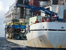
During launch operations, the Jason team gently lowers the ROV into the Gulf of Mexico.
An added benefit of ROV exploration is that time on bottom is less rushed, allowing scientists time to observe the sea floor between and around the targeted seep communities. This lets us better understand how the combined seep and normal slope systems interact rather than take a myopic view of seeps alone. Using the analytical tool of stable isotope analysis, following laboratory analysis of samples, we will better understand who eats whom within the communities. We will also be able to determine if the chemosynthetic production of seeps provides a significant source of food to the more typical deep-sea fauna of the surrounding slope. Based on initial observations, we see little suggestion of heavy utilization of seep production, but lab analyses will tell the full story. We were also able to reexamine dense populations of sea urchins found in association with seeps. First noted during explorations at the Blake Ridge seeps in the Atlantic, it is anticipated that observations in two years will help explain the origins and persistence of these animals.
Of special interest among non-chemosynthetic fauna on the continental slope are aggregations of various types of sessile (attached to a base), suspension-feeding corals. Their existence is somewhat problematic since few suspension-feeding animals subsist in the deep sea, where food is quite scarce and the hardbottoms needed for attachment are rare. Off the southeastern states, explorations have shown deep coral assemblages to be relatively common. So far, exploration of the northern Gulf of Mexico has found them to be present but less common. Below 1,500 m they have been rarely encountered even though hard substrates are present.
Hydrocarbons in nature, as well as in industrial chemistry, come in many forms and formulations. Gases such as methane contain one, or just a few, carbon atoms. At the other extreme of carbon numbers are thick dark solids commonly referred to as asphalt. It was discovered about 50 years ago that large deposits of asphalt exist as mounds in the deepest part of the Gulf of Mexico, the Sigsbee Abyssal Plain. More recently, it has been determined that chemosynthetic fauna is associated with some of these mounds. Therefore, it was especially interesting that lumps of asphalt were found at Garden Bank 647. These were small enough to be picked up by Jason but did not support chemosynthetic fauna. Found at a depth of only 1,014 m, this discovery seriously challenges speculation that superheated water at much greater depth is needed to create the formations. As with brines, our new results force us to rethink the processes that produce all types of hydrocarbons on the sea floor.
Because of the large size and mobility of the LuAnn salt sheet, it is relatively common to find brine on the sea floor. There are probably several mechanisms which create this water with very high concentrations of salt, but the easiest to envision is the dissolution of the salt layer when in contact with normal seawater. The resulting solution is so dense that it mixes into the overlying ocean water very slowly. We encountered brine in so many different situations during our Jason deployments that we will be forced to reconsider our preconceptions. Especially interesting was an apparent brine-filled crater, approximately 150 m in diameter, at a site designated as Alaminos Canyon 601. This distinct feature supported a large mussel community and had the coloration found in other brine pools. After exploring it extensively, we were quite surprised to find far more mud in the crater than brine, when we tried to take a water sample . Quite possibly, this crater had experienced a recent breech in its wall, allowing the brine to escape. Brine systems, it seems, can be quite transient.
The at-sea component of the Deep Slope explorations is now complete. The 11 student participants will complete analyses in the coming months, ponder the results, and possibly devote their careers to wider exploration and greater understanding. The eight more established investigators will fit their experiences and greater understanding into their careers. Looking back to first experiences in the deep sea nearly a half century ago, some scientists will have to adjust long-held ideas. Others, looking forward to beginning careers that will span another half century, will be forming new ideas about the workings of the deep.


