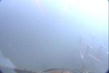
Without sonar and navigation, the remotely operated vehicle (ROV) pilots would have been lost in the dense "fog." Click image for larger view and image credit.
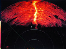
Scanning sonar return picked up this feature, which we later discovered to be the channel carved out by the "river of mud." The sonar "saw" the feature long before it was visible on the video monitors. Click image for larger view and image credit.
Adventures in Mud
June 17, 2007
Harry Roberts
Louisiana State University
27° 18.97 N
92° 6.30 W
![]() Observe push-core sample collection of the fluidized sediment scientists discovered racing through the "mud river" channel. (Quicktime, 1.8 Mb.)
Observe push-core sample collection of the fluidized sediment scientists discovered racing through the "mud river" channel. (Quicktime, 1.8 Mb.)
![]() See what happens when geologic pressure drives gas, super-salty brine, and liquefied mud out through vents in the sea floor to form mud volcanoes. (Quicktime, 1.8 Mb.)
See what happens when geologic pressure drives gas, super-salty brine, and liquefied mud out through vents in the sea floor to form mud volcanoes. (Quicktime, 1.8 Mb.)
![]() Dives at Garden Banks 697 found the scientists engulfed in thick clouds of sediment. This let them know that something unusual was happening. (Quicktime, 1.5 Mb.)
Dives at Garden Banks 697 found the scientists engulfed in thick clouds of sediment. This let them know that something unusual was happening. (Quicktime, 1.5 Mb.)
The new sites within Garden Banks Block 697 (GB 697) have just proven themselves as important sampling locations for exploring Gulf of Mexico depth ranges for both tubeworms and mussels. Impressive collections of both were made at the primary area of interest as determined from surface reflectivity patterns derived from three-dimensional (3-D) seismic data. These reflectivity anomalies were the basis for last year’s success in finding chemosynthetic communities with the deep submergence vessel Alvin, and in finding new sites this year with the Jason remotely operated vehicle (ROV).
After exploring the primary area in GB 697, we started traveling in a southeasterly direction toward our second anomaly, when we were suddenly engulfed in a cloud of suspended sediment. The cloud became so thick that we could hardly see the core tubes and other pieces of equipment on the basket in front of the ROV. Jason can stir up clouds of sediment when it passes close to the sea floor, but this time it became evident very quickly that the sediment cloud engulfing the ROV was not of our own making. We knew that active venting was taking place in the area.
We set out to find the vent by running a search pattern. There was a slight current so our strategy was to "fly" up-current until we were out of the cloud. Once out, we would travel along the edge of the cloud until we found the vent. We flew and flew, but we could never seem to get out of the cloud. During this search Jason’s forward-looking sonar picked up a strange looking linear feature, but the cloud was so thick that we could not see the sea floor. Later, we realized this was a channel eroded by the fluidized mud being forced out at the venting site.
As a final attempt to find the vent, we rose above the sediment cloud and started tracing the plume back to its source. The linear feature popped up again on the sonar and we drove straight toward it. When we arrived we were shocked. It looked like an incised channel with a fast-running "river of mud." The “river” was carrying fluidized sediment that swirled as if it were flowing over “rapids.” On the bottom of the channel were “sand waves” as one would see in a real river channel. We turned and traveled up-channel until we encountered the source of the flow. The venting area was a pit several meters in diameter with distinct bubble trains issuing from the central part. In addition, fluidized mud was being extruded from the vent into the channel that carried the dense fluid downslope.
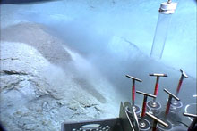
After shaking out one of the push cores, which had been used earlier in the dive, the ROV Jason prepares to take a core in the middle of the channel. Click image for larger view and image credit.
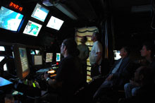
The control van is usually pretty quiet right around midnight, but not tonight. Word quickly spread through the science party that the Jason group had discovered the mud vent. Click image for larger view and image credit.
Although a small amount of sediment was being entrained in the water column by the escaping gas, the sediment cloud was not being formed at the vent site but in the channel and downslope at the “river mouth,” where the fluidized sediment spread into a sheet. We had traveled over this smooth mud bottom while trying to find the vent.
Since we had already used all of the push cores earlier in the dive, we had no way to sample the fluidized sediment racing through the channel. A decision was made to sacrifice the contents of one core and use the empty tube to sample the flowing sediments. Once back on the ship, we made a preliminary analysis of the core pore-fluids that indicated that the sediment in the flow was suspended in a dense brine many times the salinity of normal sea water. The brine and entrained sediment created a muddy slurry, much denser than normal seawater. The increased density caused the slurry to flow downslope, eroding a channel in the side of the mound.
Of all the sites we had visited to this point in our cruise, the “mud river” drew the most attention from both the scientific and technical personnel onboard the research vessel Ronald H. Brown. The ROV control van was packed to capacity with people experiencing the excitement of observing this unusual deep-water process that was changing the modern sea floor. The thrill of discovering new things about the deep marine environment is the reason most of us are in this business. We are the first humans to ever view this interesting area, and we will not soon forget it.


