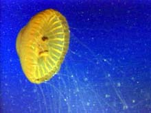
As we journeyed between sonar targets on ROPOS Dive R597 (its second dive of the expedition), a brilliant jellyfish (Poralia) drifted by with long tentacles undulating. Click image for larger view.
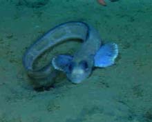
An unknown species of eelpout nestles in the soft sediments, its preferred habitat, in the bottom of Astoria Canyon. Click image for larger view.
Brittle Stars, Soft Sediments, and an Ocean Buffet
June 29, 2001
Jeff Goodrich, Teacher-at-sea
Earth Science Teacher
Lake Oswego High School
Lake Oswego Oregon
and
Susan Merle, Geological Research Assistant
CIMRS Program, Oregon State University
Vents Program, Pacific Marine Environmental Laboratory, NOAA
The good weather continued throughout the day. The remotely operated vehicle (ROV) ROPOS surfaced after its second dive along a tributary on the south side of the canyon wall. The purpose of the dive was to explore four highly reflective sonar targets that showed up on the sidescan sonar data. Chief geologist Dr. Bob Embley expected to see more consolidated material, such as sandstone, at the targets. Upon arriving at the sites, however, ROPOS found mounds covered with brittle stars, and, probing further with its claw, revealed soft sediment. Perhaps a harder interior had been blanketed and, although not revealed to ROPOS, might still be the source of the bright images on the sidescan data. Samples brought up from the dive were gathered, identified and preserved for further analysis.
Pacific white-sided dolphins, risso dolphins, fur seals and some king salmon were seen in a feeding frenzy this morning and again this afternoon. The marine mammal's prey showed up on Jackie Popp's acoustic profile printout, but were initially left unidentified. The profile also revealed a euphasid (krill) layer 175 m below the surface, a fish layer at 250-350 m, and another fish layer from 400-500 m. The team decided that the porpoises were feeding in an upwelling area in the canyon. This process brings cold, nutrient-rich bottom water toward the surface, resulting in high rates of productivity and an "oceanic buffet" for marine mammals.
The fishing vessel Sea Eagle rendezvoused with us again this afternoon. Danny Parker, the captain, and Bob Emmett, a fisheries biologist, transferred via a small boat to the NOAA Ship Ron Brown. Mr. Parker informed us that during the last few days he had observed the porpoises feeding on what he believed were herring. Mr. Emmett mentioned that large numbers of sardines have been caught farther offshore.
ROPOS is currently being deployed for its third dive along the southern canyon wall. Everyone is excited about what lurks below, as each dive thus far has revealed fascinating creatures and interesting geologic formations within the canyon.
Read the following interview with Chris Goldfinger, of Oregon State University, for a marine geologist's perspective of Astoria Canyon.
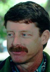
Chris Goldfinger, a marine geologist at Oregon State University.
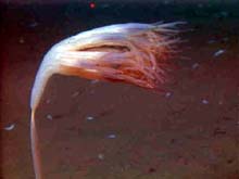
This beautiful example of an octocoral invertebrate is attached to substrate on the sea floor and filter feeding in the strong currents that flow through Astoria Canyon. Click images for larger view.
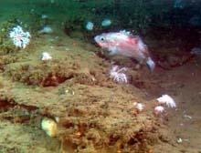
Waldo Wakefield and Mary Yoklavich, the expedition's fish experts (icthyologists), are conferring on whether this individual rockfish is an aurora or a splitnose, two of the more common species on the upper canyon wall. They typically occur in or near rocky habitat. Click image for a larger view.
Interview with Chris Goldfinger
Marine Geologist, Oregon State University
Ocean Explorer Team: What were you working on during the previous cruise to Astoria Canyon a couple of weeks ago?
Chris Goldfinger: We came out on a smaller vessel that had a high-resolution multibeam sonar system and a deep-towed sidescan sonar to map Astoria Canyon.
Ocean Explorer Team: How are submarine canyons, such as the Astoria Canyon, formed?
Chris Goldfinger: Usually, they are formed by extremely strong turbidity (sediment-laden) currents that flow downhill and cut the canyon. The same processes you see on land also occur underwater, just a little slower. Turbidity currents underwater are just like floods on land. Downcutting continues slowly, then a flood comes along and lots of cutting occurs. It's sort of a slow process interrupted and accelerated by catastrophic events. You can often show submarine canyon bathymetry data to someone who doesn't know the data was gathered underwater, and the person will think the canyon is on land.
Ocean Explorer Team: Besides mapping, what other work are you doing in the canyon?
Chris Goldfinger: We're learning a lot about the canyon just from looking at the morphology, the imagery. I'm taking geologic core samples that might help determine the ground acceleration that this area experiences when there is a big earthquake. This area has magnitude-nine earthquakes every 600 yrs, on average. Many of the slump deposits we see along the rim were released in those earthquakes and some of them were released during the last earthquake, some 300 yrs ago, around 1700. Another earthquake had occurred 800-900 yrs prior to that. So one thing we want to do with the morphology is find the freshest landslides we can, go there, and take core samples. In these samples, we should be able to tell the difference between the turbidites (sediment particles) from 300 yrs ago and all the rest. In 1999, we collected 102 turbidite cores along the entire Cascadia Margin, in all of the submarine channels from Vancouver Island to California. We correlated all of those cores, and we think we know the earthquake record for the whole margin. Phenomenally, the Cascadia Subduction Zone ruptures along its entire 800-mi length all at once!
One of the great things about this expediton is that we can try things that are a bit riskier than normal. It's more like a NASA mission that way. We get to try something that might not get funded, might be a long shot, or might not work at all. But then, it might work really well. That's sort of the theme of the cruise; trying some new things. We're pushing the envelope just a little bit.
Sign up for the Ocean Explorer E-mail Update List.


