Beyond the Blue: Papahānaumokuākea Mapping
(EX2403, EX2404, EX2501)
Lia Kim’s Daily Reflection Log Aboard NOAA Ship Okeanos Explorer
Lia Kim was the 2024 science communication Explorer-in-Training for the Beyond the Blue: Papahānaumokuākea Mapping 1 expedition. Join her throughout her adventure!
Day Nineteen
Okeanos Explorer was now docked at Pearl Harbor and the expedition has come to an end. Pulling into port is a slow process and many crew members were up early as we pulled into port early in the morning which made the night before feel extra quiet. Even when we made it to port, it would be some time before we would be able to step off the ship
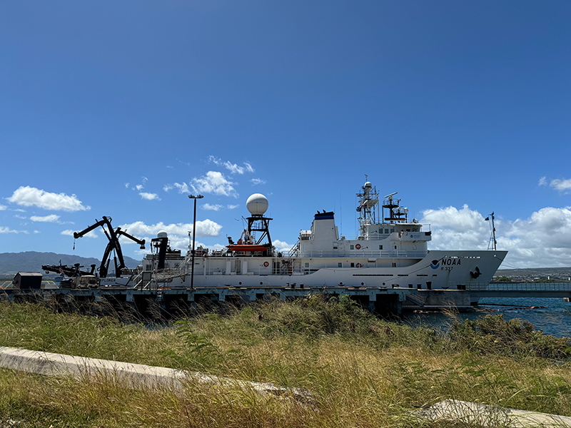
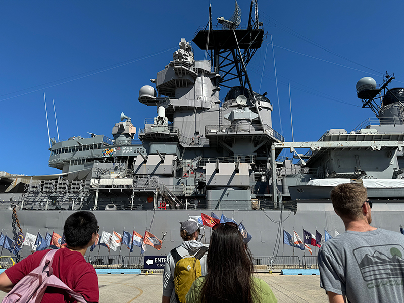
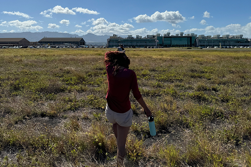
We spotted the famous turtle that hangs around the port before deciding to explore Ford Island and visited some of the historical monuments that were just down the road. We were warned of having “ship rock” when stepping onto land for the first time in weeks and some of us were definitely swaying while walking around Ford Island.
My adventure in Hawaiʻi ended with visiting Kailua Beach with some of the junior officers and other interns. Back at the ship, we watched Moana again in the forward lounge before some people left for home.
Day Eighteen
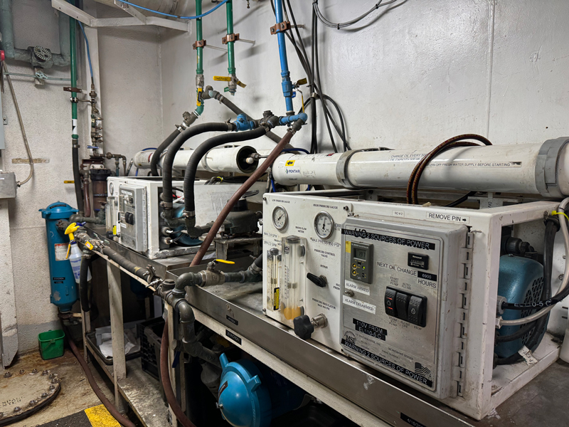
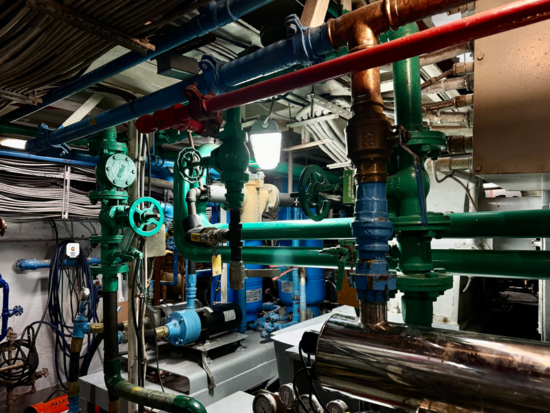
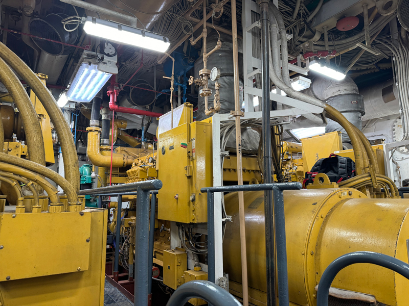
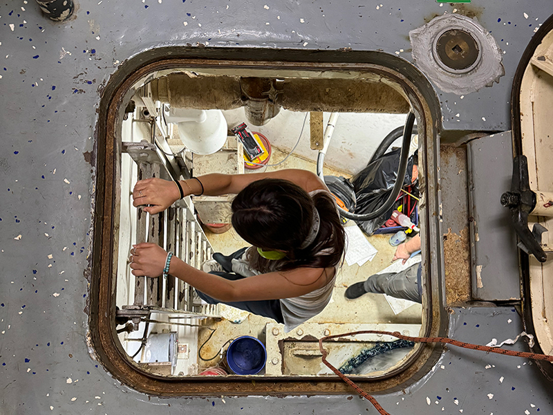
Today we toured Okeanos Explorer’s engine room, led by ship engineer Dave. The word “engine room” was misleading because we ended up walking through several doors and it almost felt like these were secret passageways through the ship. Walking through the engine room and ending up in random places in the ship made me feel like I was brand new to Okeanos Explorer and hadn’t just spent nearly three weeks on board. Some parts of the engine room were loud, so we had noise-canceling headphones to prevent any ear damage. Of course, that made communicating a little hard and shouting was definitely acceptable in this part of the ship. The tour took us all around the ship and we finally saw some of the machines that made the presence of freshwater on the ship and steering possible.
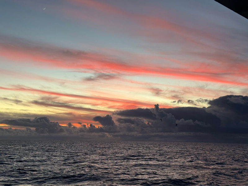
Later, it seemed like everyone was out to look at the sunset. Thomas sent a message that there was flying fish in the starboard side and many people gathered on the blue mats to watch the colorful sky. I was out on the bow, enjoying the last strong ocean breeze of the expedition as the bow tends to be windier than other parts of the ship. Suddenly, the ship turned and the sunset was bright orange/pink. I moved myself to the starboard side to watch the rest of the sunset.
Day Seventeen
Today was the last Sunday Sunrise on Okeanos Explorer for the Beyond the Blue: Papahānaumokuākea Mapping 1 expedition. Today’s sunrise on the bow was the brightest of the whole entire cruise. We perfected the “E Ala E” chant and there were many of us out on the bow for the expedition’s final sunrise chant. After we finished chanting and the sun was well over the horizon, we practiced another chant called “Hoʻonoa” which we were going to chant during cultural protocol later when the ship was about to cross from Pō to Ao, also known as the Tropic of Cancer.
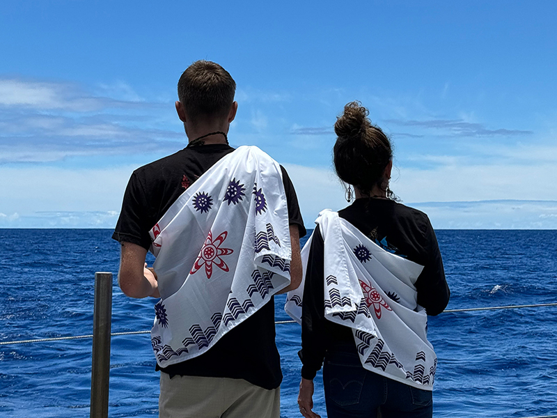
At around 1 p.m., the ship came to a stop and we all gathered on the fantail for the cleansing ceremony. All of the mission team and ship crew (minus those who were on their work shifts) stood in a large circle, ready to start chanting “Hoʻonoa.” As the ship made its return back to port in Pearl Harbor, it would be exiting the spiritual region of Pō and entering Ao, back with the living. The cultural protocol called for a cleansing to sever our ties with the spirits within Pō that were made during our many days sailing within Papahānaumokuākea Marine National Monument. With a mixture of Hawaiian salt and water, cultural liaisons Malia and Makoa walked along the circle and cleansed each of us by sprinkling the water on us. We continued the oli chant until every one of us was cleansed. Once Malia and Makoa finished going down the circle, they sprinkled water on each other which marked the ending of the cleansing process. Once the chant was over, we gathered on the starboard side of the fantail, looking back to Papahānaumokuākea and sang “Oli Mahalo.”
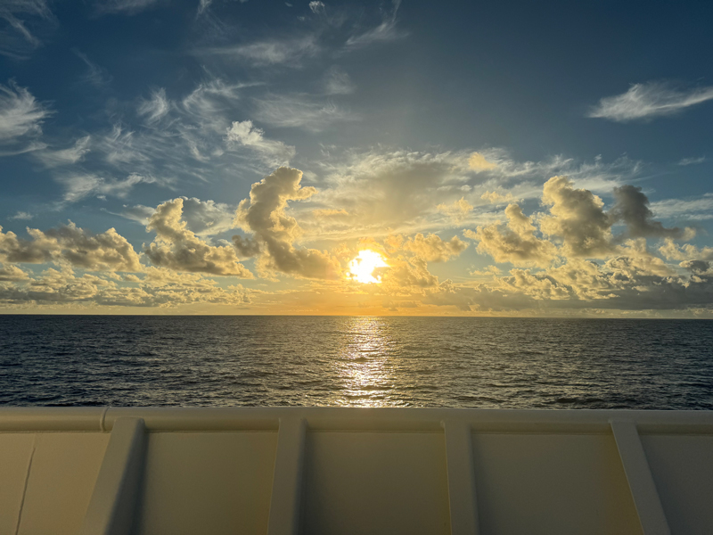
Today was a lot of “lasts” for this expedition, including the last Sundae Sunday. Our amazing stewards went all out with infinite topping options which of course included homemade whipped cream. Lots of people took their sundaes to the boat deck to catch a glimpse of the beginnings of sunset while others gathered in the forward lounge for another Super Smash Bros. playoff.
Day Fifteen
Today’s talk of the ship was the live interaction with Mokupāpapa Discovery Center scheduled for 10 a.m. Okeanos Explorer is not only a research vessel, but is also used for education and outreach. The rise of video conferencing such as Google Meet and Zoom have made these live interactions much easier to do while out at sea. The live interaction was led by expedition coordinator Thomas and cultural liaisons Malia and Makoa. The video set up for the live interaction looked very professional with the presenters wearing their own headsets, lights being set up, and all the tech people on the boat monitoring the meeting and sound technology.
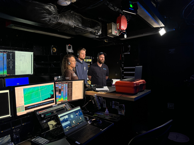
The presentation started off with Makoa joining the virtual meeting outside on the boat deck and giving a quick pan of the boat and the surrounding ocean. Thomas then kicked off a slide presentation by explaining what the expedition was all about and why we map deep waters. It was then handed off to Malia and Makoa where they explained more about the life of an island and went a little deeper about the expedition within Papahānaumokuākea Marine National Monument. The Q and A section was jam packed with questions from the kids and you could feel all of their excitement and curiosity for ocean exploration.
The presenters ended the live interaction by encouraging all of the kids at Mokupāpapa Discovery Center to join the ocean exploration team. Thomas shared that there are so many ways you can be involved with ocean exploration whether that be through science or art. Malia mentioned that her background in anthropology and archaeology is what drew her to the NOAA team. Makoa added that just by living on the Hawaiian Islands, you have more knowledge that others strive to achieve, even professional adult scientists. Ocean exploration and science is already embedded within those living on the Hawaiian Islands and there are endless possibilities in the field. The end message was that the field of science is not what it rigidly looked like in the past. Just by looking at the mission team on the Beyond the Blue: Papahānaumokuākea Mapping 1 expedition, no one is wearing a lab coat, confusing scientific jargon is kept to a minimum, and curiosity and creativity are celebrated.
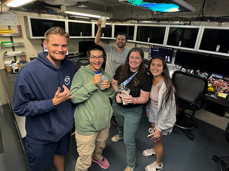
After dinner, a few of us made a bunch of milkshakes in the mess (area where we eat meals) and delivered them to people around the ship. We stopped by the control room during watch lead Mia and explorer-in-training Elizabeth’s watch shift. They took turns sipping their milkshakes in the dry lab right outside the control room since food and drink are not allowed in the control room. A milkshake also made it up to the dark and dim bridge during junior officers Julie and Aidan’s shift.
Day Fourteen
Happy Fourth of July! I woke up late today and had a very happy start to my holiday with a grand Fourth of July lunch that our amazing stewards made for us. There were burgers, hot dogs, mac and cheese, corn, two types of salads, cookies and s’mores! The mess deck was decorated with Fourth of July tablecloths and festive plates!
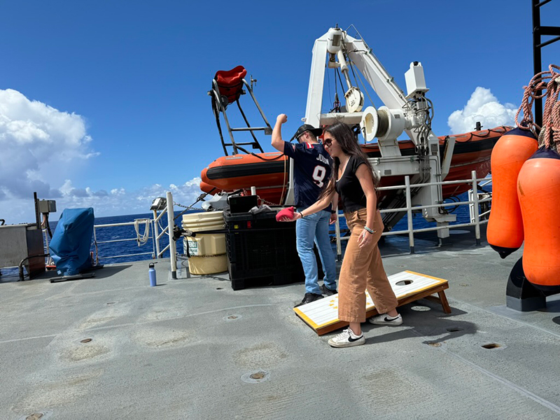
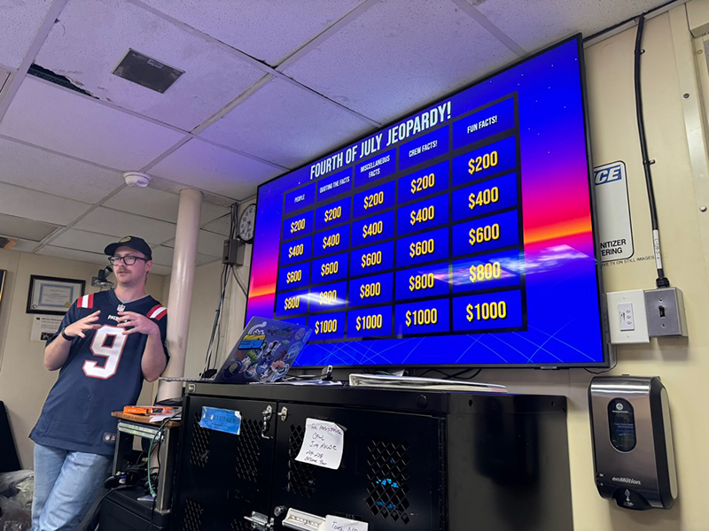
At exactly 2:40 p.m., there was an announcement that cornhole was set up on the boat deck to celebrate America’s birthday. Playing cornhole on a moving boat was interesting and sometimes terrible tosses were blamed on the ship’s rocking. There was also a reading of the Declaration of Independence on the fantail shortly after. After an amazing Fourth of July dinner, there was Jeopardy in the forward lounge set up by Junior Officer Aiden Murphy. A number of us gathered in the lounge to play, including the commanding officer (CO) and executive officer (XO). The festive day came to a perfect end with blasting Christmas music in the mission control room during explorer-in-training Elizabeth and watch lead Mia’s night shift.
Day Eleven
There was a lot of excitement today for the CTD operation! It was a particularly hot and sunny day out at sea so all of us came prepared with sunscreen, fun hats, and wearing the classic pink and blue sun shirts from the ship’s merch store. CTD drop was scheduled for 1:15 p.m., with cultural protocol at around 1 p.m. I realized that I should have been writing these logs according to military time as the ship uses military time. So, the cultural protocol would be at 1300 and the CTD drop would be at around 1315.
Since the Beyond the Blue: Papahānaumokuākea Mapping 1 expedition was taking place in Papahānaumokuākea Marine National Monument, cultural protocol before and after the CTD operation was essential. At 1300, we all gathered on the CTD deck for the cultural protocol led by cultural liaisons Malia and Makoa. We chanted a Hawaiian chant called “Hoʻonoa.” We then dispersed with the mission and operation team watching from a safe distance on the boat deck as the rest of the ship crew performed their tasks for lowering the CTD into the water. There were multiple people working the crane that was used to lower the CTD into the water and eventually pull it back up. Controls for the crane were up on the boat deck so we all had to stay quiet so that those on the CTD deck and those controlling the crane could communicate clearly. The CTD operation took less than an hour and it was hard work for the ship’s crew as the sun was beating down hard and no ocean breeze since the ship was stopped.
Video of the CTD being pulled back up by the cranes on NOAA Ship Okeanos Explorer. Video courtesy of Lia Kim. Download largest version (mp4, 22.2 MB)
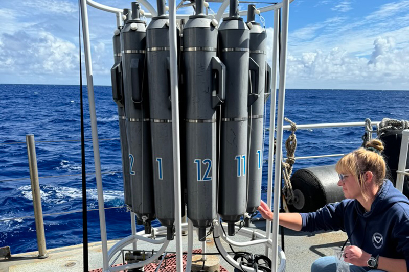
Soon after the CTD was secured, we started on the filtering process. About 10 of us worked on retrieving water samples from the Niskin bottles and we worked in almost a round robin formation. There were two types of bags to fill: 1-liter bags and 2-liter bags. These bags were marked and the water came from three different Niskin bottles. Since all the Niskin bottles were taken from the same depth and area, the water was all essentially the same. In an effort to homogenize all the samples, we filled our bags from three different Niskin bottles. On the bottom of each Niskin, there was a spout to open and close water flow, similar to a water cooler. On the top, there was a knob to control the size/strength of the flow. In order to keep the Niskin bottle from leaking, it was important to close both the top knob and bottom spout. Because of these two features on the Niskin bottles, it was easiest to work with a buddy where one person was loosening the top knob and the other was collecting and measuring the water. Explorer-in-training Elizabeth and I buddied up to collect our water samples. Communication was also key here so that we could efficiently fill up the bags and reduce water spillage (and getting seawater all over our clothes).
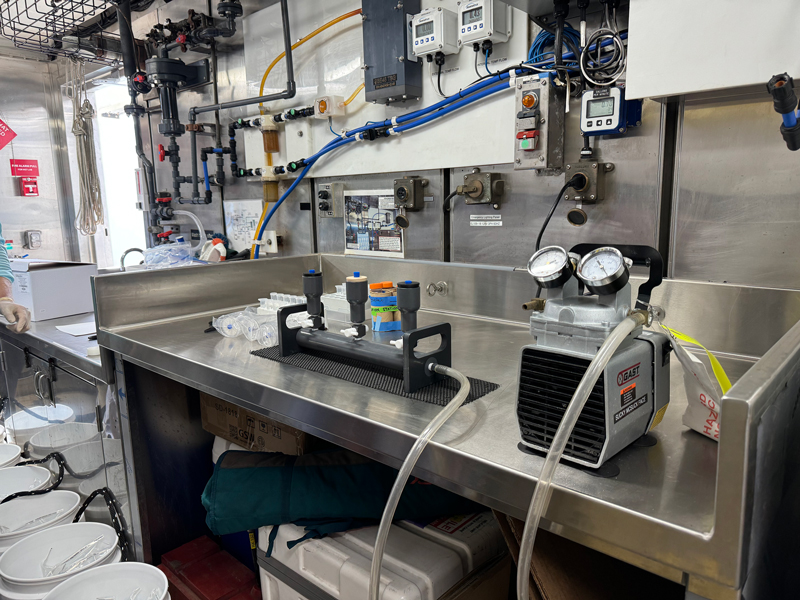
After all of the water sample bags were filled up, we moved into the wet lab to start the filtration process. We wanted to work fast since we had so many water sample bags to work with to avoid filtering into the night. The filtering machine only had three spots for where the cups with filters would go, so we split up and took shifts so that we could all get some experience and grab dinner. The collected water would be poured into a cup with a filter at the bottom and then sucked through the machine which is attached to the bottom of the cup. The excess water would be sent down one tub into a large jug which would be emptied out periodically. We all wore gloves and used tons of “DNA Away” to sterilize the bags when filtering. With every new bag and every tool used to maneuver the DNA filters, sanitation was essential!
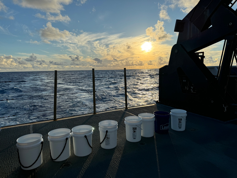
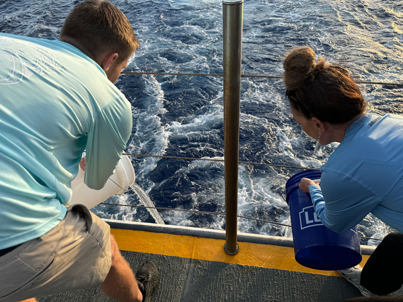
Filtering the environmental DNA (eDNA) from the collected deep ocean water left us with lots of extra seawater, so instead of dumping the excess water down the ship’s drain, we followed cultural protocol to return the water back to Papahānaumokuākea. The timing was perfect because the sun was starting to set as we gathered on the fantail (back deck of the boat) and sang “Oli Mahalo,” which is a chant to express gratitude. We thanked Papahānaumokuākea for allowing us to collect its water. After singing Oli Mahalo, we each took a bucket of water and returned it back to the ocean as the sky turned orange.
Day Ten
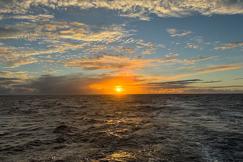
Today’s Sunday Sunrise was on the fantail at the back of the ship. The fantail being a lower deck and closer to the water made our second Sunday Sunrise even more beautiful. I felt closer to the natural environment of Papahānaumokuākea, especially the waves which were almost glowing from the sunlight. The clouds were covering the sun a bit this time but cleared to reveal a beautiful orange sun at the end of our chant.
At around 10 a.m., a few of us gathered in the wet lab with expedition coordinator Thomas to prepare for the CTD (conductivity, temperature, depth) operation scheduled for the day after. The CTD operation allows us to collect water samples from deep in the ocean to conduct environmental DNA (eDNA) analyses. By collecting eDNA from these water samples, we are able to see what organisms were in the water at this depth. On the ship, our plan was to collect the water samples from the CTD, filter the water through paper filters that collect eDNA, and send the filters with the eDNA to the Smithsonian National Museum of Natural History lab on the mainland. eDNA can tell us what organisms are in the water but it cannot tell us time or quantity; however, the data are still very useful in revealing information about these deep depths we have very little information about. The goal of this particular operation was more about seeing if the same quality of collected eDNA could be achieved through storing the samples in room temperature or the freezer before being shipped out to the Smithsonian lab. However, the data from this experiment will be useful for future operations where species identification would be analyzed.
Traditionally, these eDNA samples would be stored in extra cold freezers to be preserved, however on this ship, there are no extra cold freezers so they have to settle for the regular ones. For future expeditions that will take Okeanos Explorer to even more remote locations than Hawaiʻi such as Guam or American Samoa, it will be difficult to keep these eDNA samples cold during transit and overnighting packages is not really an option. This CTD operation will hopefully show us if it is possible to store these samples differently without losing the quality results of the data.
Like almost every operation on the boat, the water sample process had its own SOP (standard operating procedure) which was very easy to follow. Thomas and sample data manager Jennifer showed us how to collect the water from the Niskin bottles (large gray tubes numbered 1-12) in preparation for tomorrow. The Niskin bottles are positioned in a circle so the water collection process would almost be like a round robin formation. The bottles have a spout at the bottom which can open and close and the water flow strength can be controlled by a knob at the top of each Niskin bottle. Because of these two features, it’s best to collect the water with a buddy. Each bag will be filled to the 1 liter or 2 liter mark, depending on the bag, and the water should be collected from three different Niskin bottles. Once the water has been collected, we seal the bags and place them in ice buckets to be filtered soon after in the wet lab.
After dinner, it was time for my second Sundae Sunday and we were all treated with homemade caramel and fudge. After dessert, watch lead Mia busted out her quilting material and taught all of us how to quilt in the forward lounge!
Day Nine
It was time to start some mapping training in the control room! Today we learned the basics of the software the watch standers use to clean the multibeam sonar data. The multibeam sonars are stationed at the hull of the boat and send out pings to the seafloor every eight seconds. The ship moves like a lawnmower to cover the area. Every hour or so, a “line” of data (which is a portion of the mapped route) will come in and the watch standers will clean it.
We started with the 2-D cleaning tool and practiced using Qimera, which is the software used to clean the data. Naturally, there will be some outliers in the data since there are many pings being sent out for each line of data. This is where the cleaning comes in. Cleaning the mapping data is essentially deleting the outliers to create a cleaner line of data points. We followed a standard operating procedure (SOP) that is very detailed and goes through each step for the cleaning procedure.
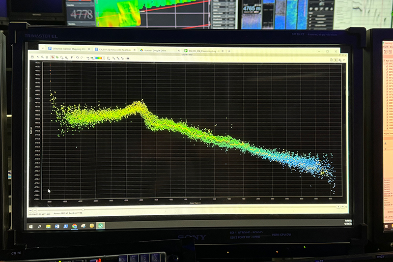
Starting the mapping training is exciting because it means there is a greater chance that I will be in the control room when/if a new seamount is discovered in Papahanāmokuākea Marine National Monument. Cultural liaison Malia explained that the process for naming newly discovered features and species within the cultural monument is a very long one. The discussion is conducted by the cultural working group at Papahanāmokuākea which includes scientists and even Hawaiian elders. The function of the organism/feature and the way it interacts with its environment are only a few factors that are taken into account before naming new discoveries within the monument. This process can take months and there is currently a long list of things that need to be named.
Fun Fact: Did you know that there is a fish species in Papahanāumokuākea named after former U.S. president Barack Obama? It is called Tosanoides obama.
Day Eight
Okeanos Explorer is filled with lots of welcoming faces, contributing to its positive atmosphere. It would be difficult to not grow close with those you see everyday and whom you are living alongside on a ship that loses its vastness the longer you live on it. Today, I noticed all the places on the boat that foster community.
Mealtimes are a place of socialization with those in different departments/roles on the boat. The largest long table in the mess hall, where we eat, was almost filled today at dinner with lots of chit chat and curiosity for each other's lives outside of the boat. I decided to take my dinner up to the table on the boat deck to enjoy the sunny weather and was welcomed by junior officer Julie and ship engineer Chris cooking their dinner on a small grill that they put on top of the boat deck table. After dinner, a few of us gathered to play some Super Smash Bros. in the forward lounge. More and more people joined the game as they passed by the lounge until we were maxed out on controllers!
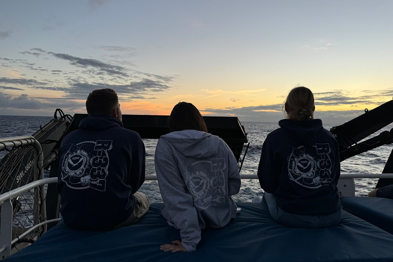
Today’s sunset attracted lots of watchers and I noticed several people outside sitting on the ship’s blue mats that had a perfect view of the sun descending over the horizon. While filming for “Hawaiian Word of the Day”, we had lots of people eager to participate in the videos for the second week.
Day Seven
After dinner, some of us non-mapping interns gathered in the dry lab to start our mapping training. Excluding expedition coordinator Thomas, all of us in the room were beginners to deepwater mapping. We began by discussing the different reasons for mapping. One key reason is safety: ocean navigators need to know their course to avoid unexpected seamounts and other potential obstructions on the seafloor. Another reason is exploration. We map because we don’t know what exists in these unmapped and unexplored areas—there may be more than just topography. As Thomas put it, “We don’t know what we don’t know.” Cultural liaison Malia added a third reason: historical continuity. The ocean floor is a vast treasure ground that can tell stories going back millions of years. Exploring the ocean floor and learning about our ocean’s history is crucial for how we proceed with future ocean exploration.
While Google maps show some topography of the ocean floor, these maps are only estimates and the data used to create them comes from satellites measuring the bulges in the water caused by the features of the ocean floor. Indigenous voyagers knew what these bulges in the water meant as well, which helped their navigation of the sea. Although satellites are able to collect measurements and create an estimate of seafloor topography, the multibeam sonar ocean mapping, like what is taking place on this expedition, provides much more accuracy.
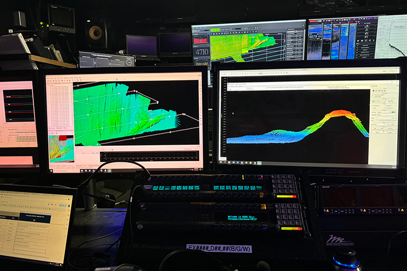
Eventually, we headed into the control room where the mapping data is collected and “cleaned” or removing extraneous data points. We learned how to use the radio in the control room and how to call the bridge. Okeanos Explorer operates 24/7 just like how the mapping is happening 24/7. There are watch standers monitoring the data and technology to make sure that the deepwater mapping mission is operating smoothly. The mission team and ship operations team work together to make the expedition possible, which is why the bridge and survey (control room) are in constant communication.
Day Six
I finally visited the bridge at night! The bridge is the area where the ship is controlled and navigated by members of the NOAA Commissioned Officer Corps. It is often referred to as the “nerve center” of the ship as most operations happen here, including the steering of the vessel. Junior officers Aidan and Julie were on watch until midnight with each watch shift being four hours. Aidan and Julie showed us a lot of the technology they use, but only scratched the surface of all operations that happen in the bridge.
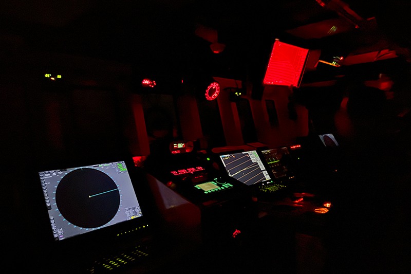
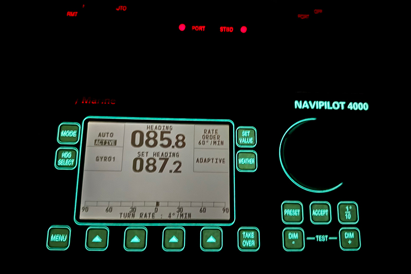
At night, the bridge is completely dark, with the exception of the buttons and screens that show the ship’s course. Aidan and Julie explained that the reason why they keep the inside of the bridge so dark is for better visibility of any light that may be outside. These lights can be buoys floating in the water or other ships. Hitting a fishing buoy in the water can blow a propeller and be detrimental to the ship’s mission and compromise the ship’s safety. Even though they have lots of technology to detect things in the water, spotting things with your eyes is the most effective.
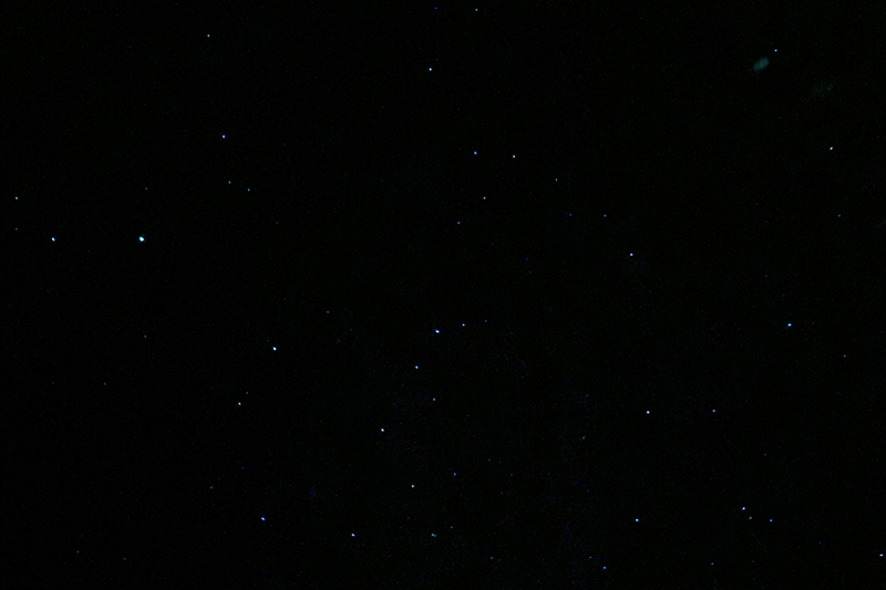
Tonight was a particularly clear night and there were a ton of stars in the sky. Aidan informed us that the best time for stargazing is between 2 a.m. and 4 a.m., so some of us stayed up to see the stars at peak brightness.
Day Five
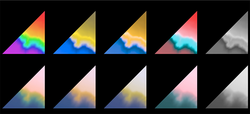
In the dry lab, expedition coordinator Thomas showed me the ship’s mapping route on one of the computers. On the computer screen, he pointed out the fracture zone we were mapping and how long it extends across the seafloor. With mapping the seafloor and collecting bathymetric data, color is a very important tool in communicating the scientific data. Different depths are shown with different colors to create a map of what the seafloor looks like. This led me to asking Thomas, “what happens to scientists with color-vision deficiency?” Thomas then showed me a past bathymetric map from 2017 with bright colors and compared it to the screen with the mapping route with more muted colors.
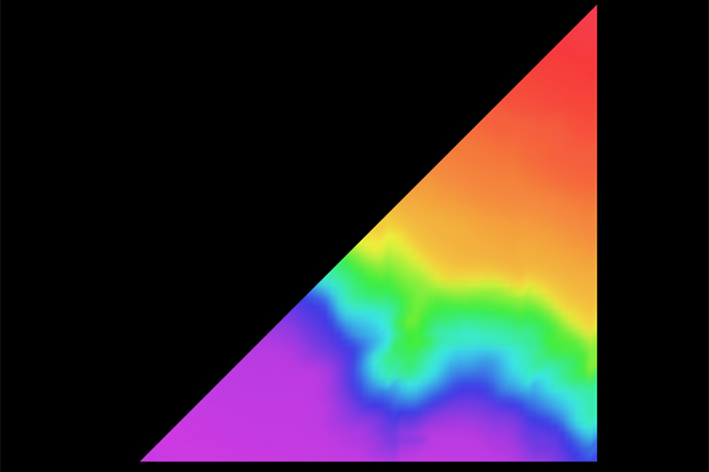
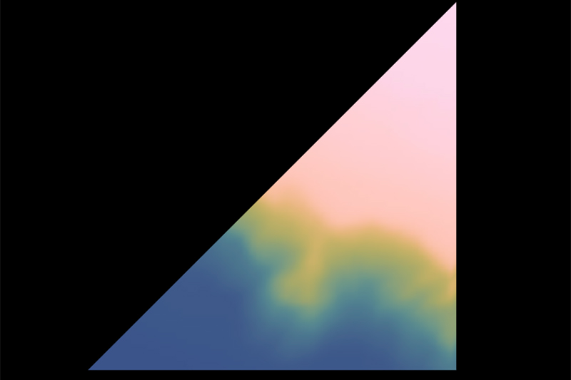
In the past, bathymetric maps would use the standard red-green-blue color scheme which is very extreme and not only inaccessible for those with color-vision deficiency (CVD), but it can also be misleading/distracting for those without CVD when interpreting the maps. The maps with more extreme color schemes––although potentially more aesthetically pleasing––do not accurately represent scientific data and in this case, the depths of the seafloor. Today, scientists more frequently use scientific color maps that accurately represent the data and are more accessible.
Day Four
It was a very different Monday being on the ship. Okeanos Explorer runs all hours of the day and all days of the week, meaning that Mondays work a little differently here! Today I assisted our cultural liaisons, Malia and Makoa, in filming short videos for a “Hawaiian Word of the Day” feature, which you can see on Instagram, Facebook, LinkedIn, and X/Twitter. I noticed that more people were outside, exercising on the ship’s bikes that have a great view of the ocean and using the other gym equipment that lives on the deck.
After a delicious Thanksgiving dinner that our amazing stewards made, it was time for oli chant practice in preparation for next Sunday’s sunrise. Many of us gathered in the forward lounge including our cultural liaisons, Malia and Makoa, expedition coordinator, Thomas, and Captain Colin Little to practice the sunrise chant we learned a few days ago at our first Sunday sunrise.
Later, a few of us joined in the forward lounge for some Super Smash Bros. gaming. As we were gaming, the waves started to get really strong and we all decided to head out to stargaze on the boat deck. Since the ship was rocking a lot, we all came up with the best route to get outside which involved choosing the easiest door to work with amidst the “high” seas we were experiencing. It’s always important to have positive control of all the doors at all times for not only safety reasons, but also to ensure that everyone is getting enough sleep for their shifts! At first, it was extremely dark outside because the clouds were covering most of the stars. As soon as one cloud shifted, we started to see a ton of stars and others tried to identify constellations.
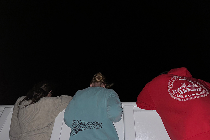
Thomas joined us outside and took us to the bow of the ship to try and spot bioluminescence in the water. We all leaned on the edge of the starboard (right) side of the boat and peered over the railing to see the glowing blue of the bioluminescence as the water crashed against the bottom of the boat! At this point, leaning against the edge of the ship felt more like an amusement park ride as we got sprayed multiple times with salty water. Some more people joined us outside to see the bioluminescence before we all headed back inside and checked back in with the bridge to notify them that everyone was back inside and safe!
Day Three
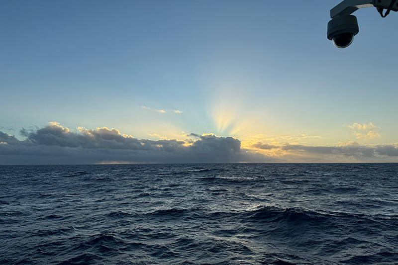
At around 5:40 in the morning, some of us gathered on the bow (front) of the ship to learn and perform a Hawaiian sunrise chant titled E Ala E, led by Malia and Makoa. Malia shared that the chant is started right before the sun peeks above the horizon and continued until the sun is fully above the horizon. If you chose the wrong time to start, you would be chanting for a long time! Unfortunately, the clouds were covering most of the sun, so we chanted until the sun started to peak over the clouds. The sunrise chant grounds us in the present and naturally connects us to the Earth, Sun, and water. As we were chanting, I was paying a lot of attention to the clouds and the sun hiding behind them. I was extra fixated on the bright outlining on the cloud bank that was created by the sunshine sneaking out. I was also noticing how my body was moving and swaying with the strong waves (partially so I wouldn’t fall during the chant). Can’t wait for next Sunday’s sunrise chant!
In the forward lounge, I sat in on a ukulele jam session with Malia and Makoa. They were playing some old Hawaiian songs and some newer ones like “Over the Rainbow” (Israel Kamakawiwo'ole’s version). Our media specialist, Nate, joined the session with his flamenco fingers and sick guitar skills on the forward lounge’s communal blue guitar.
Later, I joined expedition coordinator, Thomas, to check up on the U.S. Geological Survey bat detector that is mounted on the ship. We checked that everything was working, replaced the SD cards and batteries, and took pictures of each step to make an SOP (standard operating procedure) for those doing future maintenance. I then sat in on my first mapping watch shift with watch lead, Mia, and mapping intern, Anabel. I watched as they cleaned up the data by deleting outliers while they explained some of the basics of how to read the colorful data they were looking at. My sit-in ended with Anabel launching the XBT which is dropped into the water every six hours or so and measures water temperature.
Today was also Sundae Sunday at the mess deck! We celebrated the first Sundae Sunday of the Papahānaumokuākea Mapping 1 expedition by watching Moana in the forward lounge.
Day Two
Last night, I battled the seasickness demons which I was not expecting since I had been on smaller and more rocky fishing boats before! But I have been told that everyone deals with seasickness differently and as expedition coordinator Thomas says, there is no person that doesn’t get seasick. Everyone was very understanding and supportive because it is okay to get seasick! After taking some stronger medicine, staying hydrated, and getting lots of rest, I was feeling much better and adjusted to the ship’s swaying. I made sure to spend time outside after each meal and center myself by looking at the horizon.
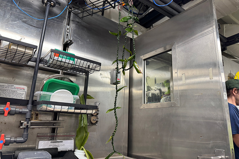
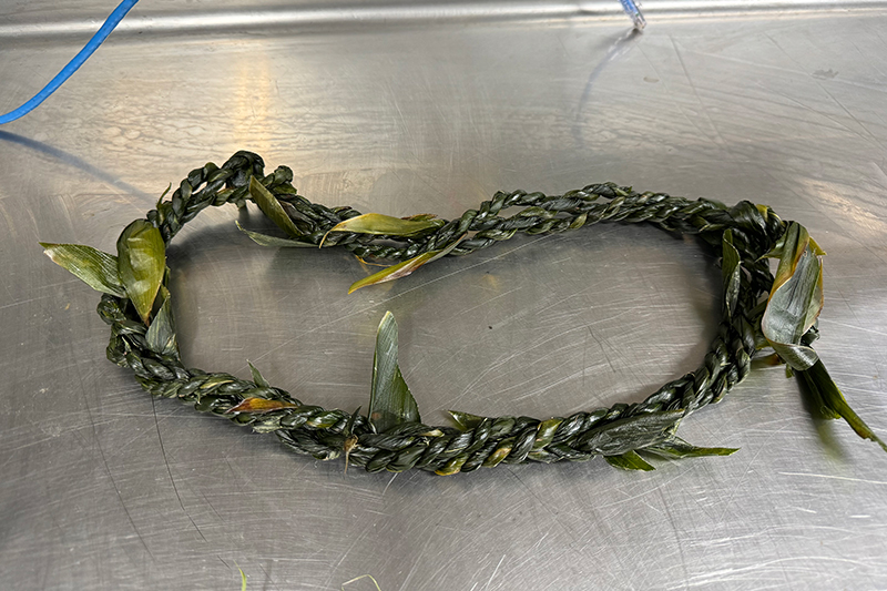
Today, it was time to engage in some cultural activity fun! In the wet lab, our cultural liaisons, Malia and Makoa, held a lei making session and we were able to make our own lei. The style of lei that we were making was called hilo, where we twist the ti leaves in the same direction and cross them over each other to make a rope-like shape. During the process, we learned that it is important to think positively and to never speak badly about anyone, as negative thoughts and words can affect the quality and energy of your lei. All of us spread out around the wet lab, some on the ground twisting their lei attached to their toes and some standing up with their lei attached to the sinks and railings. There was sticky sap everywhere, but the wet lab smelled amazing! We hung our finished lei to dry in glory before cleaning up the area.
Day One
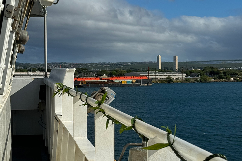
As NOAA Ship Okeanos Explorer prepares to set sail on its deepwater mapping expedition in Papahānaumokuākea Marine National Monument, our cultural liaisons, Malia and Makoa, conducted Hawaiian cultural protocol with an oli pale (protection chant), a pī kai (purifying with salt water and ʻolena), and the placing of a lei lā’i on the bridge railing of the ship. The lei lā’ī are made of ti leaves which are a significant plant in Hawaiian culture and utilized for ceremonial purposes, among many uses. In wrapping the lei on the bridge railing, the ship is now protected and ready to embark on its three-week mapping expedition in the Pacific!
At about 11:45 am, the ship started to depart! It was a much slower process than we newbies (explorers-in-training) expected. As the giant cranes on the ship scooped up the walkway that connected the ship to the dock, it finally sank in that we were about to be out at sea for almost a month! When the ship started to move, we stood on the boat deck and watched as Pearl Harbor became smaller and smaller behind us.
Published June 28, 2024
Last Updated August 13, 2024
