This page provides members of the media with information, resources, and imagery developed in association with the 2021 North Atlantic Stepping Stones: New England and Corner Rise Seamounts expedition.
From June 30 to July 29, 2021, NOAA Ocean Exploration and partners will conduct a telepresence-enabled ocean exploration expedition on NOAA Ship Okeanos Explorer to collect critical information and improve knowledge about unexplored and poorly understood deepwater areas of the New England Seamounts and the Corner Rise Seamounts in the high seas of the North Atlantic. The expedition will expand on previous NOAA Ocean Exploration expeditions to explore the New England Seamounts conducted in 2013 and 2014. The expedition will begin and end in Newport, Rhode Island.
The expedition will include both mapping and remotely operated vehicle (ROV) operations, with video from ROV dives streamed online in real time from approximately 8:30 am to 4:00 pm ET most days between July 2 to July 28 (two days will be dedicated to transit and mapping operations, with no dives scheduled). Dive sites are expected to include seamounts, deep-sea coral and sponge communities, unique geological features, and other deep-sea habitats.
On this page:
Importance | Goals | Partners | Explorers | Videos & Images | Background Info | Contact Info
The New England and Corner Rise seamount chains comprise a line of extinct submarine volcanoes that extend from near the Mid-Atlantic Ridge to the eastern continental margin of the United States. Together with the deep sides of the Azores platform, these features constitute a nearly continuous series of hard, submerged islands along the otherwise flat plain of abyssal mud extending across the North Atlantic Ocean.
How did these seamounts form? What resources do they hold? What animals live on these undersea mountains? Are they found on one seamount or many? Why? Scientists hope to begin to reveal answers to some of these questions over the course of the expedition, thereby helping us to identify, understand, protect, and manage sensitive marine life and habitats, geological features, and potential resources.
NOAA Ocean Exploration priorities for the 2021 North Atlantic Stepping Stones: New England and Corner Rise Seamounts expedition combine science, education, outreach, and open data to provide a better understanding of the North Atlantic Ocean region. Specific expedition goals include:
Additionally, the 2021 North Atlantic Stepping Stones: New England and Corner Rise Seamounts will contribute to NOAA’s Atlantic Seafloor Partnership for Integrated Research and Exploration (ASPIRE), a major multiyear, multinational collaborative field program focused on raising collective knowledge and understanding of the North Atlantic.

Expedition Coordinator, NOAA Office Exploration
Kasey Cantwell is the operations chief for the Expeditions and Exploration Division of NOAA Ocean Exploration. Kasey has a master’s degree in marine affairs and policy and marine geology and geophysics and a bachelor’s degree in marine science and biology, both from the University of Miami Rosenstiel School of Marine and Atmospheric Science. Kasey joined NOAA Ocean Exploration in 2012 and is responsible for overseeing the office’s operational portfolio, including telepresence-enabled expeditions conducted aboard NOAA Ship Okeanos Explorer. In her previous role as an expedition coordinator for remotely operated vehicle expeditions, she coordinated over a dozen expeditions and projects, including multidisciplinary expeditions to the Atlantic submarine canyons, the Mariana region, Pacific Remote Islands Marine National Monument, now known as Pacific Islands Heritage Marine National Monument, Glacier Bay National Park, and offshore the southeastern United States. Beyond deep-sea exploration, Kasey’s background includes imagery-based mapping of coral reefs throughout the Caribbean, long-term ecosystem monitoring, and evaluating resource management strategies to improve efficiency and data quality.

Expedition Coordinator in Training, NOAA Ocean Exploration
A Florida native, Kim’s interests in marine life started at a young age with regular trips to the reefs in the Florida Keys. Kim studied biological sciences at the University of Miami where she became a research assistant with the Marine Geosciences Department at the University of Miami's Rosenstiel School of Marine and Atmospheric Sciences (RSMAS). Kim continued her education at RSMAS, earning a doctorate in marine geology and geophysics, focusing on cold-water coral systems within the carbonate province of the Straits of Florida. Her research included habitat mapping and terrain classification with acoustic maps, carbonate sedimentology, stable isotope geochemistry, and geochronometry. After sailing as a geology science lead during NOAA Ocean Exploration’s 2019 Southeastern U.S. Deep-sea Exploration expedition, Kim joined the office as an expedition coordinator in 2020. During her spare time, Kim enjoys traveling, hiking, scuba diving, and baking.

Mapping Lead, NOAA Ocean Exploration
Shannon Hoy is a Mapping Lead with NOAA Ocean Exploration. She has always had a love of the ocean and pursued a degree in marine biology from the College of Charleston, where she was first introduced to seafloor mapping in 2009. During her undergraduate career, she participated with four seafloor mapping expeditions, allowing her to increase her seafloor mapping knowledge and skills, make valuable connections, and travel to exotic places such as Indonesia and Antarctica. Two of these expeditions were actually aboard NOAA Ship Okeanos Explorer in 2010! After completing her undergraduate degree, Shannon spent the next few years gaining as much multidisciplinary ocean experience as possible. She worked for the U.S. Geological Survey’s Submarine Geohazards Group in Woods Hole, as well as the University of Bristol’s Paleoceanography group in the United Kingdom. She continued to map throughout these years, and began specializing in habitat mapping using high-resolution techniques (such as remotely operated vehicle mounted multibeam), seamlessly combining her three disciplines: marine biology, geology, and seafloor mapping. In 2015, Shannon began pursuing her Master’s degree in Ocean Mapping at the University of New Hampshire’s Center for Coastal and Ocean Mapping, with the aim to increase her theoretical acoustic and geodetic background. Towards the end of her graduate degree, she jumped at the opportunity to join the NOAA Ocean Exploration team as a Mapping Lead, as being an Explorer-in-Training with the office nearly a decade earlier had greatly shaped her career and allowed her to pursue her passion for ocean exploration.

Geology Science Co-lead, Research Geologist, U.S. Geological Survey (on shore)
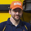
Jason Chaytor is a research geologist with the U.S. Geological Survey (USGS) at the USGS Woods Hole Coastal and Marine Science Center. Jason graduated from Queensland University of Technology (Brisbane, Australia) in 2000 with a first-class honours degree in geology, completed his Ph.D. in geological oceanography at Oregon State University in 2006, and was a postdoctoral scholar at Woods Hole Oceanographic Institution between 2006 and 2009. Jason conducts research on issues related to marine geohazards including submarine landslides, tsunamis, earthquakes, and plate tectonics, and shallow- and deep-water sedimentary processes on Atlantic, Gulf of Mexico, and Pacific margins of the United States and in the northeast Caribbean. He is the current principal scientist for the USGS Woods Hole Coastal and Marine Science Center Sediments Laboratory.

Geology Science Co-lead, Research Geologist, U.S. Geological Survey (on shore)
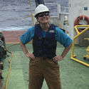
Kira Mizell is a research oceanographer for the Global Ocean Mineral Resources program at the U.S. Geological Survey (USGS) Pacific Coastal and Marine Science Center. She started working at the USGS on marine minerals research in 2011 and received her Ph.D. in 2019 from the University of California, Santa Cruz, while continuing her work at the USGS. She has attended and participated from shore in research expeditions in both the Atlantic and the Pacific Oceans. She studies minerals that form in the deep ocean, focusing on ferromanganese crusts, manganese nodules, and phosphorites. These deep-ocean minerals scavenge elements from seawater or sediment pore water during their slow precipitation. Their chemical composition reveals information about ocean chemistry from the past, and some elements accumulate to concentrations high enough to cause these mineral types to be considered as a potential mineral resource. She also investigates the relationship of different metal enrichments to the co-located biological communities, utilizing a multidisciplinary approach to holistically examine marine mineral and concomitant ecosystem resources. On this expedition, she is interested in the distribution of deep-sea minerals in this region of the North Atlantic Ocean and how the oceanographic conditions, like high sedimentation and strong currents, affect their morphology, especially compared with marine minerals from the Pacific Ocean. She hopes discoveries on this expedition will improve knowledge of where marine mineral occurrences of interest for scientific study or potential mineral resources may be found and what biological communities are associated with them.

Biology Science Lead, Associate Professor, University of Maine
Rhian Waller is an associate professor of marine sciences at the University of Maine. She received her bachelor’s degree at the University of Wales, Aberystwyth, and her Ph.D. at the National Oceanographic Centre, Southampton, also in the United Kingdom. She first came to the United States for a postdoc at the Woods Hole Oceanographic Institution in 2004, and has been in the United States ever since. Her research is mainly focused on the reproductive ecology of deep-sea organisms, primarily cold-water corals, and how this important process is affected by environmental change (natural and human caused). A large part of her research program looks at where cold-water corals live around the globe (biogeography), so that her research group can start to hypothesize larval transport linkages and what is possible given a species’ reproductive potential.
Dive highlight videos, short video clips, and photos will be posted online as they become available.
"Real-Life" SpongeBob SquarePants and Patrick Star SightingOn July 27, 2021, while exploring Retriever Seamount, one of four seamounts located within the Northeast Canyons and Seamounts Marine National Monument, the NOAA Ocean Exploration-led 2021 North Atlantic Stepping Stones expedition team imaged a yellow sea sponge (genus Hertwigia) and pink sea star (genus Chondraster) thought to resemble the Nickelodeon cartoon characters, SpongeBob SquarePants and Patrick Star.
Download raw video: ProRes (.mov, 5.6 GB) | LowRes (.mp4, 68.7 MB) Download image: (jpg, 543 kb)
Credit: NOAA Ocean Exploration, 2021 North Atlantic Stepping Stones Date: July 27, 2021 Depth: 1,885 meters (6,184 feet) Location: Retriever Seamount, Northeast Canyons and Seamounts Marine National Monument Dive Summary
Please contact Emily Crum for high-resolution footage, B-roll, and other materials posted on the NOAA Ocean Exploration website.
NOAA Ocean Exploration
Emily Crum
Communications Specialist
Email Address: emily.crum@noaa.gov
NOAA Office of Marine and Aviation Operations
David Hall
Public Affairs Officer
Email Address: david.l.hall@noaa.gov