Beyond the Blue: Johnston Atoll Mapping
(EX2405, EX2406)
Meet the Explorers

Shannon Hoy
Expedition Coordinator, NOAA Ocean Exploration
Beyond the Blue: Johnston Atoll Mapping 1
Shannon Hoy is the Expedition Coordinator Team Lead with NOAA Ocean Exploration. She has always had a love of the ocean and started going to sea as an undergraduate on numerous seafloor mapping missions. On two of these expeditions, she was a NOAA Ocean Exploration explorer-in-training on NOAA Ship Okeanos Explorer! Now she leads field expeditions aboard Okeanos Explorer using a variety of tools such as multibeam sonars and remotely operated vehicles to map and explore remote and/or poorly understood areas of our ocean. When not in the field, she focuses on improving NOAA Ocean Exploration's operational efficiency and effectiveness and works to improve the pace and quality of ocean mapping as an active participant in the global mapping community. Her specialty is in deepwater ocean mapping and she received a master’s degree in Earth Sciences: Ocean Mapping from the University of New Hampshire.

Thomas Morrow
Expedition Coordinator, NOAA Ocean Exploration
Beyond the Blue: Johnston Atoll Mapping 2
Thomas Morrow is a physical scientist with NOAA Ocean Exploration. He spends his time working as an expedition coordinator on NOAA Ship Okeanos Explorer and supporting NOAA’s ocean exploration mission. Thomas is a marine geologist and geophysicist who started his ocean exploration career while earning his bachelor’s degree in geology at the University of Florida. He then moved to the University of Idaho for master’s and doctoral degrees in geological sciences, studying mid-ocean ridges, fracture zones, and hotspot seamounts. Prior to joining NOAA Ocean Exploration, Thomas spent several years as a postdoctoral research fellow at Boston College, coordinating missions to explore the Gofar transform fault on Research Vessel Atlantis and Research Vessel Thomas G. Thompson.
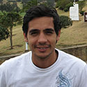
Fernando Aragon
Technical Team Member, Global Foundation for Ocean Exploration
Beyond the Blue: Johnston Atoll Mapping 1 & 2
Fernando Aragon graduated from the University of Hawai‘i at Manoa with a bachelor’s degree in mechanical engineering. During his studies, he gained experience in several fields, including conceptual design, aerospace research, mechanical design, robotics, and software development. From these activities, he was able to intern for NASA at the Jet Propulsion Laboratory, present research at a national conference, and even co-author a technical paper in the Journal of the Astronautical Sciences. His previous position was at the Field Robotics Laboratory (FRL), where he helped support operations, testing, and software development for two unmanned surface vessels. During his time with FRL, he discovered a true passion for development and design of robotic systems. Originally from Colombia, Fernando enjoys outdoor activities and currently resides in State College, Pennsylvania.
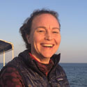
Amanda Bittinger
Mapping Watch Lead, NOAA Ocean Exploration
Beyond the Blue: Johnston Atoll Mapping 2
Amanda Bittinger began her hydrographic career as a NOAA Corps Officer, and she has been sailing as a member of the Mapping Team on NOAA Ship Okeanos Explorer since 2015. She has a bachelor’s degree in oceanography, a master’s degree in coastal management with an emphasis on using remote sensing to determine coral reef health, and 15 years of surveying and mapping experience. In addition to serving as the mapping watch lead, she has also been the onboard mapping lead for several telepresence mapping expeditions. She has an interest in coastal remote sensing and likes to teach explorers-in-training, design t-shirts, and do other creative art projects while on board. Amanda lives in Portland, Oregon.

Roland Brian
Video and Satellite Engineer, Global Foundation for Ocean Exploration
Beyond the Blue: Johnston Atoll Mapping 2
Roland Brian has 38 years of electronics and satellite experience, with 29 of those years focusing on television and video engineering specialization. Throughout his early years in television, Roland worked to hone his skills and experience for various television stations and remote broadcasters as well as national broadcasters. With a keen eye for precise high-quality, high-definition video, he really enjoys bringing imagery to life. Roland began his career in the U.S. Air Force where he worked as a satellite communications engineering technician with visions of working on the U.S. Space Station. He traded in that quest for one of deep-ocean exploration and sharing its beauty with the world. He has worked with NOAA Ocean Exploration since 2010 and plays an integral part in telepresence-enabled remotely operated vehicle (ROV) expeditions. He has also provided engineering design, integration, and operation services for other projects using various Global Foundation for Ocean Exploration (GFOE) and NOAA Ocean Exploration mobile telepresence systems. His duties aboard NOAA Ship Okeanos Explorer include operation and maintenance of the ship's telepresence and video and satellite systems, including those on ROVs Deep Discoverer and Seirios. Roland’s experience embodies the breadth and depth of knowledge that GFOE and NOAA Ocean Exploration encourage. When not at sea, Roland enjoys life with his wife and family in sunny Sarasota, Florida.
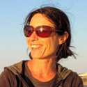
Anna Coulson
Mapping Watch Lead, University Corporation for Atmospheric Research
Beyond the Blue: Johnston Atoll Mapping 1
Anna Coulson grew up in the United Kingdom and has a bachelor’s degree in ocean science from the University of Plymouth. After graduating, she spent 10 years sailing her own 10-meter sailboat from the United Kingdom to the Philippines and working as crew on various sail and motor boats. After sailing in many poorly charted areas, she decided to attend the postgraduate certificate program for ocean mapping/hydrographic survey at the Center for Coastal and Ocean Mapping in New Hampshire, which was followed by contract work for the Hawaii Mapping Research Group. She is currently based in Portugal and works as an independent contractor for the University Corporation for Atmospheric Research as a part of the onboard survey team.

Rosie Chapina
Knauss Fellow, NOAA Ocean Exploration
Beyond the Blue: Johnston Atoll Mapping 1
Rosie Chapina was born and raised in San Jose, California, and obtained her bachelor's degree in forensic science (biology concentration) from the University of Texas at El Paso. Rosie will be defending her Ph.D. at the University of Vermont this year; her research focuses on understanding the migration and behavior of zooplankton, specifically mysid shrimp, in lake ecosystems. While Rosie’s primary focus has been on the Great Lakes, she has also conducted studies in various European lakes, the Chesapeake Bay, and the Caribbean Sea. Her research interests include modeling, predator-prey interactions, and climate change impacts on migration patterns. Rosie is currently a Knauss Fellow at the NOAA Ocean Exploration Office; as part of her fellowship, she is involved in maximizing the use of samples collected during expeditions on NOAA Ship Okeanos Explorer and Exploration Vessel Nautilus. Rosie enjoys playing tennis, singing and dancing, swimming, hiking, and traveling and exploring new cities.
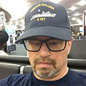
Brian Doros
Video Engineer, Global Foundation for Ocean Exploration
Beyond the Blue: Johnston Atoll Mapping 1 & 2
Brian Doros is a television broadcast engineer who was born in Long Branch, New Jersey. Active in sports throughout high school, Brian moved to Southern California and spent the next few years traveling the world surfing and then exploring his technical interests at college in San Diego, California. After changing his course of study to electronics, he focused on broadcast electronics and technical maintenance in broadcasting. His career path first led him to employment at IBM/MCA Video Laser Disc Company in Costa Mesa, California, doing research and development in the early days of optical laser disc, then to Los Angeles, where he specialized in film for television post-production. The next several years were spent working in the Hollywood post-production industry at Paramount Pictures, MGM/Lorimar Telepictures, 20th Century Fox, NFL Films, and Sony Broadcast Company North America, contributing to his 25 years of experience in television post-production and broadcast systems integration. After Hollywood, Brian worked in the field, traveling and upgrading network television facilities to digital broadcasting capabilities during the analog to digital conversion. He now has moved on to less broadcast traditional applications of his background working in his current position.
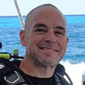
Mark Durbin
Data Engineer, Global Foundation for Ocean Exploration
Beyond the Blue: Johnston Atoll Mapping 1
Mark Durbin holds a bachelor’s degree in information technology and a master’s in computer information systems from Tarleton State University, where he focused on network security solutions. Mark has over 28 years experience in designing, testing, and supporting numerous variations of voice/data wired/wireless telecommunications networking solutions and security solutions, services, and products. During his career at MCI/Verizon, he held several engineering, research and development, and management positions and was with the company for over 23 years. During this time, he worked on key network projects and initiatives, including federal security solutions, access solutions, security services, virtualization, and many other large network solutions. In addition, he received four patents for networking and security solutions. Mark is married to Laura, his wife of 32 years, and has three kids and five grandkids. Some of Mark's hobbies and interests include car, truck, and boat repair/restoration; hiking; biking; running; camping; hunting; fishing; boating; amateur radio; storm chasing; home automation/security systems; fitness instructing; and scuba diving.
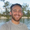
Dan Freitas
Mapping Watch Lead, University Corporation for Atmospheric Research
Beyond the Blue: Johnston Atoll Mapping 1
Daniel Freitas is from Rochester, New York. He worked for NOAA as a general vessel assistant for over three years in the augment pool while attending Coastal Carolina University, where he studied marine biology and applied mathematics. Over the last eight years, he has worked in the deck, engineering, and survey departments aboard many NOAA vessels before taking a permanent position aboard NOAA Ship Okeanos Explorer. For the last several years, he has worked as an independent contractor on Okeanos Explorer via the University Corporation for Atmospheric Research, supporting the NOAA Ocean Exploration mapping team. His time aboard consists of acting as a mapping watch lead, helping train and direct explorers-in-training, and working with the senior survey technician and other crew members to ensure the ship’s operations are completed.
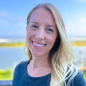
Jessica Gwinn
Internship Program Coordinator, NOAA Ocean Exploration
Beyond the Blue: Johnston Atoll Mapping 2
Jessica (Jesse) Gwinn is the internship program coordinator with NOAA Ocean Exploration, where she works to coordinate undergraduate and graduate student engagement through the Explorer-in-Training Program and other internship and fellowship opportunities. Jesse holds a bachelor’s degree in bioenvironmental sciences from Texas A&M University and earned her doctorate in marine sciences from the University of South Alabama, where her graduate research was focused on ecotoxicology of harmful algae toxins in tropical marine systems. Before coming to NOAA Ocean Exploration, Jesse was a 2023 Sea Grant Knauss fellow supporting Pacific Islands capacity building projects and communications for NOAA’s Global Ocean Monitoring and Observing Program. Jesse is passionate about providing opportunities for students and early-career professionals, supporting them along their journeys in ocean science, and improving equitable access to marine education and careers. Jesse is originally from Katy, Texas, and enjoys working out, traveling, crocheting, and playing fetch with her dog — and she’s recently taken up drumming!

Art Howard
Video Editor, Global Foundation for Ocean Exploration
Beyond the Blue: Johnston Atoll Mapping 1 & 2
For more than 30 years, Emmy-award winning photographer and producer Art Howard has helped viewers experience life through images from 50 countries and 7 continents. A native of North Carolina, Art has followed researchers aboard multiple deep-sea missions, documenting the excitement and challenges of exploration. Art uses the latest video technology to bring viewers as close as possible to life at sea, capturing both scientists and the marine life they seek to understand. Art has spent the last 11 years independently producing media for the North Carolina Museum of Natural Sciences.

Nathaniel Kenney
Video Editor, Global Foundation for Ocean Exploration
Beyond the Blue: Johnston Atoll Mapping 2
Nathaniel (Nate) Kenney joined the Global Foundation for Ocean Exploration (GFOE) in the role of video editor in 2023. Nate comes with a five-year background as an editor and cinematographer with a diverse background that includes working on narrative feature films and wildlife docuseries. He is a proud graduate of Montana State University's Science and Natural History Filmmaking program, where he earned a Master of Fine Arts. With a genuine appreciation for the natural world and a passion for storytelling, Nate is excited to apply his skills to GFOE's mission and create captivating content that advances our understanding of the ocean and its vast ecosystems.
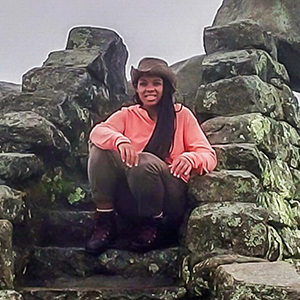
Gina Knox
Explorer-in-Training, NOAA Ocean Exploration
Beyond the Blue: Johnston Atoll Mapping 2
Gina Knox is a senior at Old Dominion University majoring in geography with an expected graduation in fall 2024. Throughout her academic and professional journey, Gina has developed a profound interest in geospatial and imagery analysis and the science of light and sensors, which is driven by her love for exploration and mapping. In her free time, Gina enjoys hiking long distances and dreams to thru-hike the entire length of the Appalachian Trail northbound from Georgia to Maine. She is always seeking opportunities to share her passion for exploratory science, conservation, and the outdoors with others.
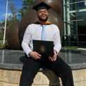
Nathanael Mathis
Explorer-in-Training, NOAA Ocean Exploration
Beyond the Blue: Johnston Atoll Mapping 2
Nathanael Mathis is a biology major with a diverse background in oceanography, marine biology, microbiology, and chemistry. His passion for these fields ignited a career path in astrobiology, where he researches the viability of microorganisms in conditions analogous to ocean worlds like Enceladus, aiming to uncover the potential for life beyond Earth and blending his interests in biology, the cosmos, and the beautifully mysterious ocean here on Earth. Nathanael is originally from New Jersey and proudly embraces his African American and Puerto Rican heritage. Outside the lab, he is dedicated to teaching science through a summer program in a community that’s predominantly people of color. This role not only fuels his own academic passions, but also allows him to mentor and nurture young scientific minds and inspire the next generation of scientists of color. Through his research and work in mentoring, Nathanael fulfills his passion for community outreach, creating opportunities for underrepresented groups in STEM — science, technology, engineering, and math — and helping to build a more inclusive and innovative future in science.
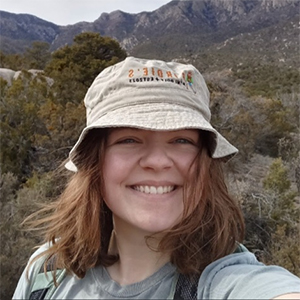
Abigail Norstad
Explorer-in-Training, NOAA Ocean Exploration
Beyond the Blue: Johnston Atoll Mapping 2
Abigail Norstad recently graduated from the University of Wisconsin Eau-Claire with a Bachelor of Science in geology. During her studies, she gained mapping and ArcGIS experience from field camp courses held in New Mexico and Montana. Abigail plans to go to graduate school to study geomorphology/glacial geomorphology, hoping to study the climate's effect on glaciers and erosion rates. Abigail looks forward to gaining hands-on experience with mapping and ArcGIS, learning more about the research and data collection process, and seeing what life is like on Okeanos Explorer. In regard to this expedition, Abigail was looking forward to gaining hands-on experience with mapping and ArcGIS, learning more about the research and data collection process, and seeing what life is like on Okeanos Explorer.
Caitlin Ruby
Data Manager, NOAA National Centers for Environmental Information
Beyond the Blue: Johnston Atoll Mapping 1
Caitlin Ruby is a data manager with NOAA’s National Centers for Environmental Information through the University of Colorado’s Cooperative Institute for Research in Environmental Sciences. Caitlin always knew she would someday work in the ocean sciences, and has held positions with the Naval Oceanographic Office, NASA, the Naval Research Laboratory, and NOAA. She earned her bachelor's in geography from the University of Southern Mississippi and her master's degree in geospatial sciences from Mississippi State University. Her graduate research focused on improving the geospatial visualization of NOAA Ocean Exploration’s remotely operated vehicle (ROV) video data. Caitlin is thrilled to work with such a wonderful group of data scientists, researchers, and explorers!
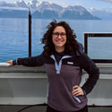
Danielle Warren
Mapping Watch Lead, NOAA Ocean Exploration
Beyond the Blue: Johnston Atoll Mapping 2
Danielle Warren is a contract mapping technician with the NOAA Ocean Exploration through the University Corporation for Atmospheric Research (UCAR). She has a bachelor’s degree in biological sciences/marine science and over eight years of sailing experience as a NOAA senior survey technician across NOAA’s fleet of oceanographic and fisheries research vessels. Her main areas of expertise include CTD (conductivity, temperature, depth) operations, scientific data collection, and seafloor mapping. In her time with NOAA, she sailed seven ships and supported upwards of 30 scientific research missions while also spearheading training initiatives, shipboard metadata updates, and work transition programs to provide better work/life balance and training opportunities to current and future survey technicians. When not at work, Danielle can be found curled up with a good book at her favorite local coffee shop.

Chris Wright
Data Engineer, Global Foundation for Ocean Exploration
Beyond the Blue: Johnston Atoll Mapping 2
Chris Wright holds a Bachelor of Science in business administration from the University of Mary Washington and a Master of Business Administration from Rollins College. After graduation, he worked as a network and systems administrator and engineer in the hospitality industry in the Northeast and Mountain West for more than 15 years. Recently relocating back to the East Coast, Chris joined the Global Foundation for Ocean Exploration (GFOE) data team in early 2019 as one of the newest members of the organization. In 2019, he completed his first expedition aboard NOAA Ship Okeanos Explorer and is extremely excited about continuing the journey to explore the oceans around the world. When he isn't sailing on Okeanos Explorer, he’s busy working in GFOE’s Quonset office planning, designing, and implementing data solutions to help refine and mature its base of operations for ocean exploration. Chris and his family currently reside in Newport, Rhode Island.