Photo & Video Log

This page contains photos and videos taken during Exploring the Submerged New World, a mission that took place from July 23 to August 5, 2009. Click on any image to view a larger version and for additional information. If a movie camera icon camera icon is present, a video can be viewed by clicking on the image. Multiple video formats are available on the linked pages. If a Podcast icon Podcast Icon is present, a video or audio file is available for download or you can subscribe to the RSS Podcast Feed. NOAA Podcast RSS 2.0 Feed

If a slideshow icon slideshow icon is present, a visual log of exploration images can be viewed. You can scroll through them one by one, or select the play button for an automatic slideshow.

(HR) = "High Resolution" images available.

camera icon Video & Slideshows

Video slideshow of towfish.

camera icon July 28 Log
Video slideshow of the towfish deployment.

Video slideshow of zodiac deployment.

camera icon July 27 Log
Video slideshow of a Zodiac deployment.

Video of sample collection.

camera icon July 26 Log
Video of sample collection.

Video of sample storage.

camera icon July 26 Log
Video of sample storage.

Video detailing remote sensing using a side-scan sonar system.

camera icon July 25 Log
Video detailing remote sensing using a side scan sonar system.

Video introduction C. Andrew Hemmings and Dr. J. M. Adovasio Part 1

camera icon July 24 Log
Video introduction presented by Dr. C. Andrew Hemmings and Dr. J. M. Adovasio — Part I

Video introduction C. Andrew Hemmings and Dr. J. M. Adovasio Part 2

camera icon July 24 Log
Video introduction presented by Dr. C. Andrew Hemmings and Dr. J. M. Adovasio — Part II

Video slideshow of The 2009 Submerged New World Expedition first day at sea.

camera icon July 23 Log
Video slideshow of The 2009 Submerged New World expedition's first day at sea.

Images

Principal Investigator, Dr. Adovasio, hands off an underwater video camera to divers.

Mission Summary
Principal Investigator Dr. J.M. Adovasio hands off an underwater video camera to divers. (HR)

Bedrock Chert after sampling.

Mission Summary
Bedrock chert after sampling. (HR)

Drs Loebel & Hemmings plot research areas near the mouth of the Suwannee.

Mission Summary
Drs.Thomas Loebel and C. Andrews Hemmings plot research areas near the mouth of the Suwannee. (HR)

Halligan & Loebel run computers while the crew deploys the towfish.

Mission Summary
Jessi Halligan and Thomas Loebel run computers, while the crew deploys the towfish. (HR)

Co-PI, Dr. Andy Hemmings, and Graduate Student, Cliff Brown, pose with Chert samples collected during the expedition.

Mission Summary
Co-principal Investigator Andy Hemmings and graduate student Cliff Brown pose with chert samples collected during the expedition. (HR)

The Klein 3000 combined side scan sonar and sub-bottom profiler used during the mission.

Mission Summary
The Klein 3000 combined the side scan sonar and sub-bottom profiler capabilities used during the mission. (HR)


Drs. Loebel and Hemmings plan the orientation

July 28 Log
Thomas J. Loebel and C. Andrew Hemmings (wearing the orange hat) plan the orientation. (HR)


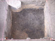
Southern Methodist University terrestrial excavation site of a Whiskey Distillery and Mill.

July 27 Log
The Southern Methodist University terrestrial excavation site of a whiskey distillery and mill.

Southern Methodist University terrestrial excavation site of a Whiskey Distillery and Mill.

July 27 Log
The Southern Methodist University terrestrial excavation site of a whiskey distillery and mill.

Southern Methodist University terrestrial excavation site of a Whiskey Distillery and Mill.

July 27 Log
The Southern Methodist University terrestrial excavation site of a whiskey distillery and mill.

Southern Methodist University terrestrial excavation site of a Whiskey Distillery and Mill.

July 27 Log
The Southern Methodist University terrestrial excavation site of a whiskey distillery and mill.

ROV monitor illustrating one of the larger geological samplers collected.

July 26 Log
The ROV monitor illustrating one of the larger geological samplers collected. (HR)

Geological (chirt) sample in a plastic bag.

July 26 Log
Geological chert sample in a plastic bag. (HR)

Ashley Lemke on site in a terrestrial dig.

July 26 Log
Ashley Lemke on site in a terrestrial dig. (HR)


These lines represent the edge of the Clovis continent.

July 25 Log
A close-up of buried Holocene coral. (HR)

Drs. Hemming and Alvarado dig a hole through old coral covering the buried ancient Suwannee River.

July 25 Log
Drs. Hemmings and Alvarado dig a hole through the old coral covering the buried ancient Suwannee River. (HR)

SCUBA diving , allows scientists to closely observe very small portions of the seabed.

July 25 Log
Scuba diving, unlike remote sensing, allows scientists to observe very small portions of the seabed. (HR)


These lines represent the edge of the Clovis continent.

July 24 Log
These lines represent the edge of the Clovis continent. (HR)


Port bow of the USF R/V Weatherbird II

July 23 Log
Port bow of the University of Florida research vessel Weatherbird II. (HR)

A spiraling bamboo coral grows upward off a vertical wallStern of the University of South Florida RV Weatherbird II leaving St. Petersurg port..

July 23 Log
Stern of the University of South Florida R/V Weatherbird II as it leaves the port in St. Petersurg, Florida. (HR)

Benjamin Wells and Cliff Brown attempting to lift the Towfish.

July 23 Log
Benjamin Wells and Cliff Brown attempting to lift the towfish. (HR)

Dolphins off the bow.

July 23 Log
Dolphins off the bow. (HR)

U-frame at sunset in the Gulf of Mexico.

July 23 Log
U-frame at sunset in the Gulf of Mexico. (HR)


Christopher Columbus landing on San Salvador.

Evolving Beliefs
Christopher Columbus landing on San Salvador.

View of Meadowcroft Rockshelter, facing west, just prior to the initiation of excavation.

Evolving Beliefs
View of Meadowcroft Rockshelter, facing west, just prior to the initiation of excavation.

Ice Age human behavior

Evolving Beliefs
Ice Age human behavior.

Excavations at Monte Verde.

Evolving Beliefs
Excavations at Monte Verde.

Map of the Bering land bridge during the late Wisconsin glaciation.

Early Occupation
Map of the Bering land bridge during the late Wisconsin glaciation.

Sea level rise since the last glacial episode.

Early Occupation
Sea level rise since the last glacial episode.

Dr. Jack Rink of McMaster University taking an OSL sample in the Pre-Clovis levels at Gault, Texas.

Early Occupation
Dr. Jack Rink of McMaster University taking an OSL sample in the Pre-Clovis levels at Gault, Texas.


 A modern map of Florida with a dark line showing the approximate location of the Last Glacial Maximum (LGM) coastline.

Climate Change
A modern map of Florida with a dark line showing the approximate location of the Last Glacial Maximum (LGM) coastline. (HR)

During the Late Pleistocene Florida's shoreline extended much farther offshore than the present coast.

Climate Change
During the Late Pleistocene, Florida's shoreline extended much farther offshore than the present coast.


Map of the eastern Gulf of Mexico

Mission Plan
The eastern Gulf of Mexico showing the three sub-areas examined in 2008.

Side scan sonar image

Mission Plan
Side scan sonar image showing near-shore sand ridges associated with the Last Glacial Maximum.


Sign up for the Ocean Explorer E-mail Update List.