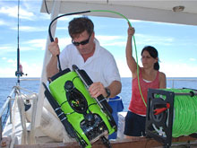
Dr. Rikk Kvitek and graduate student Krystle Gomez prepare the remotely operated vehicle (ROV) for deployment in waters off the Bermuda Platform. Click image for larger view and image credit.
Phase 1: Mission Summary
September 5 – 30, 2009
![]() View a slide show of images from the Bermuda Deep Water Caves 2009.
View a slide show of images from the Bermuda Deep Water Caves 2009.
The first phase of this two-year expedition searching for deep-water caves in and near Bermuda was successfully completed in September. With the assistance of Dr. Rikk Kvitek and his team from the Seafloor Mapping Lab at California State University – Monterey Bay, we were able to map and then explore the seafloor surrounding the island of Bermuda and the nearby Challenger Bank.
The first two weeks of the expedition were dedicated to multibeam mapping of the seafloor along the continental shelf break, centered at the 100-meter (328-foot) depth contour line. Using newly developed sonar acquisition software for the RESON 7124 multibeam system, we were able to collect ultra-high resolution bathymetric data at water depths greater than 150 m (492 ft). From this, we produced detailed geo-referenced maps of the shelf edge of the entire Bermuda Platform and 75% of the Challenger Bank.
Data from the mapping surveys was used to identify potential cave sites. Such sites were identified when there were consistent gaps in the multibeam data profile, which could indicate a potential void or overhang. Using this method, over 100 “points of interest” were identified as potential caves. The majority of these sites were located along the northwest, north, east, and southwest sides of the main platform, and the southern and eastern sides of the Challenger Bank. Additionally, mapping surveys discovered what appeared to be the heads of several submarine landslides around the perimeter of the Bermuda shelf.
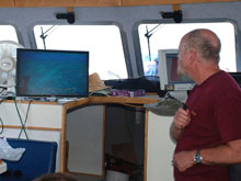
Using our results from the multibeam surveys, we selected the most promising points of interest for further investigation with the Seabotix LBV (little benthic vehicle) 200 during the final week of the expedition. Our team completed 33 video survey dives of various points of interest and recorded 25 cumulative hours of dive time.
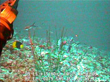
Colorful reef fish, as well as invasive lionfish, were present in water deeper than 80 m (262 ft) along the Bermuda Shelf. Click image for larger view and image credit.
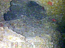
During the ROV we dives discovered numerous karstic (limestone) sinkholes along the northern edge of the Bermuda Platform, as well as many ledges, overhangs, and potential cave entrances on the walls of the platform edge (ranging from 110 to 120 m/361 to 394 ft depth). A karstic natural bridge — 10 m wide, 6 m high, and 25m long (32 ft wide, 20 ft high, and 82 ft long) — was discovered at 60 m (197 ft) depth.
ROV dives also recorded a notable presence of an invasive species, the lionfish, in Bermuda waters. Lionfish were plentiful around potential cave entrances and overhangs, at water depths of 80 m (262 ft) or greater.
We will review the ROV video further to select the most promising sites for diving investigations during Phase II of the expedition, in 2010. Instrument placement, biological and geological studies, and specimen collections will be carried out in Phase II as well.
Sign up for the Ocean Explorer E-mail Update List.


