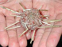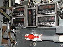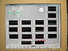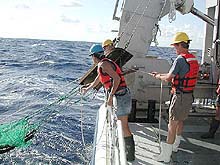
An Otter trawl is one of the devices being used to sample the ocean floor. Here, the science team prepares to release the net from the R/V Seward Johnson. The two wooden boards attached to the net are called spreaders. They keep the mouth of the net open as it is pulled along the ocean bottom. Click image for a larger view.
Advances in Technology
August 11, 2002
LaVern Taylor, Senior Marine Technician
Harbor Branch Oceanographic Institute
Bruce Moravchik, Islands in the Stream Web Coordinator, Leg 2
NOAA Ocean Service
![]() Watch a video of the deployment of an Otter trawl. (mp4, 1.2 MB)
Watch a video of the deployment of an Otter trawl. (mp4, 1.2 MB)
In the middle of last week, our expedition was subject to the effects of tropical storm Cristobal. High winds from the north and waves reaching up to 12 feet forced us to cancel our last 10 submersible dives. To avoid the rough weather and continue with our sampling protocols, the decision was made to steam toward shore and to the north. Traveling in this direction, we’ve been able to find protection from the more severe sea conditions behind the Cape Lookout Shoals just south of Pamlico Bay. We hope that when the weather conditions relax, we’ll be able to steam to the northeast and begin submersible operations on the Lophelia coral banks.
Despite the rough weather, our team has conducted surface sampling using neuston and plankton nets and bottom sampling using an Otter trawl and a benthic sled.
A great deal of oceanographic science involves collecting data and specimens from various depths in the oceans. This almost always requires that nets and/or data recording devices be lowered over the sides of the vessel. In the past, scientists used sensors that logged data internally. Only when these sensors were back aboard the ship could the collected data be downloaded and analyzed. At this point, sampling locations and depths could be decided. Net or sample bottles were then lowered on cables, and by knowing the amount of cable released and the angle of the wire, the researchers could approximate the depth of the nets or sample bottles. This process was very time consuming because many miles of cable had to be laid out and then retrieved. Often, it could take an entire day to take a single sample.
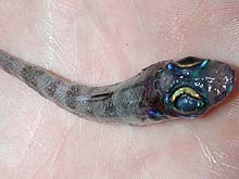
This deep-sea fish called a green eye exhibits a beautiful iridescent pattern around its large eyes and head. Click image for a larger view.
In the past few decades, however, cables and sensors have evolved tremendously. With today’s equipment, scientists at sea now know exactly at what depth their equipment is located. The strong wire cables carrying the underwater sensors or nets have electrical conductors build inside them. These conductors allow data to travel back to the scientists on board the ship as the gear is descending, sampling and ascending. The sensors take readings every 0.5 seconds, and the scientists are able to see those readings on a computer screen instantaneously. The ability to see this information in real time is a tremendous time saver and allows us to sample more frequently and more effectively.
Another advancement that allows scientist to find specific areas of the oceans involves the underway sampling system. This system allows researchers to view the characteristics of the water wherever the ship travels. Water is pumped into the ship and passed through sensors that analyze the water and display the results on computer screens. Scientists then can pinpoint a location where salinity, temperature, water clarity or chlorophyll concentrations change. In the past, the ship had to be stopped to allow for water samples to be taken and analyzed. This process took considerably longer and covered much less area. In conjunction with the underway sampling system, scientists consult satellite images of the oceans to direct their ships and their sampling efforts to areas of interest or concern. These advances save valuable time and resources, and optimize our sampling efforts.
We use many of these technological advances aboard the R/V Seward Johnson. They have allowed us to gather more precise data in less time, enabling us to learn even more about the depths of our oceans.
Sign up for the Ocean Explorer E-mail Update List.


