Expeditions
Follow the adventures of the NOAA Ship Okeanos Explorer via the web offerings below. You can also retrace the previous field seasons.
Learn how to get involved in Okeanos expeditions.
Access data collected during past expeditions via the NOAA Ocean Exploration Data Atlas.
2018

NOAA Ship Okeanos Explorer: Gulf of Mexico 2018
(April - May 2018) From April 11 to May 3, 2018, NOAA and partners will conduct a telepresence-enabled ocean exploration expedition on NOAA Ship Okeanos Explorer to collect critical baseline information about unknown and poorly understood deepwater areas in the Gulf of Mexico.

NOAA Ship Okeanos Explorer: Gulf of Mexico Technology Demonstration
(March - April 2018) The Gulf of Mexico Technology Demonstration is the first operational cruise on board NOAA Ship Okeanos Explorer in 2018, during which we will conduct our first emerging technology demonstration projects. From March 23 - April 5, we will work with three new technologies.

NOAA Ship Okeanos Explorer: 2018 Overview
(October 2017 - September 2018) From October 2017 to September 2018, NOAA Ship Okeanos Explorer will return to the Atlantic Ocean and conduct a series of expeditions to continue exploration of the deep waters of the U.S. Gulf of Mexico and North Atlantic.
2017

NOAA Ship Okeanos Explorer: 2018 Overview
(October 2017 - September 2018) From October 2017 to September 2018, NOAA Ship Okeanos Explorer will return to the Atlantic Ocean and conduct a series of expeditions to continue exploration of the deep waters of the U.S. Gulf of Mexico and North Atlantic.

Gulf of Mexico 2017
(November - December 2017) From November 29 through December 21, 2017, a team of scientists and technicians, both at-sea and shore-based, will conduct exploratory investigations into the diversity and distribution of deep-sea habitats and associated marine communities in the Gulf of Mexico basin.

Canal Transit and Gulf of Mexico Mapping
(November 2017) From November 15 - 22, 2017, NOAA Ship Okeanos Explorer will conduct an exploratory mapping expedition from Panama City, Panama, to Key West, Florida.

Deep-Sea Symphony: Exploring the Musicians Seamounts
(September 2017) From September 6 to 30, NOAA and partners will conduct an expedition on NOAA Ship Okeanos Explorer to explore unknown and poorly understood deepwater areas around the Musicians Seamounts and the Hawaiian Islands.

Musicians Seamounts Telepresence Mapping
(August 2017) Operations during the expedition, from August 8 - 31, will include focused mapping and strategic mapping transits by NOAA Ship Okeanos Explorer within the waters of Hawaii and in international waters at the Musician Seamounts chain.

2017 Laulima O Ka Moana: Exploring Deep Monument Waters Around Johnston Atoll
(July - August 2017) From July 7 to August 2, NOAA and partners will conduct an expedition on NOAA Ship Okeanos Explorer to continue collecting critical baseline information about unknown and poorly known deepwater areas in the Johnston Atoll Unit of the Pacific Remote Islands Marine National Monument.

Mountains in the Deep: Exploring the Central Pacific Basin
(April - May 2017) NOAA and partners will conduct a telepresence-enabled expedition on NOAA Ship Okeanos Explorer to collect critical baseline information about deepwater areas as it transits across the northern portion of the Cook Islands, with focused work in the vicinity of both the Jarvis Island and Kingman/Palmyra units of the Pacific Remote Islands Marine National Monument, prior to returning to Honolulu.

Telepresence Mapping in American Samoa and the Cook Islands
(April 2017) NOAA Ship Okeanos Explorer will conduct mapping operations 24 hours per day using the ship's state-of-the-art suite of sonars focused on mapping the seafloor, the water column, and the sub-seafloor. This is the second of two Okeanos cruises focusing on exploring the waters of American Samoa and Samoa, and is the first of two cruises focusing on exploring the waters of the Cook Islands.

Discovering the Deep: Exploring Remote Pacific Marine Protected Areas
(March 2017) NOAA and partners will conduct a telepresence-enabled ocean exploration expedition on NOAA Ship Okeanos Explorer to collect critical baseline information about unknown and poorly known deepwater areas in the Howland and Baker Unit of the Pacific Remote Islands Marine National Monument and the Phoenix Islands Protected Area.

2017 American Samoa Expedition: Suesuega o le Moana o Amerika Samoa
(February - April 2017) NOAA and partners will conduct two telepresence-enabled ocean exploration cruises on NOAA Ship Okeanos Explorer to collect critical baseline information of unknown and poorly known deepwater areas in American Samoa and Samoa, with an emphasis on Rose Atoll Marine National Monument, National Marine Sanctuary of American Samoa, and National Park of American Samoa.

CAPSTONE Telepresence Mapping in Pacific Marine Protected Areas
(January - February 2017) This seafloor mapping expedition will commence on January 20, 2017, in Honolulu, Hawaii, and will conclude on February 11 in Pago Pago, American Samoa.

NOAA Ship Okeanos Explorer: 2017 Overview
(December 2016 - September 2017) From December 2016 through September 2017, a team of NOAA and external partners will conduct the third year of the ‘Campaign to Address Pacific monument Science, Technology, and Ocean NEeds (CAPSTONE)’ field effort, deploying NOAA Ship Okeanos Explorer to investigate and document the diversity and distribution of deepwater environments in U.S. central Pacific waters, the high seas, and waters of several Pacific Island countries and territories.
2016

Shakedown, Calibration, and Testing in the Main Hawaiian Islands
(December 2016) The Okeanos team will conduct two at-sea "shakedown" cruises, to test all of the ship’s mission systems to ensure everything is performing properly and that the ship is fully ready for 2017 expeditions. The first cruise, from December 1 – 8, 2016, is focused primarily on testing remotely operated vehicle and telepresence systems. The second cruise, running from December 10 – 16, is dedicated to mapping and continued telepresence shakedown.

Telepresence Seafloor Mapping in the Pacific Remote Islands Marine National Monument - Wake Island Unit
(August - September) From August 25 to September 11, 2016, NOAA Ship Okeanos Explorer will transit from Kwajalein Atoll to the operational working grounds near Wake Island, followed by final transit to Honolulu, Hawaii. Mapping efforts will focus on using the ship's deepwater sonar systems to explore several unnamed, previously unexplored seamounts near Wake Island.

Deepwater Wonders of Wake: Exploring the Pacific Remote Islands Marine National Monument
(July - August) From July 27 through August 19, 2016, NOAA and partners will conduct a telepresence-enabled ocean exploration cruise on NOAA Ship Okeanos Explorer to collect critical baseline information in and around the Wake Island Unit of the Pacific Remote Islands Marine National Monument.

2016 Deepwater Exploration of the Marianas
(April - July) From April 20 to July 10, 2016, NOAA and partners will conduct a three-cruise expedition on NOAA Ship Okeanos Explorer to collect critical baseline information of unknown and poorly known areas in and around the Marianas Trench Marine National Monument and the Commonwealth of the Northern Mariana Islands.

Mapping in the Pacific Remote Islands Marine National Monument
(March - April) From March 23 to April 13, 2016, NOAA Ship Okeanos Explorer will conduct 24-hour mapping operations to explore the largely unknown region surrounding the Wake Island Unit of the Pacific Remote Islands Marine National Monument (PRIMNM). This is the first of three cruises in the 2016 field season focused on deepwater exploration of the PRIMNM.

2016 Hohonu Moana: Exploring Deep Waters off Hawaiʻi
(February - March) From February 25 to March 18, scientists will continue 2015 Hohonu Moana expedition efforts to explore deep-water habitats in and around Papahānaumokuākea Marine National Monument. The expedition will include work on seamounts in the Mid-Pacific Mountains while en route to port in Kwajalein.

Mission System Shakedown 2016
(February) From February 12 to February 17, the team will shakedown newly installed systems, test data work flow and integration, and prepare for the rest of the field season. A primary objective of this cruise is to test the remotely operated vehicle (ROVs) in a controlled environment and train new ROV engineers.
2016 Field Season Overview
(January - September) A team of NOAA and external partners will investigate and document deep-water environments in and around the Hawaiian Archipelago, the Commonwealth of the Northern Marianas Islands and Marianas Trench Marine National Monument, and Wake Atoll section of the Pacific Remote Islands Marine National Monument.
2015
Signature Expeditions

Hohonu Moana: Exploring the Deep Waters Off Hawai’i
(July - September) From July 10 to September 30, a team of NOAA and external partners both at-sea and on shore will conduct mapping and remotely operated vehicle operations in the deep waters of the Hawaiian Archipelago, including the Papahānaumokuākea Marine National Monument and Johnston Atoll.

Tropical Exploration 2015
(May - June) From May 8 to June 12, NOAA Ship Okeanos Explorer will journey from the Atlantic Ocean to the Pacific Ocean, exploring along the way. Okeanos Explorer will leave Puerto Rico to traverse the Western Caribbean, Panama Canal, and Eastern Pacific.

Océano Profundo 2015: Exploring Puerto Rico’s Seamounts, Trenches, and Troughs
(February - April) From February through April 2015, the NOAA Office of Ocean Exploration and Research will lead a three-leg expedition aboard NOAA Ship Okeanos Explorer to explore unknown and poorly known deepwater regions around Puerto Rico and the U.S. Virgin Islands.
Summary Expeditions

Campaign to Address Pacific monument Science, Technology, and Ocean NEeds (CAPSTONE)
(2015 - 2017) In July 2015, a team of NOAA and partners initiated the ‘Campaign to Address Pacific monument Science, Technology, and Ocean NEeds (CAPSTONE),' a multi-year effort focused on deepwater areas of U.S. marine protected areas in the Pacific.

NOAA Ship Okeanos Explorer: 2015 Field Season Overview
(February - September) From February through September 2015, NOAA Ship Okeanos Explorer will embark on a journey to investigate and document the Caribbean and the Hawaiian Islands. A combination of scientists, technicians, and engineers – both on board the ship and on shore – will map and explore the geological, biological, archaeological, and chemical features of these vast areas.
2014
Signature Expeditions

Our Deepwater Backyard: Exploring Atlantic Canyons and Seamounts 2014
(August - October) From August through October 2014, NOAA Ship Okeanos Explorer will explore the largely unknown deep-sea ecosystems of the U.S. Atlantic coast. Our at-sea and shore-based science team will collect baseline data in the Atlantic submarine canyons and along the New England Seamount Chain.
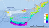
Exploration of the Gulf of Mexico 2014
(February - May) From February 24 - March 15, 2014, the NOAA Ship Okeanos Explorer will conduct an expedition from its home port of Davisville, Rhode Island, to Galveston, Texas, while conducting seafloor and water column mapping of top-priority exploration focus areas in the Gulf of Mexico.
Summary Expeditions

Exploration, East Coast Mapping
(May) From May 7-May 22, 2014 the NOAA Ship Okeanos Explorer will conduct a sixteen day mapping expedition beginning in Tampa, Florida and ending at the ship’s home port of North Kingstown, Rhode Island. Exploratory ocean mapping will occur at all times during the expedition as the Okeanos Explorer voyages around the Florida Keys and heads northward along the U.S. East Coast.
2013
Signature Expeditions
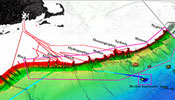
Northeast U.S. Canyons Expedition 2013
(July - August) From July to August 2013, a team of scientists and technicians both at-sea and on shore will conduct exploratory investigations on the diversity and distribution of deep-sea habitats and marine life along the Northeast U.S. Canyons and at Mytilus Seamount, located within the U.S. Exclusive Economic Zone.
Summary Expeditions
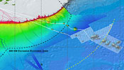
NOAA Ship Okeanos Explorer: New England Seamount Chain Exploration
(June) The NOAA Ship Okeanos Explorer will conduct seafloor and water column mapping operations in the Western North Atlantic Ocean over a portion of the New England Seamount Chain from June 11-29, 2013.
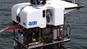
NOAA Ship Okeanos Explorer 2013 ROV Shakedown and Field Trials in the U.S. Atlantic Canyons
(May - June) From May 13 – June 6, NOAA Ship Okeanos Explorer will be conducting mapping operations and testing a new remotely operated vehicle off the East Coast of the United States.
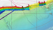
NOAA Ship Okeanos Explorer 2013 Shakedown: Kicking the Tires
(March - April) Between March 18 and April 5, NOAA Ship Okeanos Explorer will conduct mapping operations within the Western North Atlantic Ocean as part of the annual ship shakedown.
2012
Signature Expeditions

NOAA Ship Okeanos Explorer Gulf of Mexico 2012 Expedition
(March - April) From March to April 2012, a team of scientists and technicians both at-sea and on shore will conduct exploratory investigations on the diversity and distribution of deep-sea habitats and marine life in the northern Gulf of Mexico.
Summary Expeditions
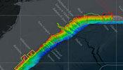
NOAA Ship Okeanos Explorer Northeast and Mid-Atlantic Canyons Expedition
(November) Between November 2 and November 20, 2012, NOAA Ship Okeanos Explorer will be operating in the North Atlantic Ocean, between Cape Hatteras, North Carolina, and the U.S.-Canadian territorial boundary.
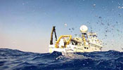
NOAA Ship Okeanos Explorer Atlantic Canyons Undersea Mapping 2012 Expeditions
(February - August) Between February and August 2012, a team of NOAA and external partners will conduct a mapping ‘blitz’ focused on deepwater canyons off the northeastern seaboard.
2011
Signature Expeditions
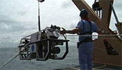
NOAA Ship Okeanos Explorer Mid-Cayman Rise Expedition 2011
(August) Join the NOAA Ship Okeanos Explorer as it travels to the deepest part of the Caribbean Sea, where a team of international scientists both at-sea and on shore will conduct interdisciplinary investigations of the Mid-Cayman Rise.
NOAA Ship Okeanos Explorer Galápagos Rift Expedition 2011
(July) The NOAA Ship Okeanos Explorer embarks on a unique expedition to one of the most fascinating areas of the world’s oceans, to explore the water column and unexplored benthic environments in the Galápagos region.
Summary Expeditions
NOAA Ship Okeanos Explorer Gulf of Mexico Expedition 2011
(August – September) Very few deep water multibeam sonars are capable of providing water column backscatter data. Learn why the primary purpose of this expedition is to study the feasibility of using this capability to map gasses in the water column.
NOAA Ship Okeanos Explorer California Shakedown Cruise 2011: Exploring California's National Marine Sanctuaries
(March) EX1101 provided an opportunity to get the ship underway and ensure that all of its systems and equipment were fully operational prior to integration of the ROV on board.
2010
Signature Expeditions
NOAA Ship Okeanos Explorer Indonesia-USA Deep-Sea Exploration of the Sangihe Talaud Region
(June – August) An international team led by scientists from the United States and Indonesia will participate in a collaborative effort to explore the depths of Indonesian waters. The expedition, Indonesia-U.S. Deep-Sea Exploration of the Sangihe Talaud Region.
Summary Expeditions
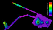
NOAA Ship Okeanos Explorer Maximizing Operations
(October) Systematic exploration aboard the NOAA ShipOkeanos Explorer is an evolving operational model referred to as a “sticks and boxes” approach. The variety of data being collected onboard the Okeanos during this cruise from Hawaii to California represents a step forward in the exploration that can be conducted with the at-sea time allotted to the ship.
2009
Summary Expeditions
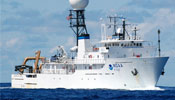
NOAA Ship Okeanos Explorer: Getting It Together
(June) Everything takes longer than expected
Refitting a ship to conduct deep ocean exploration, installation of complex, high-tech equipment and systems to enable remote access to data and information from sea, and build out and installation of deep water dual-body ROV’s with an associated state-of-the-art control room - all monumental efforts. See how we did it!
Field Season Products
- Mendocino Ridge Mapping Shakedown Cruise
(May 5-26, 2009) Mendocino Ridge Insets Mapping Shakedown Cruise. (pdf 15 MB)
- Gorda Ridge Water Column Shakedown Cruise
(June 1-12, 2009) Water Column Exploration Gorda Ridge and East Blanco Fracture Zone. (pdf 19.4 MB)
- Mendocino Ridge Mapping Field Trials II Shakedown Cruise
(June 17-27, 2009) Mendocino Ridge Mapping Field Trials II: Exploring Extent of Volcanic Fields. (pdf 12.8 MB)
- Okeanos Explorer Multibeam Survey with the Office of National Marine Sanctuaries (ONMBS)
(July 2009) The Okeanos Explorer multibeam survey with ONMS produced products for the Garden Flower Banks NMS expansion area, Channel Islands NMS expansion area, Cordell Bank NMS, Gulf of the Farallones NMS, and the Monterey Bay NMS (USS Independence). (pdf 2.8 MB)
- Hawaiian Islands Multibeam Transit Data (pdf 23.5 MB)
(September 8-26)
- Leg 2 West of Necker Ridge Mapping Data (pdf 31.4 MB)
- Leg 3 Middle Bank Seamount Mapping Data (pdf 5.6 MB)
- Leg 4 Seamounts of the North Pacific Data (pdf 1 MB)
(October 26-November 15, 2009)
Email Updates | User Survey | Contact Us | Report Error | Privacy Policy | Disclaimer | Site Info | Site Index
Revised February 02, 2023 by the NOAA Ocean Explorer Webmaster
Office of Ocean Exploration and Research | National Oceanic and Atmospheric Administration |
U.S. Department of Commerce
http://oceanexplorer.noaa.gov/okeanos/explorations/explorations.html
