
Date: July 3, 2021
Location: Lat: 33.66116°, Lon: -60.33575°
Dive depth range: 2,368 - 2,592 meters (7,769 - 8,504 feet)
Access Dive Summary and ROV Data
During the first dive of the 2021 North Atlantic Stepping Stones, we explored a seamount that had not been mapped, much less visually surveyed, making the dive a true exploration endeavor. Everything seen during the dive was thus new to human eyes and our exploration of the shallowest of three peaks just outside the Bermuda Exclusive Economic Zone did not disappoint. Video courtesy of NOAA Ocean Exploration, 2021 North Atlantic Stepping Stones: New England and Corner Rise Seamounts. Download largest version (mp4, 58.1 MB).
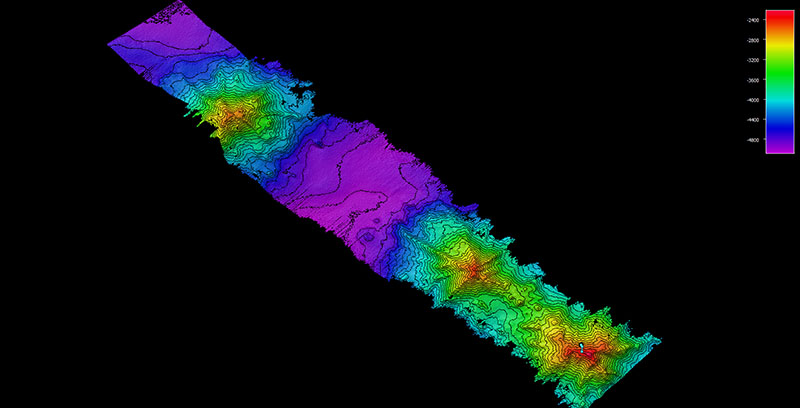
The multibeam data displayed in this image was collected and processed by the NOAA Ocean Exploration mapping team just hours before Dive 01 of the 2021 North Atlantic Stepping Stones expedition took place — allowing the expedition team to select a productive dive site. Image courtesy of NOAA Ocean Exploration, 2021 North Atlantic Stepping Stones: New England and Corner Rise Seamounts. Download largest version (jpg, 635 KB).
The first dive of the 2021 North Atlantic Stepping Stones: New England and Corner Rise Seamounts took place on a seamount that is not part of either the New England nor Corner Rise seamount chains. After heading nearly 200 miles south of the originally planned dive site in an effort to avoid bad weather, the team conducted overnight mapping operations outside of the Bermude Exclusive Economic Zone and discovered that where it was thought there were two seamount peaks, there were actually three! Given that these peaks had not been mapped, much less visibly surveyed, we weren’t sure what we’d find. However, our dive on the shallowest of the peaks did not disappoint.
The remotely operated vehicles traversed southward during the dive, moving up a slope towards the summit of the seamount. We covered a variety of mixed terrain that included soft, unconsolidated mixed sediment that was likely biological in origin, cobble- to boulder-sized rock debris, and hard bottom (possibly of volcanic origin) covered in ferromanganese crusts. Throughout the dive, we observed patchy but diverse deepwater coral and sponge communities, including some species that may be new to the region or new to science. Coral and sponge associates were limited, as were mobile fauna.
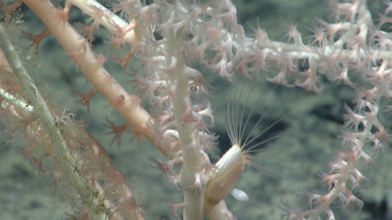
A close look at a bamboo coral in the family Isididae with an associated barnacle, seen at 2,530 meters (8,300 feet) depth during Dive 01 of the 2021 North Atlantic Stepping Stones expedition. Corals, as well as sponges, provide important habitat for many other animals in the deep ocean. Although associates on corals were not abundant throughout the dive, we did see organisms such as barnacles, brittle stars, squat lobsters, and anemones living in the branches of corals in order to get higher in the water column for feeding or protection. Image courtesy of NOAA Ocean Exploration, 2021 North Atlantic Stepping Stones: New England and Corner Rise Seamounts. Download largest version (jpg, 714 KB).
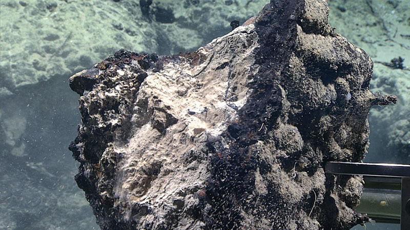
A close look at a geological sample collected during Dive 01 of the 2021 North Atlantic Stepping Stones expedition. The remotely operated vehicle team was able to break off a piece of the frequently observed ferromanganese crust, which is visible as a black band in this image. Analyses of this sample will provide scientists with information such as mineral composition and age of the crust, water chemistry, and past water circulation patterns. Image courtesy of NOAA Ocean Exploration, 2021 North Atlantic Stepping Stones: New England and Corner Rise Seamounts. Download largest version (jpg, 1.1 MB).
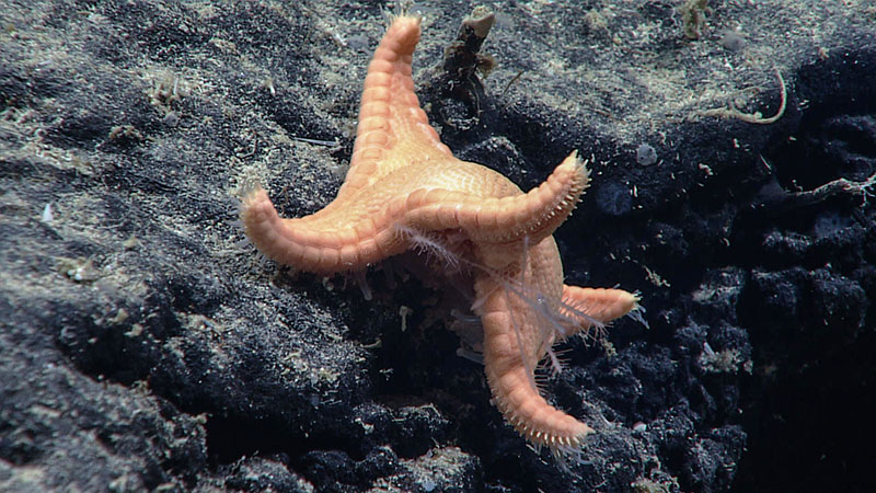
During the first dive of the 2021 North Atlantic Stepping Stones expedition, we saw this goniasterid sea star feeding on a predatory sponge in the family Cladorhizidae, a behavior that none of our participating scientists had previously observed. Sea stars feed by extending their stomachs in a gradual, but deliberate process that can take days, months, weeks, or even years. This was one of only a few sea star observations made during the dive. Image courtesy of NOAA Ocean Exploration, 2021 North Atlantic Stepping Stones: New England and Corner Rise Seamounts. Download largest version (jpg, 1.3 MB).
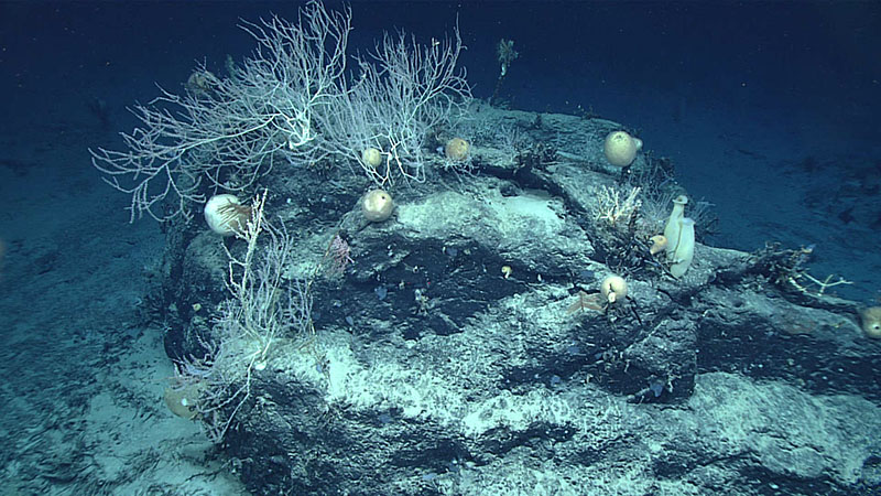
As we moved upslope during the first dive of the 2021 North Atlantic Stepping Stones expedition, we saw many scenes like this one, where a diversity of corals and sponges covered exposed rock surfaces. These live corals and sponges were frequently seen in conjunction with dead coral and sponge stalks that were covered in a ferromanganese coating. Scientists estimate this coating grows at a rate of approximately one millimeter every million years, suggesting that the corals and sponges had been dead for quite some time. Image courtesy of NOAA Ocean Exploration, 2021 North Atlantic Stepping Stones: New England and Corner Rise Seamounts. Download largest version (jpg, 1.2 MB).
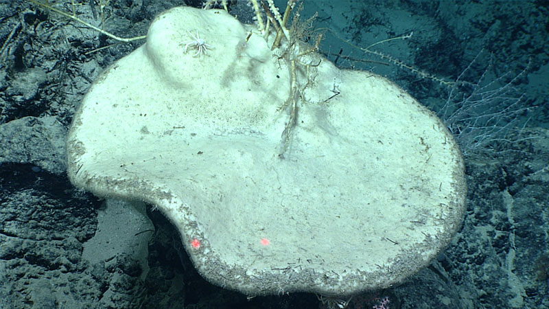
Sponges were well represented during the first dive of the 2021 North Atlantic Stepping Stones expedition, including this large, plate-like demosponge seen at 2,423 meters (7,950 feet) depth that may represent a potential species range extension. Rossellid and farreid glass sponges as well as several unknown species of sponges were also observed. Image courtesy of NOAA Ocean Exploration, 2021 North Atlantic Stepping Stones: New England and Corner Rise Seamounts. Download largest version (jpg, 1.1 MB).
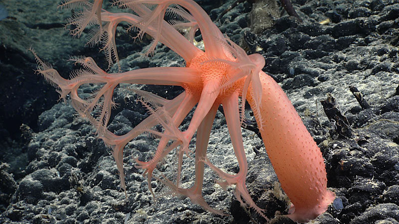
This colorful Anthomastus soft coral was observed at a depth of 2,550 meters (8,366 feet) during Dive 01 of the 2021 North Atlantic Stepping Stones expedition. This genus of coral was frequently seen during the dive. Image courtesy of NOAA Ocean Exploration, 2021 North Atlantic Stepping Stones: New England and Corner Rise Seamounts. Download largest version (jpg, 1.2 MB).
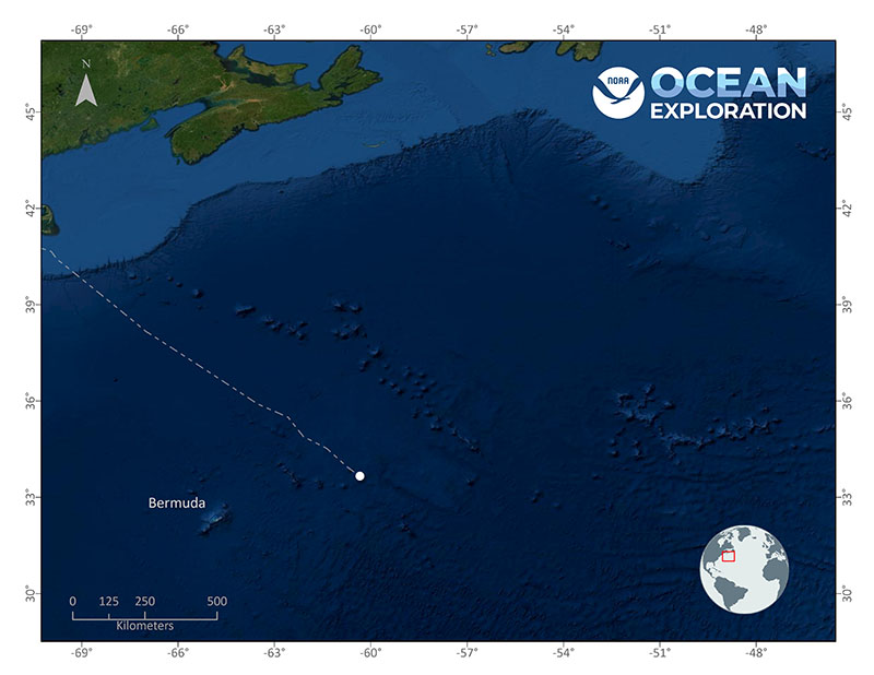
Location of Dive 01 of the 2021 North Atlantic Stepping Stones expedition on July 3, 2021. Map courtesy of NOAA Ocean Exploration, 2021 North Atlantic Stepping Stones: New England and Corner Rise Seamounts. Download largest version (jpg, 2.4 MB).
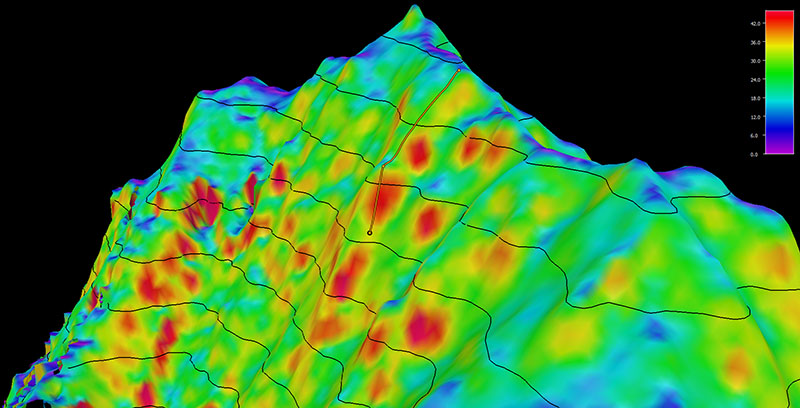
Image showing the dive track of Dive 01 of the 2021 North Atlantic Stepping Stones expedition. Scale is water depth in meters. Image courtesy of NOAA Ocean Exploration, 2021 North Atlantic Stepping Stones: New England and Corner Rise Seamounts. Download largest version (jpg, 708 KB).