
By Heidi Hirsh, Natural Resources Management Specialist - NOAA Fisheries Service, Marine National Monuments Program
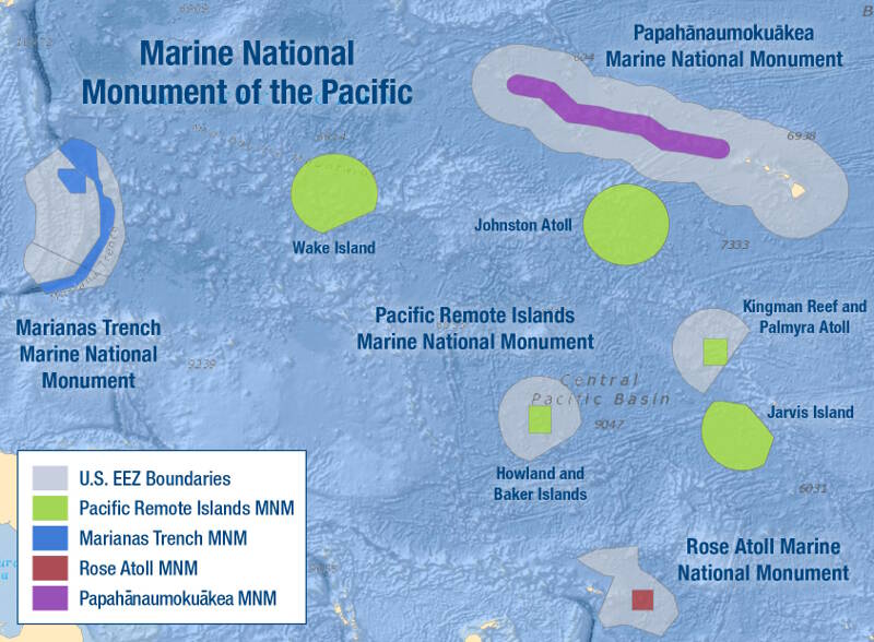
The Pacific Remote Islands Marine National Monument (PRIMNM) provides broad scale protections to marine ecosystems within its boundaries. Image courtesy of NOAA National Marine Fisheries Service. Download larger version (jpg, 539 KB).
The Pacific Remote Islands Marine National Monument (PRIMNM) was established in January 2009 through Presidential Proclamation 8336 and then expanded by President Obama in September 2014 with Presidential Proclamation 9173. The area, jointly managed by NOAA and the U.S. Fish and Wildlife Service, now covers about 370,000 square nautical miles of near-pristine waters and abundant, thriving marine life.
Located south and west of Hawaiʻi and further described in the PRIMNM fact sheet, the PRIMNM hosts diverse ecosystems among Howland, Baker, and Jarvis Islands; Johnston, Wake, and Palmyra Atolls; and Kingman Reef.
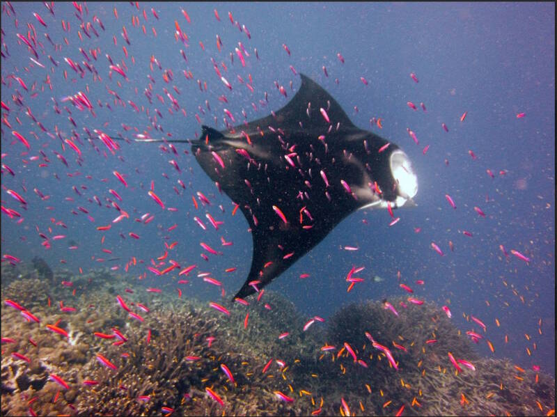
Manta ray at Baker Island. Image courtesy of NOAA Coral Reef Ecosystem Program. Download larger version (jpg, 254 KB).
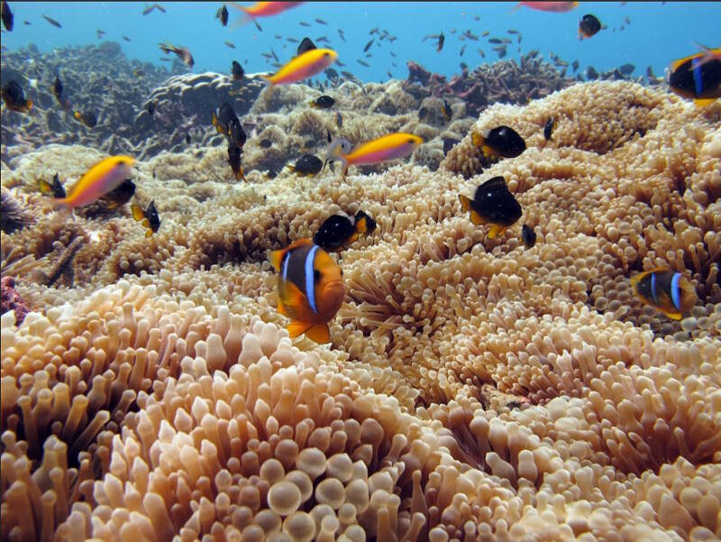
Anemone and clown fish at Baker Island. Images courtesy of NOAA Coral Reef Ecosystem Program. Download larger version (jpg, 304 KB).
This expedition is virtually the first time the deep-sea ecosystems of the Pacific Remote Islands will be explored. The NOAA Pacific Islands Fisheries Science Center's Rapid Assessment and Monitoring Program (RAMP) has conducted near-shore and shallow-water ecosystem assessments of the area since 2000. The Pacific RAMP established baseline ecosystem assessments and initiated long-term monitoring of trends that integrate biological observations with water quality and oceanographic data. However, very little deep-sea exploration or mapping has taken place on seamounts or seafloor within or around the PRIMNM.
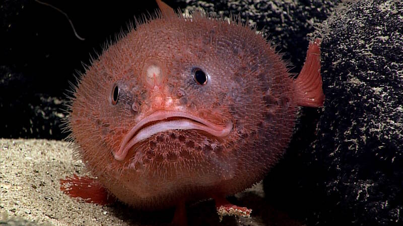
A sea toad, which is a fish that can "walk," waits for its next meal to swim by. Image courtesy of NOAA Office of Ocean Exploration and Research, Deepwater Exploration of the Marianas. Download larger version (jpg, 463 KB).
The capabilities of NOAA Ship Okeanos Explorer with the remotely operated vehicle (ROV) Deep Discoverer are expected to broaden our understanding of marine life, ecosystem functions, and climate change processes within and around the PRIMNM.
Deep Discoverer can reach 6,000-meter depths, which will enable many of the 33 seamounts in the Monument and some 132 more in the vicinity to be mapped, characterized, and photographed. These seamounts are expected to host unknown amounts of undiscovered species with possibilities for research interests, medications, and other important benefits.
The expedition will likely help gather information on the connectivity, similarities, and differences between the deepwater communities of Howland, Baker, Johnston, and Wake Islands; the Line Islands of Palmyra, Kingman Reef, and Jarvis; and the Phoenix Islands Protected Area in the Republic of Kiribati.
The Pacific Remote Islands and reefs can be divided into three groups based on ecological characteristics: the equatorial islands, which includes Baker, Howland, and Jarvis Islands; the central transition islands, which includes Kingman Reef and Palmyra Atoll; and the northernmost islands, which includes Wake and Johnston Atoll. The equatorial islands are especially productive because they benefit from the Equatorial Undercurrent upwelling, which brings cool, nutrient-rich waters to the surface. In contrast, the northernmost islands to the north are influenced by the North Equatorial Current, a nutrient-poor and well-mixed current. The North Equatorial Countercurrent and North Equatorial Current both influence the central transition islands.
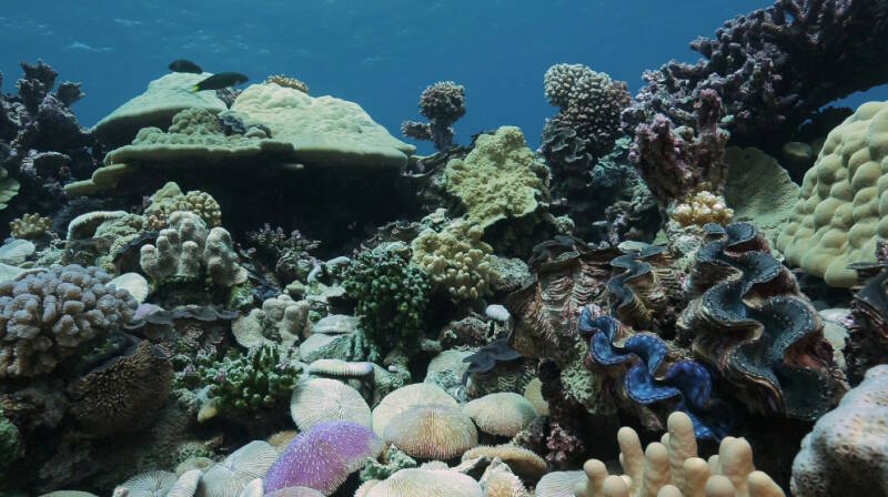
Healthy corals at Kingman Reef. Image courtesy of Open Boat Films / NOAA. Download larger version (jpg, 282 KB).
The unique geology and geochemistry, rare biological conditions, and near-pristine ecosystems provide an ideal location for studying climate change and many other research topics. Because the area has a distinct position in the biogeography of the Pacific as a place where a high number of regional endemic and unusual species assemblages thrive, the PRIMNM holds outstanding potential for globally significant scientific contributions and expanding international partnerships.
The mapping efforts may lead to the discovery of new seamounts and geologic features that give insight to the features of the ocean floor and new discoveries into the continued creation of the continents and connectivity to all life on Earth.