
This media resources page provides members of the media with information; resources; and broadcast-, print-, and web-quality imagery developed during the Discovering the Deep: Exploring Remote Pacific Marine Protected Areas (MPAs) expedition.
From March 7 – 29, NOAA and partners will conduct an ocean exploration expedition on NOAA Ship Okeanos Explorer to collect critical baseline information about unknown and poorly known deepwater areas in the Howland and Baker Unit of the Pacific Remote Islands Marine National Monument (PRIMNM), now known as Pacific Islands Heritage Marine National Monument and the Phoenix Islands Protected Area (PIPA). During the cruise, our at-sea and shore-based science teams will work together to map the seafloor and make some of the first deepwater scientific observations in these areas. Live video of the expedition can be viewed online in real-time from March 8 – 27, 2017.
The ship will conduct 24-hour operations consisting of daytime remotely operated vehicle (ROV) dives and overnight mapping operations, including during transit. Mapping and ROV dives with high-resolution visual surveys and limited sampling activities will focus on areas in and around the PRIMNM and PIPA, as well as dives in New Zealand’s Territory of Tokelau, as the ship transits through to the cruise priority areas. Dive sites are expected to include deep-sea coral and sponge habitats, bottom fish habitats, and seamounts. This expedition will help establish foundational information in the region to catalyze further exploration, research, and management activities.
Note: The above dates are Western Samoa Time and are a day ahead of the mainland U.S., Hawaii, and Alaska. ROV operations in the mainland U.S. are planned daily from March 7 - 26.
Why? | Who? | B-roll Footage/Highlight Videos & Images | Press Releases | Background Info | Contact Info
The expedition is part of the three-year Campaign to Address the Pacific monument Science, Technology, and Ocean NEeds (CAPSTONE), a foundational science initiative to collect deepwater baseline information to support science and management decisions in and around U.S. marine protected areas in the central and western Pacific. These areas contain some of the last relatively pristine marine ecosystems on the planet and harbor numerous protected species, undiscovered shipwrecks, and cultural landscapes. Their designation is unprecedented in terms of geographic scope, ecological value, and national symbolism for ocean conservation. However, their remoteness creates substantial challenges. Most deepwater areas remain poorly known and are of high interest to federal and state agencies with research and management responsibilities.To address this challenge, NOAA is conducting a series of expeditions aboard NOAA Ship Okeanos Explorer.
Located south and west of Hawaii, the Pacific Remote Islands Marine National Monument (PRIMNM) includes approximately 1,269,000 square kilometers of submerged lands and waters. It is one of the largest MPAs in the world and an important part of the most widespread collection of marine life on the planet under a single country’s jurisdiction. The unique ecosystems inside the Monument include Baker, Howland, and Jarvis Islands; Wake and Johnston Atolls; Kingman Reef; and Palmyra Atoll. The seven islands and atolls are also designated as national wildlife refuges and sustain a diversity of species including corals, fish, shellfish, marine mammals, seabirds, land birds, insects, and vegetation not found anywhere else in the world. Only recently have scientists visited the deep waters of the Monument, where they observed previously unknown biological, chemical, and geological wonders of nature. As part of CAPSTONE, Okeanos Explorer has conducted expeditions in and around the Johnston Atoll Unit and the Wake Island Unit of PRIMNM. The Howland and Baker Unit likely include many geological, biological, and historical secrets yet to be discovered throughout this expedition. The Monument is cooperatively managed by NOAA’s National Marine Fisheries Service and the U.S. Fish and Wildlife Service, with the exception of Wake and Johnston Atolls which are currently managed by the Department of Defense, U.S. Air Force. To learn more about PRIMNM, see the “Pacific Islands Marine National Monument Management” background essay for this expedition.
The Phoenix Islands Protected Area (PIPA) is the largest and deepest UNESCO World Heritage Site on the planet, representing a no-take MPA of 405,755 square kilometers. Part of the Republic of Kiribati and first created in 2008, PIPA is a remote and largely uninhabited archipelago. Although there has been exploration of the shallow benthic (seafloor) reefs and terrestrial habitats since 2000, prior deep exploration was very limited with a small-scale benthic exploration around Nikumaroro Island conducted by the The International Group for Historic Aircraft Recovery, and an initial bottom profiling expedition from the Sea Education Association. This expedition will focus on exploring seamounts and other interesting benthic features and will provide a first-glimpse insight and knowledge of the ecosystems, habitats, and organisms in the deep waters of PIPA. The Republic of Kiribati, in partnership with the New England Aquarium and Conservation International, is committed to the protection of the Phoenix Islands and their surrounding waters. To learn more about PIPA, see the “Taking exploration to new depths in the Phoenix Islands Protected Area” background essay for this expedition.
The expedition will address science themes and priority areas proposed by scientists and managers from NOAA and partners. Operations will complement previous and planned work in the area. NOAA priorities for the expedition include a combination of science, education, outreach, and open data objectives that will support management decisions at multiple levels:
This expedition is part of the three-year Campaign to Address the Pacific monument Science, Technology, and Ocean NEeds (CAPSTONE), a foundational science initiative to collect deepwater baseline information to support science and management decisions in and around U.S. marine protected areas in the central and western Pacific. Other 2017 focus areas include National Marine Sanctuary of American Samoa, Rose Atoll Marine National Monument, Musicians Seamounts, and the Pacific Remote Islands Marine National Monument, including the units Jarvis Islands; Palmyra Atoll and Kingman Reef; and Johnston Atoll. While the focus of 2017 operations remains within U.S. waters, NOAA is pleased to partner with several Pacific Island countries and will explore the deep waters of Samoa, the Republic of Kiribati’s Phoenix Islands Protected Area, the Cook Islands, and New Zealand’s Territory of Tokelau.
The expedition involves a number of NOAA partners including National Marine Fisheries Service’s Pacific Islands Fisheries Science Center, Pacific Islands Regional Office, and Office of Habitat Conservation's Deep-sea Coral Research and Technology Program; National Ocean Service’s Office of National Marine Sanctuaries, Office of Marine and Aviation Operations; National Environmental Satellite, Data, and Information Service’s National Centers for Environmental Information; and Office of Oceanic and Atmospheric Research’s Office of Ocean Exploration and Research.
The individuals listed below will primarily lead the activities the expedition. They will coordinate input from multiple scientists and managers participating from shore to plan dives, and are the voices you hear on the live video feeds and the primary participants in outreach events. For a full list of our on-ship team, please visit this page.
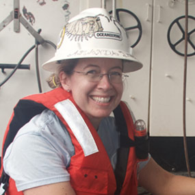
Science Lead, U.S. Geological Survey
Amanda Demopoulos is a Research Benthic Ecologist for the U.S. Geological Survey (USGS) at the Wetland and Aquatic Research Center in Gainesville, Florida. Her work examines the community structure and function of animals found on the seafloor or in the mud (a.k.a. sediment). After completing a post-doctoral fellowship at Scripps Institution of Oceanography, Amanda obtained her current position at USGS, where she conducts research on the community ecology of coastal wetlands, seagrass habitats, shallow and deep-sea corals, seeps, submarine canyon, and seamount environments.
Amanda Demopoulos received a B.S.in Oceanography from the University of Washington (1996), and M.S. (2000) and Ph.D. (2004) in Biological Oceanography from the University of Hawaii at Manoa.
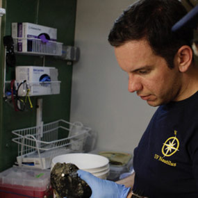
Science Lead, Temple University
Steve is a PhD student in the Cordes Lab at Temple University. He is broadly interested in deep-sea coral biogeography, particularly between seamount ecosystems. Specifically, he is interested in how deep-sea water mass characteristics influence coral assemblages over depth. In late 2017, he will be returning to the Phoenix Islands Protected Area aboard the R/V Falkor to continue surveying unexplored seamounts in the region. Steve has also participated in several field seasons aboard the E/V Nautilus in the Gulf of Mexico, Caribbean Sea, and Pacific Ocean as data manager and watch leader.
Steve received his B.S. in Marine Sciences at the University of Connecticut at Avery Point. He then went on to receive an M.S. at the University of Maine, Darling Marine Center, where he studied biogeographic patterns on seamount communities in the Drake Passage and Southern Ocean. He is currently at Temple University studying deep-sea coral biogeography on seamounts in the Caribbean Sea and Pacific Ocean. More information about Steve’s research updates can be found on his website at http://stevenauscavitch.weebly.com ![]()
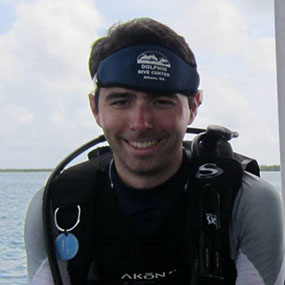
Expedition Coordinator, NOAA Office of Ocean Exploration and Research
Brian Kennedy – Expedition Coordinator, NOAA Office of Ocean Exploration and Research
When Brian was five years old, he decided that he wanted to be a marine biologist and explore the unknown reaches of the planet, and now he has his dream job. Originally from land-locked Athens, Georgia, Brian grew up fascinated with marine mammals and the ocean. Brian attended the Honors College at the College of Charleston (CofC) in South Carolina where he majored in Marine Biology and minored in Marine Geology. While at CofC, he had the opportunity to sail on multiple research cruises aboard two different NOAA research vessels and meet multiple NOAA Commissioned Officer Corps members. Shortly after graduating with honors from CofC, Brian was awarded a commission in the NOAA Corps. His first sea assignment was as a Junior Officer aboard NOAA’s Okeanos Explorer, America's Ship for Ocean Exploration. Upon completion, Brian was then assigned to NOAA’s Ocean Exploration Program, where he worked as an Expedition Coordinator for the Okeanos Explorer. Now separated from the NOAA Corps, Brian works for the Office of Ocean Exploration and Research as the telepresence coordinator. Brian has participated in or led more than 25 expeditions of exploration taking him to two oceans (Atlantic and Pacific), three continents (North America, South America and Asia), and through the waters of more than five countries (Ecuador, Panama, Costa Rica, Honduras, Indonesia). Brian is serving as the ROV navigator on this expedition.
Assist. Expedition Coordinator, NOAA Office of Ocean Exploration and Research
LTJG Nick Pawlenko joins OER as Expedition Operations Leader. Nick is rotating to land after three field seasons aboard NOAA Ship Okeanos Explorer. During his time aboard the Okeanos Explorer, Nick was able to work with the ROV team, often sitting in as ROV navigator and co-pilot.
Nick graduated from the University of Pittsburgh with a Bachelor of Science in Mechanical Engineering and a Masters in Business. He also recently completed MIT’s Professional Education program Rapid Robotics: Autonomous Systems with Open Source Software.
Prior to joining NOAA, Nick was very involved in the Pittsburgh community and served on the Board of Directors and as Treasurer for the Oakland Business Improvement District for many years. While in Pittsburgh, he also remodeled residential and commercial real estate and was involved in the bar and restaurant business.
Nick is very excited to continue his work with OER and be an asset to the team in his new land assignment.
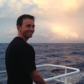
Mapping Lead, NOAA Office of Ocean Exploration and Research
Derek Sowers holds a B.S. in Environmental Science from the University of New Hampshire and an M.S. in Marine Resource Management from Oregon State University. He has 14 years of previous coastal research and management experience, including work for NOAA's National Estuarine Research Reserve network and the Environmental Protection Agency’s National Estuary Program in both Oregon and New Hampshire. Derek has participated in ocean research expeditions in the Arctic Ocean, Gulf of Maine, Gulf of Mexico, Pacific Northwest continental shelf, North Atlantic Canyons, and New England Seamounts.
During at-sea expeditions, Derek leads sonar data collection by planning the ship’s mapping routes and producing maps of seafloor and water column features to guide exploration. On shore, Derek works at the Center for Coastal and Ocean Mapping/Joint Hydrographic Center at the University of New Hampshire to coordinate future mapping expeditions, process and archive data, and collaborate with other scientists. Derek is also a part-time Oceanography Ph.D. student focused on using Extended Continental Shelf and Okeanos Explorer data to develop marine ecological classification maps.
B-roll footage is available here.
Additional dive highlight videos and photos will be posted online as they are available.
Please contact Katie Wagner for high-res footage, b-roll, and other materials at (301) 734-1008 or Katie.Wagner@noaa.gov.
Access LIVE video feeds here
Expedition home page
NOAA ship journeys into remote, deep Pacific ocean
February 14 - NOAA News