
By Kasey Cantwell - Expedition Coordinator, NOAA Office of Ocean Exploration and Research
June 18, 2016
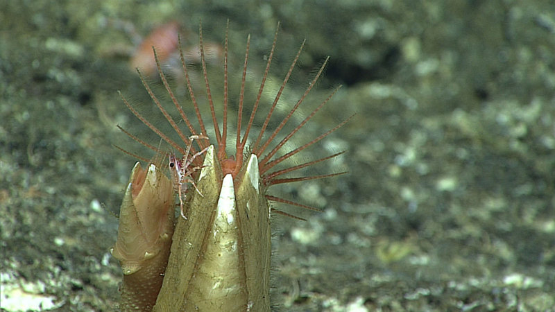
One of the things I most look forward to during a cruise is the tiny life. Our videographers are very talented and make collecting imagery of very small organism look easy. It always amazes me how every time we zoom in on something, like these barnacles, there is almost always additional life, like this small squat lobster, if you look closely enough. Image courtesy of NOAA Office of Ocean Exploration and Research, 2016 Deepwater Exploration of the Marianas. Download larger version (jpg, 726 KB).
Planning for an expedition of the magnitude of the 2016 Deepwater Exploration of the Marianas begins months in advance. The seeds of the expedition are planted years earlier as basic geographic regions of interest are identified by scientists and management stakeholders through community workshops. As geographic priorities are identified, partnerships develop between organizations with mutual interests so that the baseline data that NOAA Ship Okeanos Explorer collects can be beneficial and used by as many people as possible.
After a basic operating area is identified, the NOAA Office of Ocean Exploration and Research and expedition partners work with the science community to identify specific dive targets for each cruise. And then the fun begins.
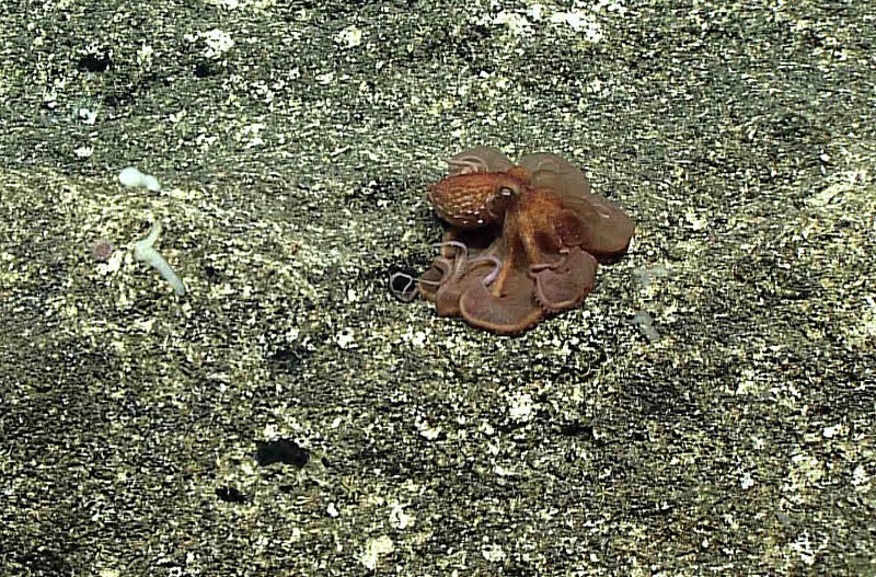
The first dive of the expedition fell on #OctopusFriday, and we were not disappointed at our dive on Farallon de Medinilla. Image courtesy of the NOAA Office of Ocean Exploration and Research. Download larger version (jpg, 1.4 MB).
As an expedition coordinator, my job is to plan and see to the overall success of a cruise. This means balancing the demands of multiple scientists with differing objectives, the interests of our partners, and operational constraints.
Fortunately, we have a set of criteria – priority objectives and data needs – that help sort through some of this. For Leg 3 of the Deepwater Exploration of the Marianas expedition, we sought to address expedition-specific objectives, as well as those established by the Campaign to Address Pacific monument Science, Technology, and Ocean NEeds (CAPSTONE) effort.
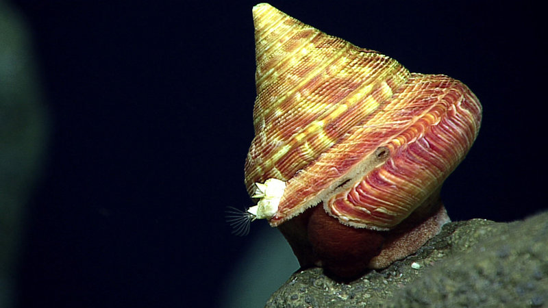
his beautiful slit shell – a type of snail – is a rare find and likely a new species! Image courtesy of the NOAA Office of Ocean Exploration and Research. Download larger version (jpg, 616 KB).
Logistical constraints, such as how far can you travel in one night, can you make water at a site, how long will it take for the vehicles to reach the bottom, where are mapping data holidays (gaps) that we can fill overnight, and how will our schedule impact shoreside participation, are factored in and result in a rough cruise plan.
Sometimes, compromises and slight sacrifices need to be made in order to achieve the best overall outcome for the expedition. For example, for our first dive, we only conducted a six-hour dive, just off of Farallon de Medinilla (FDM). This is because FDM and our second dive site, Pagan, are a 16-hour transit apart. Both FDM and Pagan were chosen for their value to resource managers, but it is impossible for the ship to transit for that long during our normal overnight transit period, so we had to lose some dive time to accommodate for the long transit. The other option was to have another dive between Pagan and FDM, but our science team decided it was better to use that additional dive at a different site, to further characterize northern operating grounds.
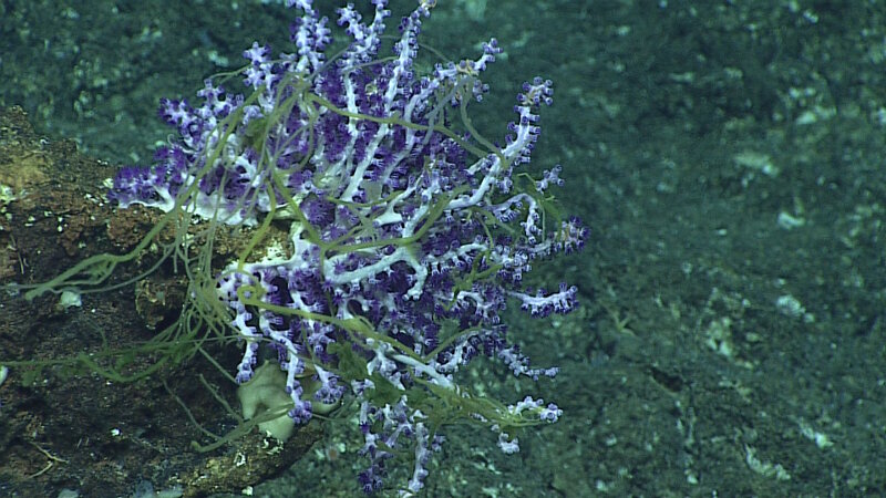
This unusual and unknown filamentous material or organism was in high abundance on almost every coral and sponge documented during our dive at Farallon de Medinilla. Image courtesy of the NOAA Office of Ocean Exploration and Research. Download larger version (jpg, 1.1 MB).
As almost anyone who goes to sea will tell you, plans change and evolve very quickly. As the original assumptions that were made during the initial planning phase change, and they inevitably do, the cruise plans have to change as well. The plans for a cruise are constantly evolving and adapting as new information is received. For example, the first dive of this leg was originally part of the plan for Leg 1 of this expedition, but as initial planning for Leg 3 began, we realized that in order to be most efficient with the time available for Leg 3, Okeanos should transit as far north as possible. The farthest that we could possibly go in one day happened to be FDM, and luckily there was already a suggested remotely operated vehicle (ROV) dive target there. Unfortunately, the team on Leg 1 was scheduled to dive on it in three days. We quickly worked with the team on shore and on the ship to adjust their plans so that we could dive along the southern flank of FDM and the Leg 1 dive focused on the northern edge of the bank.
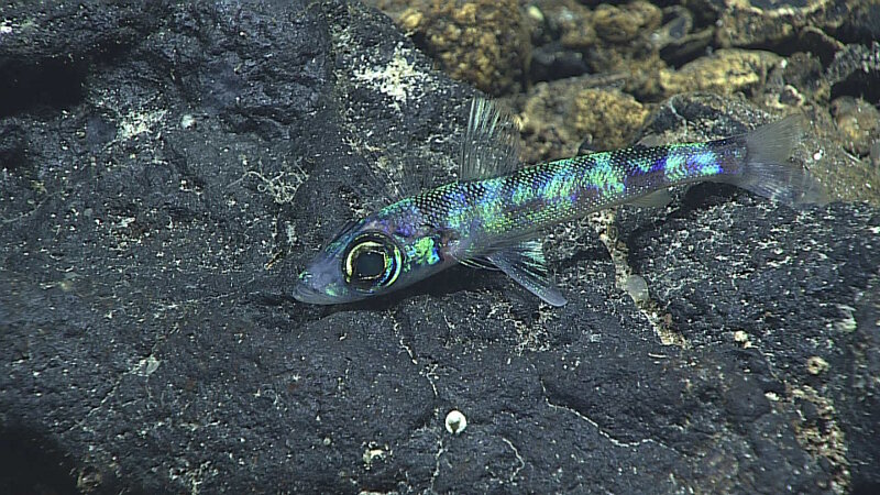
While abundant during our dive at Farallon de Medinilla, we believe the documentation of these Green Eyes to be a novel observation for the Mariana region. Image courtesy of the NOAA Office of Ocean Exploration and Research. Download larger version (jpg, 1.2 MB).
That was the first round of cruise plans. We are now two days into the cruise and are on version nine of our dive schedule. Most of the changes were made to increase our efficiency – collecting the most amount of priority mapping data possible at night while balancing extended ROV dive operations and the distance between dive sites. We also had a couple of sites that need to be mapped before we dive on them, so as the order of one or two dives change, I have to look at the impact to how the overnight mapping on either side of these dives would be affected and adjust accordingly.
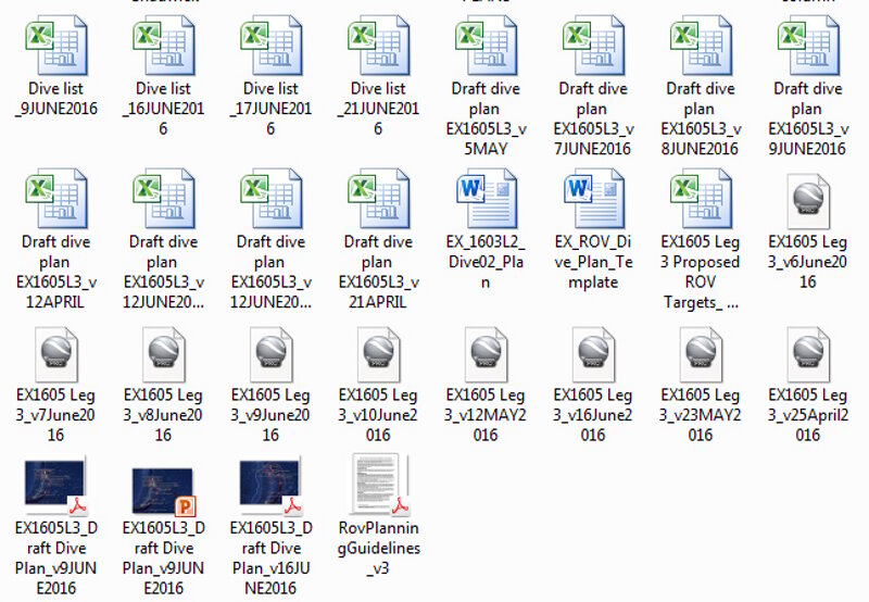
With so many changing variables on any given cruise, keeping all of the information updated and organized becomes a serious version-control problem. Image courtesy of the NOAA Office of Ocean Exploration and Research. Download larger version (jpg, 307 KB).
Even once we are underway, our dive plan is still fluid. Things like weather or mechanical issues can cause plans to be shifted or rearranged. We are planning several very deep dives during this cruise, so weather we will be a key factor in our ability to execute, as our weather window for deep dives is very small since it can take up to three and a half hours to return to the surface.
Since every day will bring a new opportunity for yet another version of the dive plans, the puzzle of cruise planning is one of the most challenging, and interesting, parts of being an expedition coordinator.