by Mike Jakuba, Woods Hole Oceanographic Institution
Jim Partan, Woods Hole Oceanographic Institution
LCDR Chris Dolan, Woods Hole Oceanographic Institution/U.S. Navy
July 29, 2019
On this expedition, we are testing a low-power navigation system with a long-term goal of enabling remote robotic exploration of the global mid-ocean ridge.

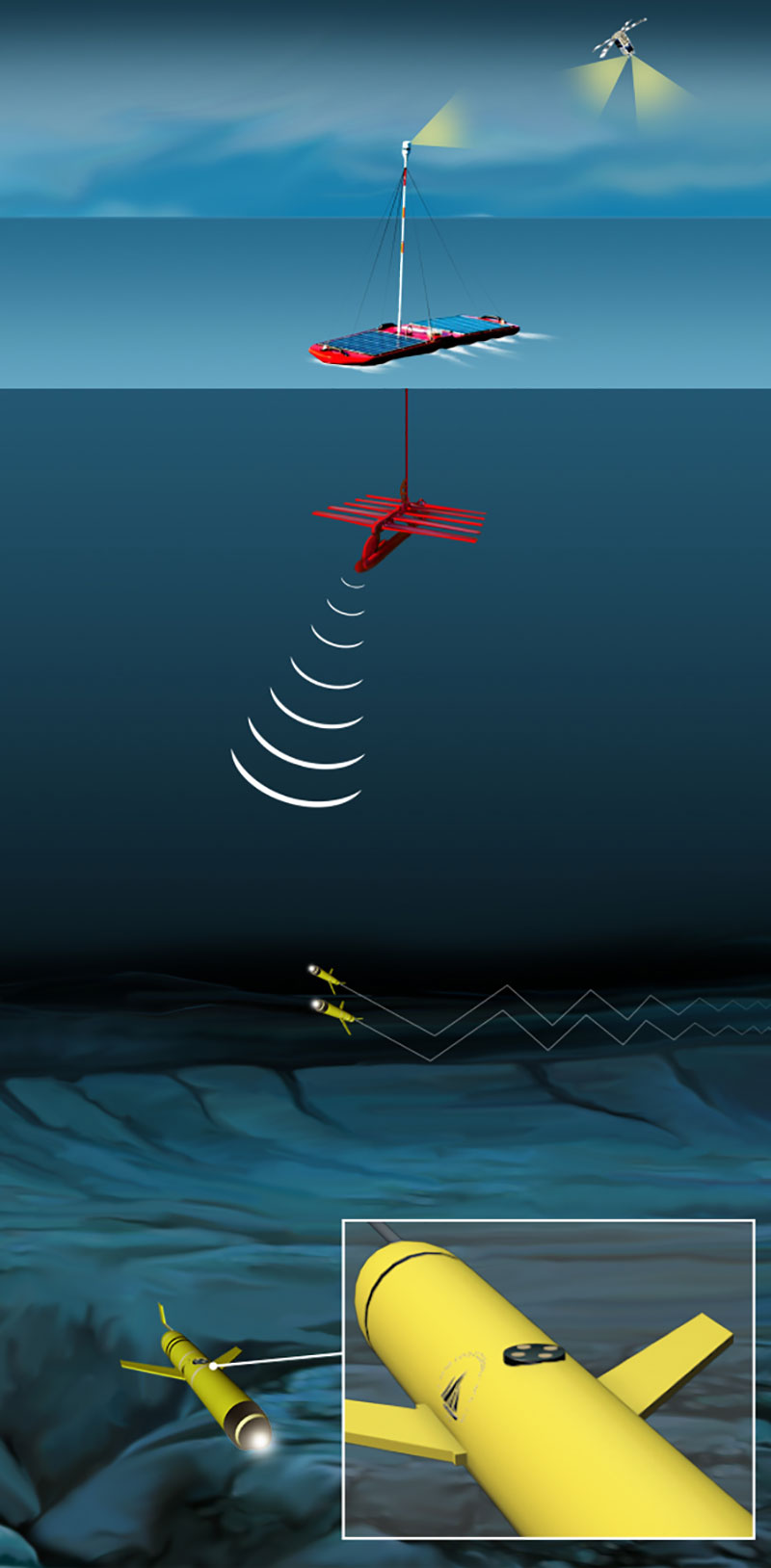
Illustration of a glider equipped with a one-way-travel-time inverted ultra-short-baseline transducer, 'listening' for a signal from the surface to determine the glider's location. Image courtesy of the Woods Hole Oceanographic Institution. Download larger version (jpg, 336 KB).
The 60,000-kilometer (40,000-mile) long mid-ocean ridge is a continuous geologic feature that encircles our planet and hosts hydrothermal activity in every ocean basin. Hydrothermal vents provide insights into the geology of Earth, influence ocean chemistry, and host chemosynthetic ecosystems (ecosystems that derive their energy from the chemical interactions between ocean water and rock, rather than from the sun). Discovered only a few decades ago, the chemosynthetic ecosystems around hydrothermal vents have revealed insights into the origin of life and the limits of life at the extremes.
Yet only about 20 percent of the mid-ocean ridge is explored at the detail necessary to identify the presence of venting, and far less at the scale of individual vent sites. One of the applications motivating our research is detailed exploration of the mid-ocean ridge, particularly the remote portions difficult to access via ship. Our technology will enable long-range oceanographic robots called gliders to be used in an exploration capacity.
Gliders are not typically used for exploration. Gliders are used primarily to study the vertical structure of the ocean, for example, its temperature, salinity, and currents. Glider missions typically last six months or more, during which time a glider will traverse thousands of kilometers. Extreme endurance could enable gliders to reach remote regions and to cost-effectively map large portions of the mid-ocean ridge. However, extreme endurance comes with a price—payload devices on a glider must be extremely low-power.
Gliders do not have the high-accuracy navigation systems found on typical seafloor-mapping robots and remotely operated vehicles (ROVs) like Deep Discoverer (D2), because these systems consume many times the power of a glider itself. Instead, gliders use GPS to determine their locations while on the surface. But GPS does not work underwater, and the accuracy of a glider's navigation quickly degrades until it comes back to the surface for another GPS fix.
Our system, one-way-travel-time inverted ultra-short-baseline (OWTTIUSBL), is a very low-power acoustic navigation system that will provide gliders with accurate navigation while deep, not just at the surface. OWTTIUSBL will work like a kind of underwater GPS, although the principle of operation is different. Conventional USBL systems, like the one used to navigate D2, use a bi-directional acoustic exchange to determine the location of the ROV. OWTTIUSBL uses a one-way transmission. The glider need only listen (transmitting requires high power). The concept calls for a team of robots composed of an autonomous surface vessel that transmits its location, and one or more subsea gliders all simultaneously listening and determining their ranges and bearings to the surface vessel using array processing implemented on their OWTTIUSBLs.
On this expedition, we are testing the components of the OWTTIUSBL in a custom-built pressure housing mounted on the brow of D2. Our objective is to characterize the performance of the system by collecting data from two OWTTIUSBL arrays mounted on the housing while D2 transits the water column and works on the seafloor. One array is connected to the processing stack we expect to install in a glider later this year. The other is connected to a data recorder and will collect raw data that we can use to explore other processing schemes.
If we are successful, we expect to operate a OWTTIUSBL-equipped glider and an autonomous surface vessel called a Wave Glider in the Gulf of Mexico next summer to explore for methane seeps; one step closer to exploring the rest of the mid-ocean ridge!