by Barry Eakins, University of Colorado Boulder and NOAA's National Centers for Environmental Information
July 24, 2019

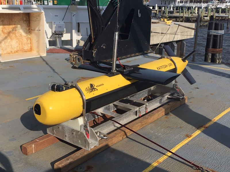
The KATFISH™ on the deck of the Okeanos Explorer. The fins allow for operator adjustments (side-to-side and up-down) along track during a survey. Image courtesy of B. Eakins, CU Boulder and NOAA NCEI. Download larger version (jpg, 275 KB).
I am here on the NOAA Office of Ocean Exploration and Research (OER) 2019 Technology Demonstration to learn about the data collected by two instruments: the towed KATFISH™, and the REMUS 600 autonomous underwater vehicle (AUV). Both map the seafloor at high resolution (sub-meter scale). In particular, I want to learn what is necessary to properly describe the data, what files would be contributed to the long-term archive, what technical challenges could be encountered, and how to assess data quality.
NOAA’s National Centers for Environmental Information (NCEI), which I work with, is a national and world repository for oceanographic data and is responsible for managing data collected by OER and NOAA Ship Okeanos Explorer. That data management includes ensuring that the data are well-described, that they are discoverable and accessible, and that they are archived for the long term. In essence, we are preserving ocean exploration data for our great-grandchildren, so that they may look back and see what the ocean is like now.
The REMUS 600 AUV on the deck of the Okeanos Explorer. Image courtesy of B. Eakins, CU Boulder and NOAA NCEI. Download image (jpg, 116 KB).
What I’ve learned about the towed KATFISH™ is that the raw synthetic aperture sonar data are in a proprietary format and therefore are not appropriate for archiving. However, the Kraken software that processes the data can export seabed visualization products in standard, non-proprietary formats that are readable by a wide variety of open-source and commercial software. The level of seabed detail that the KATFISH™ can capture is incredible – and beautiful. NCEI can manage these products and make them available to the public, though they will need to be well described so that users will know how they were created, especially as the raw data will be unavailable.

Synthetic aperture sonar imagery of the bow of the USS Murphy, DD-603. I am a U.S. Navy veteran and feel an affinity with the sailors who lost their lives during World War II and are entombed with their ship. Image courtesy of ThayerMahan, Inc., Kraken Robotics,and the NOAA Office of Ocean Exploration and Research. Download larger version (jpg, 11.1 MB).
The REMUS 600 AUV records multibeam swath sonar data that are in a standard, non-proprietary format similar to other multibeam swath sonar data that NCEI manages, including from the Okeanos’ hull-mounted sonar system. The raw data are retrieved after AUV recovery and require post-processing. Products from these data will also need to be well described and in a standard, non-proprietary format.
Information about the data (“metadata”) is valuable as it helps future users discover and understand the data. Such metadata, written by the data collector, should include a description of the type of instrument used, how the data were processed, important settings (such as height above the seafloor), and targets that were mapped.