by Rod Mather, Ph.D., University of Rhode Island
July 20, 2019

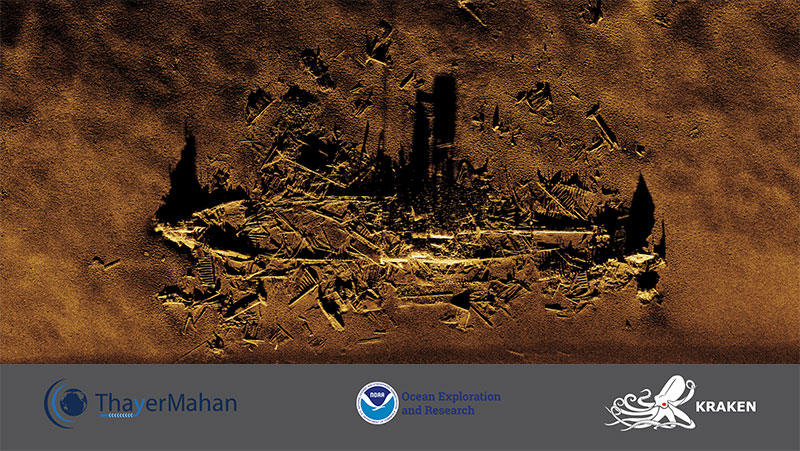
Synthetic aperture sonar data collected over a shipwreck site offshore of Virginia/North Carolina using the towed KATFISH™ equipped with a 180-centimeter AquaPix® MINSAS synthetic aperture sonar sensor. The system is being operated by ThayerMahan, Inc. and Kraken Robotics on NOAA Ship Okeanos Explorer as part of the 2019 Technology Demonstration. Image courtesy of ThayerMahan, Inc. Kraken Robotics, and the NOAA Office of Ocean Exploration and Research. Download larger version (jpg, 7.9 MB).
This shipwreck was mapped off the coast of Virginia/North Carolina on July 18, 2019, as part of the 2019 Technology Demonstration. It is likely a World War II freighter with evidence of degradation typical of World War II-era freighters.
The data were collected by Kraken Robotics and ThayerMahan, Inc. using the towed KATFISH™ with synthetic aperture sonar on board NOAA Ship Okeanos Explorer. This type of data can be used for site identification, assessment, and monitoring of Underwater Cultural Heritage sites over time. The resolution of the data are high enough that they could also contribute to site mapping for archaeological studies.
Within the image, one can observe the single propeller shaft, machinery, and boiler spaces.

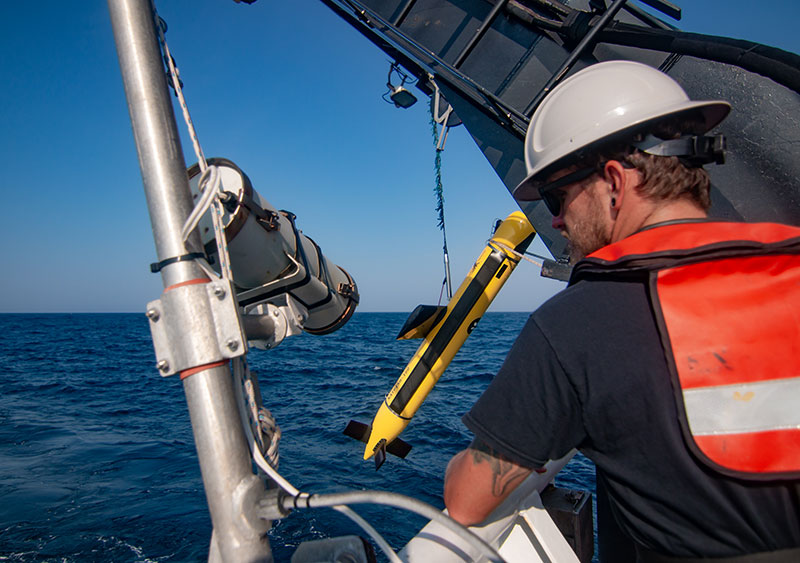
The Kraken towed KATFISH™ being deployed from NOAA Ship Okeanos Explorer. Image courtesy of the NOAA Office of Ocean Exploration and Research, 2019 Technology Demonstration. Download larger version (jpg, 3.5 MB).

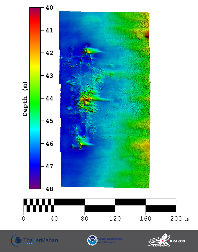
Bathymetric image of the shipwreck, developed from data collected using the KATFISH™ system on the Okeanos Explorer on July 18, 2019. Scale is water depth in meters. Image courtesy of ThayerMahan, Inc. Kraken Robotics, and the NOAA Office of Ocean Exploration and Research. Download larger version (jpg, 1.0 MB).