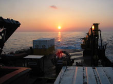
Sunset over the aft deck while in the Gulf of Mexico. Click image for larger view.
Northwestern Gulf of Mexico Topographic Features
G.P. Schmahl, Manager
Flower Gardens Banks National Marine Sanctuary
On July 30, SSE 2002 moved from the eastern Gulf of Mexico to an area off the coast of Texas and Louisiana known as the northwestern Gulf of Mexico Topographic Features. Along the edge of the outer continental shelf, approximately 60 to 100 miles offshore, a series of underwater pinnacles rise from the relatively flat expanse of sand and mud that is typical of this area.
These features are essentially underwater mountains, formed by the expansion and migration of salt deposits (salt domes or diapirs) deep beneath the seafloor, which have pushed overlying rocks up through thousands of feet of sediment. The exposed hard substrate rises above the flat softbottom areas, forming islands with which a variety of marine communities are associated. These areas have been shown to be critically important fish habitat, and provide substrate for attached benthic communities. If these prominences rise to a shallow enough depth, coral communities can become established, as has happened at the Flower Garden Banks. Typically, water depth in this area of the continental shelf averages about 400 feet. Most of the topographic features rise from this depth to within 150 to 200 feet of the surface. In some cases, such as the Flower Garden Banks, water depths are as shallow as 60 feet.

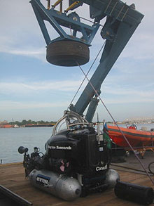
DeepWorker on the launch pad, in preparation of loading to the ship in Morgan City.
Interest in the topographic features began with the arrival of offshore oil and gas exploration in the 1960s and early 1970s. Besides creating the topography that supports interesting biological features, salt domes are also the prime areas where oil and gas deposits are found. Thus, the oil industry was extremely interested in drilling in and around these salt dome features. Obviously, the direct impacts of drilling could be very detrimental to the marine resources associated with these features. In the 1970s, the Bureau of Land Management (precursor to the Minerals Management Service) sponsored a series of studies of the topographic features to evaluate options for management of these areas. These studies, performed primarily by scientists from Texas A&M University, culminated in the publication of the book "Reefs and Banks of the Northwestern Gulf of Mexico" (1985) by Richard Rezak, Tom Bright and David McGrail. As a result of these studies, most of the topographic features were designated by MMS as off limits to oil and gas development, through what is known as the "Topographic Features Stipulation." Excellent baseline information exists for the topographic features due to the MMS studies. However, most of these areas have not been re-visited since they were first documented more than 20 years ago. This provides us with the enviable opportunity to compare the health and condition of these areas with direct observational data to evaluate changes over time and the effect of management actions.
The goal of this portion of the Sustainable Seas Expedition is to revisit 12 of the topographic features first studied in the 1970s to provide direct comparable data on the status of the marine resources. We will attempt to visit the following banks: Jakkula, Alderdice, Rezak, Sidner, Bouma, McGrail, Sonnier, Geyer, Bright, Rankin, MacNeil, and 29 Fathom. For each we will compile a list of fish species and document the benthic communities associated with various depth regimes. We are particularly interested in potential human-induced effects which may have occurred over the past 25 years. These may include perturbations associated with oil and gas activities, fishing, vessel anchoring and water quality conditions.
Sign up for the Ocean Explorer E-mail Update List.


