EXPRESS: West Coast Mapping 2022 (EX2208)
October 16 - November 3, 2022
Exploration Team

Thomas Morrow
Expedition Coordinator, NOAA Ocean Exploration
Thomas Morrow is a physical scientist with NOAA Ocean Exploration. He spends his time working as an expedition coordinator on NOAA Ship Okeanos Explorer and supporting NOAA’s ocean exploration mission. Thomas is a marine geologist and geophysicist who started his ocean exploration career while earning his bachelor’s degree in geology at the University of Florida. He then moved to the University of Idaho for master’s and doctorate degrees in geological sciences, studying mid-ocean ridges, fracture zones, and hotspot seamounts. Prior to joining NOAA Ocean Exploration, Thomas spent several years as a postdoctoral research fellow at Boston College, coordinating missions to explore the Gofar Transform Fault on Research Vessel Atlantis and Research Vessel Thomas G. Thompson.

Sam Cuellar
Mapping Watch Lead and Expedition-Coordinator-in-Training, NOAA Ocean Exploration
Sam Cuellar is a physical scientist with NOAA Ocean Exploration. With a background in underwater archaeology, Sam specializes in mission and survey planning and the collection and interpretation of numerous types of geophysical data from oceanographic systems, including autonomous underwater and remotely operated vehicles and novel one-off technologies. Sam received his B.A. in anthropology and M.A. in nautical archaeology from Texas A&M University, focusing on the development of a low-cost, off-the-shelf infrared imaging system to aid archaeological conservators in better diagnosing the state of recovered artifacts and revealing details invisible to the human eye. He is currently finishing his Ph.D. in nautical archaeology at Texas A&M, exploring the cultural maritime landscape of the abandoned 19th century port city Indianola, Texas, and surrounding Matagorda Bay. Sam’s research fuses newly collected geophysical data with ecological, historical, and archaeological contexts to better understand how various indigenous and European groups were impacted by and morphed the landscape in which they settled. With 11 years of underwater archaeology experience, Sam has had the fortune of investigating an abandoned World War I fleet in a Texas river, excavating a wrecked 17th century Venetian merchantman carrying goods for the Ottoman Sultan in Croatia, and searching for the lost ships of Hernán Cortés along the Gulf Coast of Mexico.

Roland Brian
Video Engineer, Global Foundation for Ocean Exploration
Roland Brian brings 29 years of experience and a keen eye for precision high-definition video to the program as a video/satellite and telepresence engineer. Roland began his career in the U.S. Air Force where he worked as a satellite communications engineering technician with visions of working on the U.S. Space Station. He traded in that quest for one of deep-ocean exploration and sharing beautiful imagery with the world. He has worked with NOAA Ocean Exploration since 2009 and has been engaged in every telepresence-enabled remotely operated vehicle (ROV) expedition. He has also provided services for other projects using NOAA Ocean Exploration’s mobile telepresence system, including the 2012 Ring of Fire Expedition. His duties aboard NOAA Ship Okeanos Explorer include operation and maintenance of the ship's telepresence and video systems, including on ROVs Deep Discoverer and Seirios. Again, Roland’s experience embodies the breadth and depth of knowledge NOAA Ocean Exploration encourages. When not fine-tuning the video and telepresence systems or training and mentoring new team members, he's actively involved in the editing process of our ever-expanding ocean exploration video library. While not at sea, Roland enjoys life with his wife and family in sunny Sarasota, Florida.
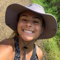
Jennifer Clifton
Explorer-in-Training
Jennifer Clifton is earning her bachelor's degree in environmental studies with minors in coastal management and biology at Eckerd College. She enjoys working on various research and literature review projects that have been conducted under the guidance of her professors. Her area of interests include marine ecosystems, coastal management, and marine conservation. In her down time, Jennifer enjoys being outdoors exploring various nature preserves.
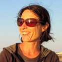
Anna Coulson
Mapping Watch Lead, University Corporation for Atmospheric Research
Anna Coulson grew up in the United Kingdom and has a bachelor’s degree in ocean science from the University of Plymouth. After graduating, she spent 10 years sailing her own 10-meter sailboat from the United Kingdom to the Philippines and working as crew on various sail and motor boats. After sailing in many badly charted areas, she decided to attend the post-graduate certificate program for ocean mapping/hydrographic survey at the Center for Coastal and Ocean Mapping in New Hampshire, which was followed by contract work for the Hawaii Mapping Research Group. She is currently based in Portugal and works as an independent contractor for the University Corporation for Atmospheric Research as a part of the on-board survey team.
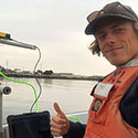
Marcel Peliks
Mapping Watch Lead, NOAA Ocean Exploration
Marcel Peliks is a graduate student working towards his Master of Science in geological oceanography at Moss Landing Marine Laboratories. His thesis is focused on developing multibeam mapping capabilities for the school, as well as conducting preliminary surveys of Monterey Canyon and surrounding beaches. In 2021, he was a NOAA Ocean Exploration mapping explorer-in-training and participated in the cloud mapping pilot project for the 2021 NOAA Ship Okeanos Explorer field season. Participating from his home in California, Marcel helped test all aspects of the cloud-based mapping system. His efforts contributed to standard operating procedures for future cloud mapping operations. Marcel has previously sailed aboard Okeanos Explorer as an at-sea explorer-in-training. After completing graduate school, Marcel plans to pursue career opportunities that apply his knowledge of geologic processes and instrumentation to ocean exploration.
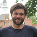
Benjamin Stablow
Explorer-in-Training
Ben Stablow recently earned his master's degree in environmental science and policy from George Mason University. His thesis research examined fine-scale spatial distributions of deep-sea coral mound associates with respect to their habitat boundaries. His work used remotely operated vehicle footage collected during NOAA Ocean Exploration expeditions on NOAA Ship Okeanos Explorer off the southeast coast of the United States between 2018 and 2019. Ben is interested in how ecological modeling can be used to identify and map vulnerable seafloor habitats. In his free time, Ben enjoys mountain biking, hiking, camping, snowboarding, and scuba diving.
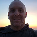
Chris Wright
Data Engineer, Global Foundation for Ocean Exploration
Chris Wright holds a Bachelor of Science in business administration from the University of Mary Washington and a Master of Business Administration from Rollins College. After graduation, he worked as a network and systems administrator and engineer in the hospitality industry in the Northeast and Mountain West for more than 15 years. Recently relocating back to the East Coast, Chris joined the Global Foundation for Ocean Exploration (GFOE) data team in early 2019 as one of the newest members of the organization. In 2019, he completed his first expedition aboard NOAA Ship Okeanos Explorer and is extremely excited about continuing the journey to explore the oceans around the world. When he isn't sailing on Okeanos Explorer, he’s busy working in GFOE’s Quonset office planning, designing, and implementing data solutions to help refine and mature its base of operations for ocean exploration. Chris and his family currently reside in Newport, Rhode Island.