by ENS Brianna Pacheco, Ship’s Navigator, NOAA Corps
July 21, 2017

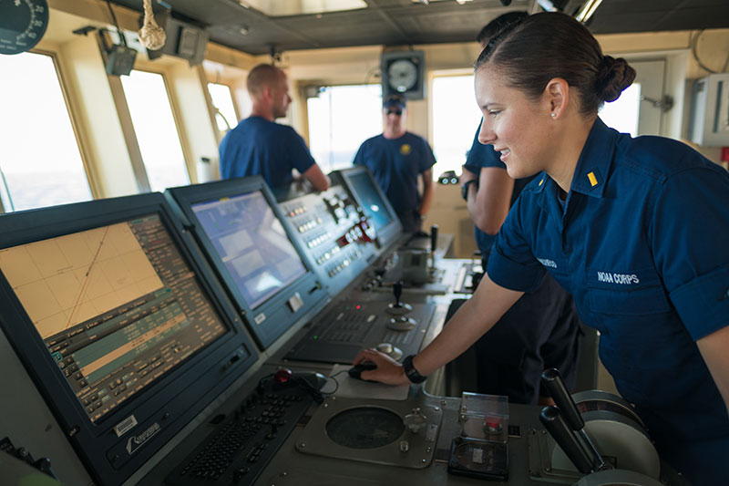
ENS Brianna Pacheco using the ship's Electronic Chart Display Information System (ECDIS) to navigate the ship. ECDIS is an “industrial-sized” navigation app that encompasses electronic navigation charts, GPS, gyrocompass, radar, depth sounder, autopilot, automatic route safety scanning programs and a host of other electronic tools. Image courtesy of the NOAA Office of Ocean Exploration and Research, 2017 Laulima O Ka Moana. Download larger version (jpg, 10.0 MB).
All have heard the three “Ws” (Where are we? Where are we going? When do we get there?). Perhaps it was a voice piping up from the back seat of the car while cruising on a road trip. For us, those onboard NOAA Ship Okeanos Explorer, the scientists and crew will call these out over a two-way radio. Time and place – they are always important ashore, but even more so when one is sailing the vast expanse of an endless, featureless ocean.
Answering the three “Ws” evolved alongside people’s need to explore. The memories of tribal elders gave way to various means of physically representing our world and our place on it, culminating in the maps and charts we use for navigation today (Note: there is a difference between maps and charts; hint: check out how land and water features are detailed).
Take a hard copy chart or map, digitize the printed information, and ¡Voila!: you have a map app, just like cellphones do. Add amazing technology, like the satellite-based Global Positioning System (GPS), to that app and a personal navigation package is born. Overlay electronic chart data with gyrocompass, radar, depth sounder, autopilot, automatic route safety scanning programs, plus a host of other electronic tools and you get the Okeanos Explorer's Electronic Chart Display Information System (ECDIS).
The Okeanos’ ECDIS is an impressive – and vital – piece of the ship’s navigation equipment. ECDIS is so complete it can even drive the Okeanos from one location to the next (with a little oversight from the ship’s officers); this is a real benefit on long voyages!

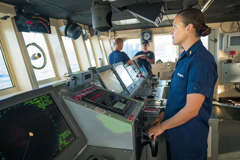
ENS Brianna Pacheco, one of the ship’s navigators, takes the helm and manually steers the ship on the bridge of NOAA Ship Okeanos Explorer. Image courtesy of the NOAA Office of Ocean Exploration and Research, 2017 Laulima O Ka Moana. Download larger version (jpg, 10.8 MB).
ECDIS is an “industrial-sized” navigation app that allows ship’s officers to answer the three “Ws” in a fraction of the time, when compared to toiling over conventional paper charts and using “old school” navigation equipment (dividers, pencils, parallel rulers, calculator, etc.). Today’s ship’s officers need to know how to work an ECDIS click-and-drag mouse and computer program as effortlessly as their maritime forebearers worked sextants and magnetic compasses.
ECDIS answering the three “Ws” is not much different from traditional navigation, just faster and more accurate. Paper charts are converted to electronic format. GPS inputs determine the appropriate electronic charts to display and the ship’s location is shown on the chart (the first of the three “Ws”). Charts automatically scroll underway on the monitor via GPS while gyrocompass inputs display the ship’s real-time location/travel direction (the second of the three “Ws”). Instant ECDIS computer calculation of the ship’s power and speed using the ship’s clock, and GPS makes the standard nautical “Distance, Speed, and Time” equation calculation a snap (the third of the three “Ws”). Every “W” is instantly answered right on the monitor!
Okeanos missions are planned years in advance, yet they can change underway at sea quickly. Hurricanes, broken ship equipment, at-sea emergencies, and other “surprises” require constant three “Ws” knowledge. The ECDIS allows tremendous “what if” capabilities to turn mission and navigation surprises into manageable, safe sailing options.
The Okeanos Explorer Captain and officers’ first job is safety, for both ship and crew, while performing our ocean exploration mission. The ECDIS’s multitude of navigation and safety features allow officers to make quick, accurate, informed three “Ws” decisions and do the really important part of their job – looking out the window to answer the most critical “A” question: “Are we safe?”