
By
Derek Sowers - NOAA Office of Ocean Exploration and Research (ERT, Inc.)
Charles Wilkins - NOAA Ship Okeanos Explorer
Jason Meyer - Meyer Hydrographic
March 11, 2017
What is the first thing you need when exploring a mysterious part of the ocean? What might you need before deploying expensive one-of-a-kind remotely operated vehicles (ROVs) into the deep sea? Well, good maps of the area, of course!
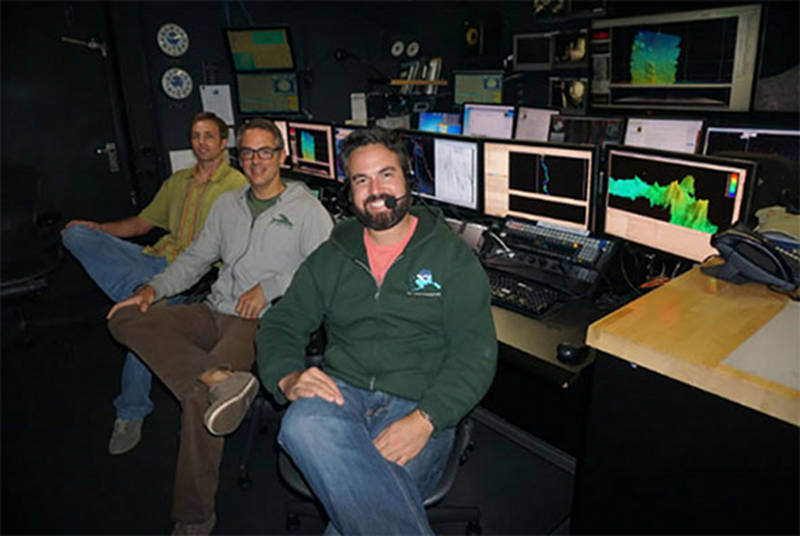
Mapping personnel on the Discovering the Deep: Exploring Remote Pacific MPAs expedition: Mapping Lead Derek Sowers, Watch Lead Jason Meyer, and Survey Technician Charles Wilkins. Image courtesy of the NOAA Office of Ocean Exploration and Research, Discovering the Deep: Exploring Remote Pacific MPAs. Download image (jpg, 55 KB).
You can’t find the deep-sea treasures without a map. Behind every decision of where NOAA Ship Okeanos Explorer goes and what the ROVs dive on is a good map of the seafloor (and in some cases, features in the water column as well). Ocean mapping (also called hydrography) is an essential part of successful ocean exploration work.
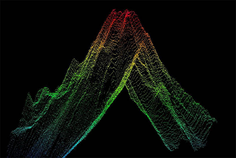
Raw multibeam sonar data of an underwater mountain visualized in 3D computer software. Image courtesy of the NOAA Office of Ocean Exploration and Research, Discovering the Deep: Exploring Remote Pacific MPAs. Download image (jpg, 62 KB).
So how does the Okeanos Explorer map ocean features? Since light does not travel far in seawater and we can’t easily see the depths of the ocean, we rely on sound energy to reveal the mysteries of the deep. Using sound to map in the ocean is called SONAR (SOund Navigation And Ranging).
Fundamentally, active sonars send out a ping and listen for its echo, precisely measure the travel time from the sonar to the seafloor or object and back to the sonar, then use this time delay (along with the speed of sound travel in water) to calculate the distance from the sonar to the source of the echo target (e.g., fish, submarine, seafloor, bubble plume, etc.). Taking many of these measurements enables a ship with highly accurate GPS positioning to quickly build maps of the seafloor in the vicinity of the ship and identify water column features that produce echoes.
Mapping work on the Okeanos Explorer employs a variety of different sonars that provide different insights into the marine areas we are exploring. These sonars are described below.
The Okeanos Explorer is equipped with a Kongsberg EM302 multibeam on the hull (bottom) of the ship. Each ping of the multibeam produces a swath of sound that can generate up to 864 echoes of the seafloor – thereby mapping large continuous areas of the seafloor underneath the ship.
This sonar makes highly detailed topographic maps in a short period of time as the ship moves along. This sonar also measures the intensity of the reflected echo (“backscatter”), thereby providing insights into the relative hardness of the seafloor or the echo strength of features in the water column.
Most of the areas that this ship explores have not been mapped in detail with a modern multibeam ship-mounted sonar.

Example highlighting the importance of ship-based ocean mapping work. The left image shows Pao Pao Seamount as resolved from satellite-derived bathymetry (barely discernible bump). The right image shows the same feature as mapped with the ship's multibeam sonar – providing a detailed map with 50-meter resolution. This map was used for ROV dive planning. Image courtesy of the NOAA Office of Ocean Exploration and Research, Discovering the Deep: Exploring Remote Pacific MPAs. Download larger version (jpg, 241 KB).
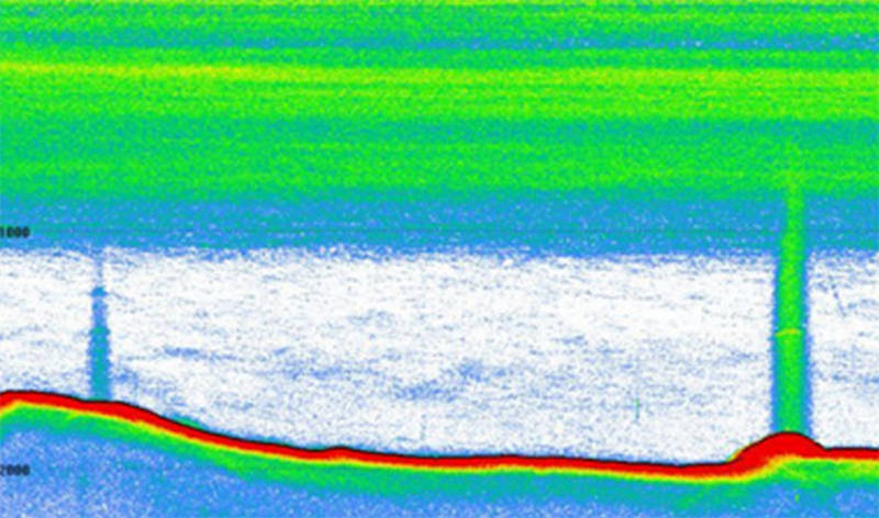
Example image of echogram from EK60 fisheries sonar. The red feature is the seafloor. Green and blue areas in the water column are features with high backscatter – the lines near the surface show dense layers of biology (zooplankton, fish, gelatinous creatures, etc.), while the vertical lines are bubble plumes emanating from the seafloor. Image courtesy of the NOAA Office of Ocean Exploration and Research, Discovering the Deep: Exploring Remote Pacific MPAs. Download image (jpg, 79 KB).
Also on the hull of the Okeanos Explorer are five fisheries sonars (Kongsberg EK-60s). Each of these fishery sonars have a different sound frequency able to resolve different features in the water column.
Frequency is the number of cycles per second. High frequency sound provides greater resolution of small things in the water column because there are more cycles in that second. Lower frequency sound can travel much farther, providing greater range to be able to detect features further away.
These sonars collect calibrated water-column backscatter data able to reveal dense layers of biology, fish, and bubble plumes in the water column.
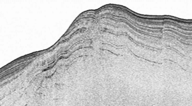
Image of sub-bottom profiler echogram. This image is built from many pings over a period of time and shows different layers of sediment or rock composition beneath the seafloor. Image courtesy of the NOAA Office of Ocean Exploration and Research, Discovering the Deep: Exploring Remote Pacific MPAs. Download image (jpg, 44 KB).
The Okeanos Explorer has a Knudson Sub-bottom profiler that sends out a low frequency "chirp" signal every few seconds. This "chirp" bounces off different layers of sediment and rock underneath the seafloor. This is useful for mapping sediments and deposits below the seafloor in order to interpret the shallow geology in the area we are exploring.
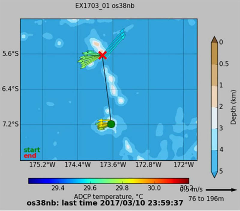
Example of an ADCP vector plot. The red "X" is the location of the ship. The many arrows coming from the X show the magnitude and direction of currents at a variety of depths beneath the ship. Image courtesy of the NOAA Office of Ocean Exploration and Research, Discovering the Deep: Exploring Remote Pacific MPAs. Download image (jpg, 52 KB).
The Okeanos Explorer uses two Acoustic Doppler Current Profilers (ADCPs): a Teledyne RDI Workhorse Mariner (frequency: 300 kilohertz [kHz]) and an Ocean Surveyor (38 kHz).
ADCPs are Doppler sonar systems, which transmit acoustic signals and listen to the echoes of those signals returned from materials floating with the currents throughout the water column. By processing this information, ADCPs provide information about current velocity and direction at various depths in the water column.
These sonars are useful for characterizing the physical oceanography of an area and assessing currents near ROV dive locations to inform dive planning and ensure safe ROV deployment and recovery operations.
With only approximately 10-15 percent of the Earth’s ocean mapped with multibeam sonars, there is much exploration and discovery yet to be accomplished! Advances and improvements in ocean mapping technologies are helping to accelerate our understanding and appreciation of our planet's oceans.