By Lindsay McKenna - NOAA Office of Ocean Exploration and Research
October 3, 2014

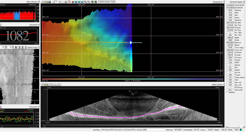
Ever looked at the Okeanos Explorer live video feeds when we're mapping and wonder what this is? It's our multibeam system collecting real-time seafloor data! Left side, top to bottom: beam intensity plot; cross track depth and nadir (middle beam) depth reading; seabed image of the backscatter returns; time series of attitude data (roll, pitch, heave). The large box is the real-time seafloor image being populated by SIS (seafloor information system). The bottom shows the water column backscatter fan and cross section of the water column, where the pink line is the seafloor. Image courtesy of the NOAA Office of Ocean Exploration and Research, Exploring Atlantic Canyons and Seamounts 2014. Download larger version (jpg, 558 KB).
What happens on NOAA Ship Okeanos Explorer when the weather is too poor to deploy the remotely operated vehicles (ROVs)?

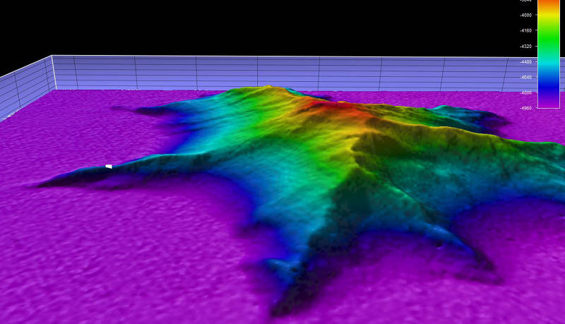
This image shows a side view, two-times vertical exaggeration, of the unnamed seamount we explored during Dive 10. The white dot represents the point where remotely operated vehicle Deep Discoverer was deployed. Image courtesy of the NOAA Office of Ocean Exploration and Research, Exploring Atlantic Canyons and Seamounts 2014. Download larger version (jpg, 356 KB).
We map! The ship is equipped with three sonar systems that allow us to collect a variety of different ocean data, including:
During regular ROV dive operations, we run all three sonars at night as we transit from one dive site to the next. When rough weather or strong currents prevent us from deploying the ROVs, we immediately switch over to mapping operations so that we can maximize our time exploring the ocean.
Mapping operations onboard Okeanos are managed by a team of three seafloor mapping scientists. One of us sails on every ROV cruise, where we make detailed maps that the scientists and ROV team use to identify exactly where to deploy the ROVs and explore the seafloor the evening before a dive. We also manage the overnight and inclement weather mapping operations. We must take into consideration where existing mapping coverage exists and what parts of the seafloor might be more important to map over others, all while making sure the ship is on location at 5:30 in the morning for the next scheduled dive.
During overnight and bad weather mapping operations, we also try to incorporate more specific exploration requests from on-shore scientists. For example, on this leg, we have collected single-beam sonar data that can pick up schools of fish for fisheries biologists and subbottom profile lines that geologists at the U.S. Geological Survey are using to study the history of landslides along the mid-Atlantic Canyons.
Okeanos is truly always exploring, even if we're not streaming live video from the seafloor!