- Home
- Expeditions
- Exploring Atlantic Canyons and Seamounts 2014
- Background
- Clues to a Marine Geologic Puzzle

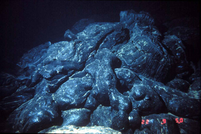
Lava flows can have different morphologies based on how quickly they were extruded. Pillow lavas are a common and very striking type of flow seen at seamounts. Image courtesy of Submarine Ring of Fire 2002, NOAA/OER. Download larger version (jpg, 583 KB).
Geologists are scientific storytellers. They study the history of rocks in order to tell evidence-based stories about how the Earth formed in the past, how it is evolving now, and what it might look like in the future. To reconstruct geologic history, we need to measure time, or at least be able to put geologic events in chronological order.
On ROV dives, we get a very limited picture of the seafloor. We see only what is at the surface instead of getting a slice through the layer-cake of geologic history. However, there are still many visual cues that can tell us whether the rocks and sediments we are seeing are old or young and whether they have been moved or modified by seafloor processes.

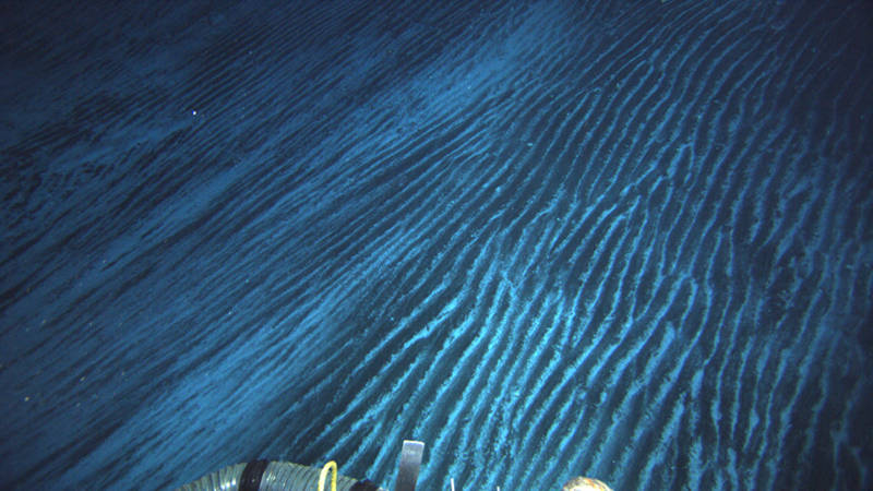
Strong currents can flow around seamounts, leaving ripple marks on sandy slopes. Image courtesy of Bill Chadwick, Oregon State University, National Science Foundation, and Woods Hole Oceanographic Institution. Download larger version (jpg, 2.1 MB).
Here are some of the things we look for during a dive:
- Substrate Type: Substrate refers to the types of deposits and rocks that cover the seafloor, providing a surface for living organisms to attach to or burrow in. The main substrates we see on the seafloor around canyons and seamounts are sediments (mud, sand, pebbles, and other loose, unconsolidated material); breccias (rocks composed of smaller rock fragments that are cemented together); and lava flows. Mapping the distribution of these substrate types can tell us about where submarine landslides have occurred or where ocean currents are picking up and depositing material.
- Grain Size: As sediment creeps, slides, or tumbles downslope, it can become sorted by grain size. Large pebbles and coarse sand grains are heavier and can’t be carried as easily, so they tend to be dropped close to where they were picked up. Smaller silt and clay grains can be carried easily and for long distances, so we see finer deposits farther from the source of a landslide. Pebbles and boulders can also break off larger outcrops and roll down slopes, forming a sort of breadcrumb trail leading back to an exposed section of lava flows.
- Rock Shape: Rocks can be smooth and rounded, or angular and jagged. Rocks that have traveled farther and experienced more erosion are smoother, just as sea glass found on a beach is smooth and rounded after being tossed around in the surf for many years. In contrast, fresh volcanic rock fragments are still sharp and jagged, as they often lie exactly where they first fell after being ejected out of the volcanic vent.

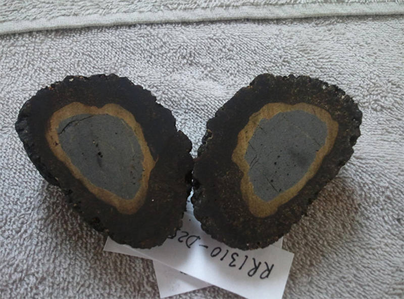
Manganese crust is a type of deposit that crystallizes out of seawater. In this picture, a rock has first been altered by contact with seawater (the yellow margin) and then covered in a black manganese rind. Image courtesy of the OSU Argon Geochronology Lab. Download image (jpg, 86 KB).
- Lava Flow Morphology: On seamounts, we see many different types of lava flows. Lava can be extruded out of a vent at different rates and onto either steep or gentle slopes. The interplay of these two factors can produce thick pooled massive flows, thin spread-out sheet flows, or long tubular pillow flows. Pillow lavas are abundant on seamounts and have a very distinct lumpy shape. By studying flow types, we can understand how lava extrusion rates may have changed over time at a seamount.
- Rock Color: On the seafloor, hard rock is usually dark grey to black because of the types of minerals that make up the rock. However, this color can change due to reactions with seawater and when rocks become covered by other materials. For example, in active volcanic environments, white or yellow sulfur can coat rocks. Hot hydrothermal fluids can also move through rocks, likewise coating them in white deposits. Sometimes the rocks are covered in colorful filaments and mats created by microbes feeding on the chemicals in the hydrothermal fluid. Since the New England Seamount Chain is 80-100 million years old, it is unlikely we will see active erupting environments, but we may still see the traces of ancient hydrothermal alteration on the rocks.
- Manganese Crust: Seawater contains the elements manganese (Mn) and iron (Fe). Over time Mn and Fe crystallize out of seawater and combine to form thin black crusts over seafloor features. Detailed studies have shown that these crusts build up at a rate of several millimeters per million years. Observing the thickness of crust on a rock outcrop can give us a sense of how old that outcrop is.
- Sediment Cover: Over long time periods, dust, sand, and the shells of marine organisms sink down through the ocean and cover the seafloor in a layer of fine sediment. This layer grows thicker over time, so looking at the amount of sand covering a rock outcrop can tell us how long ago those rocks formed. Strong currents may also have brought in sand from elsewhere or a landslide may have brought down sand from above. Evidence of strong currents can be seen on seamounts, where ripple marks cover sandy slopes.

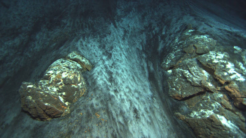
A contact is a sharp boundary between two geologic units. Here we see a clear boundary where sand has slid down to partially cover lava flows on a steep slope. Image courtesy of Bill Chadwick, Oregon State University, National Science Foundation, and Woods Hole Oceanographic Institution. Download larger version (jpg, 1.2 MB).
None of these properties alone is enough to establish local geologic history; the precise age of a rock still needs to be measured in the laboratory. However, by mapping out changes in these properties on the seafloor, we can identify geologic “units”—that is, rock groups that formed at the same time.
A very important idea in geology is that new rocks form over old ones. For example, lavas on a volcano flow out one after another, forming a pile with old lavas at the bottom and young lavas at the top. Since we do not get this cross-section from remotely operated vehicle dives, we have to look for “contacts” where two rock units meet each other. For example, debris could partially cover a lava flow, indicating that a landslide happened after the volcano built up. By identifying contacts between units, we can begin to put events in order. This will help us understand the kinds of processes that are changing seamounts even long after they have stopped erupting.


