
By Ed Baker, Supervisory Oceanographer - NOAA Pacific Marine Environmental Laboratory
and Meme Lobecker, Physical Scientist/Hydrographer - NOAA Okeanos Explorer Program
Scientists were stunned by the discovery of hydrothermal venting and strange biology on the Galápagos Rift in 1977. Since then, explorations on midocean ridges and volcanic arcs have found similar hot springs throughout the oceans. Ridges and volcanoes are where new ocean crust is built by molten lava, erupting onto the seafloor from deep in the Earth. Scientists have learned that vents are most common wherever the supply of lava—and thus heat—is most abundant.
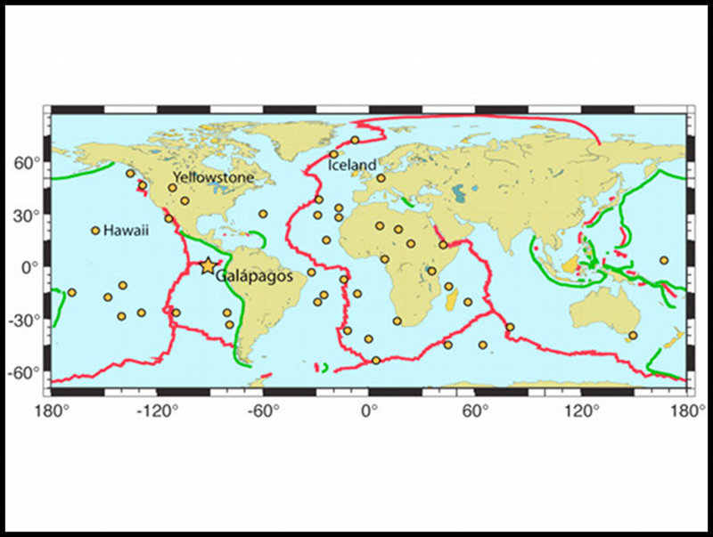
Figure 1. Locations of mantle “hotspots” (orange dots) around the globe. The Galápagos hotspot is marked by the large star. Red lines are midocean ridges, where the Earth’s major tectonic plates originate. Green lines are subduction zones, where the plates sink and return to the mantle. Image courtesy of NOAA Pacific Marine Environmental Laboratory. Download larger version (jpg, 954 KB).
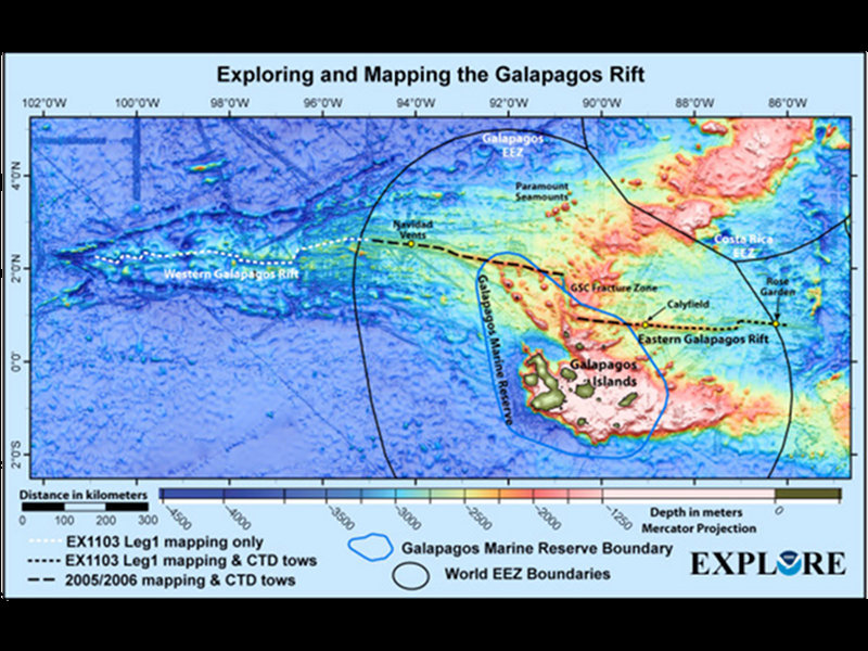
Figure 2. Bathymetry of the Galápagos Rift region, showing the work areas for Leg 1 of GALREX. Some of the known vent areas to be visited on Leg 2 are indicated by yellow dots on the rift. Exploration for new vent sites on Leg 1 will cover the eastern third of the Rift, to complement the 2005/2006 cruise. Image courtesy of Susan Merle, NOAA Pacific Marine Environmental Laboratory. Download larger version (jpg, 177 KB).
The Galápagos Rift is also a rare example of a ridge that overlies a mantle “hotspot.” Hotspots are locations where greatly increased lava output lasts millions of years. More than 40 hotspots are known, including those that are building Hawaii, Iceland, and the Galápagos Islands, but only a few lie beneath a ridge (Figure 1). Our first hydrothermal survey of the Galápagos Rift, in 2005-2006, tested the hypothesis that the increased supply of lava there would create an abundance of active vent sites. Paradoxically, we found that vents were not abundant but unusually scarce. Because the 2005-2006 survey covered only the middle third of the ridge, we will explore the eastern third during the GALREX expedition to further test this hypothesis (Figure 2).
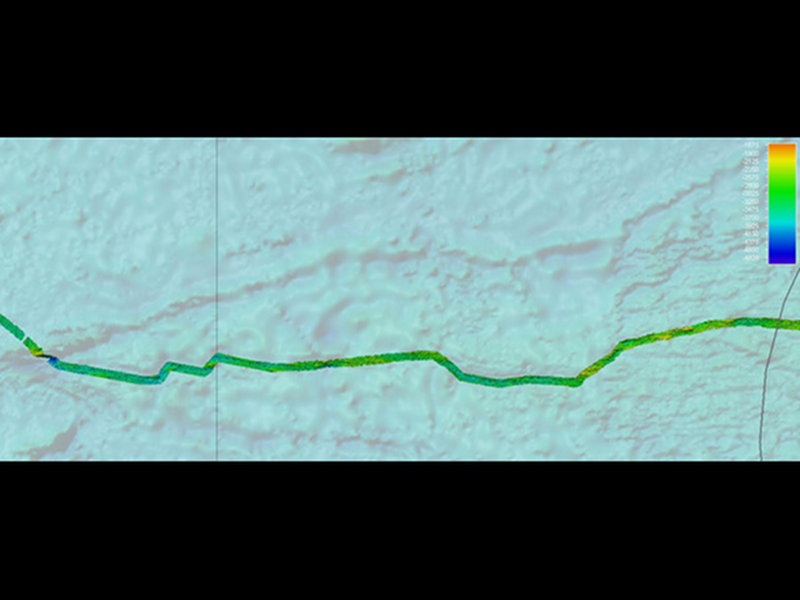
Figure 3. High resolution EM302 bathymetry collected by the Okeanos Explorer during EX1103 Leg, corresponding to the white dashed line in Figure 2. Image shown north up, grid cell resolution 50 meters. Depth color bar in meters. Background satellite-alimetry derived data courtesy of Sandwell and Smith. Image courtesy of NOAA Office of Ocean Exploration and Research. Download larger version (jpg, 301 KB).
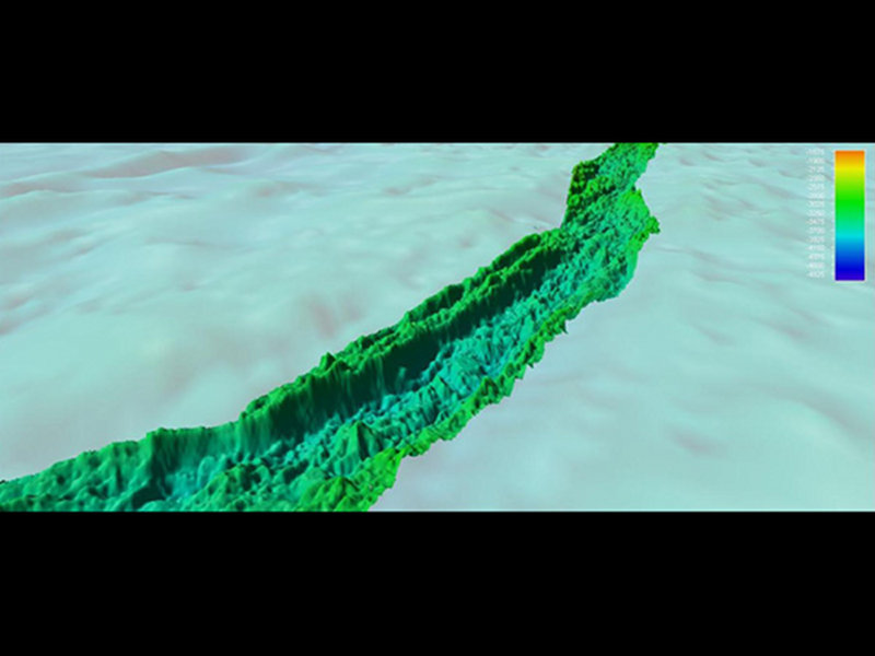
Figure 4. Oblique angle showing detail of gridded EM302 multibeam bathymetry along Western Galápagos Rift. Depth color bar in meters. Background satellite-altimetry derived data courtesy of Sandwell and Smith. Image courtesy of NOAA Office of Ocean Exploration and Research. Download larger version (jpg, 313 KB).
Our maps thus provide a more realistic image of the seafloor than has ever been seen before. Can we see individual chimneys or other individual hydrothermal vents? No, not likely even with the EM302. However, the EM302 does create high-resolution maps of geological features—such as faults and small volcanoes—where we are most likely to find vents.
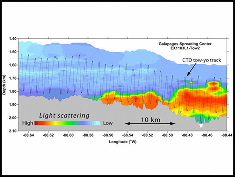
Figure 5. An example of a CTD “tow-yo” hunting for hydrothermal plumes along the Galápagos Rift during Leg 1. The black sawtooth line, following the bathymetry of the seafloor, shows the CTD path raising and lowering above the seafloor through the water column as cable is winched in or out. A light-scattering sensor on the CTD recorded changes in the relative concentration of hydrothermal “smoke” particles. The highest values are shown by the red contours. On Leg 2, the ROV will investigate this site to find and observe the seafloor source of the venting. Image courtesy of Sharon Walker, NOAA Pacific Marine Environmental Laboratory. Download larger version (jpg, 1.7 MB).
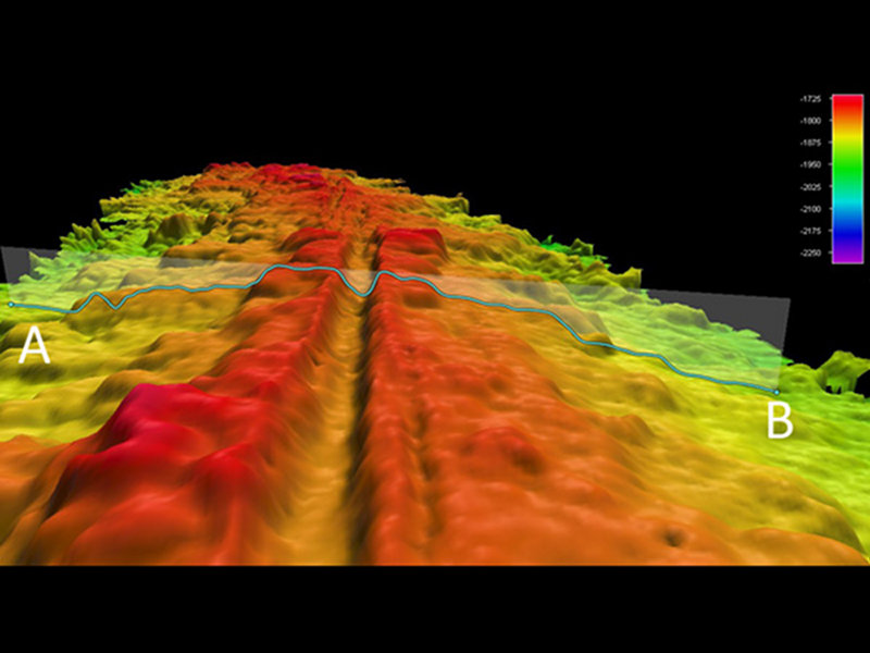
Figure 6. Oblique angle showing detail of gridded EM302 multibeam bathmetry along Western Galápagos Rift. The spreading center is clearly visible as the narrow valley along the shallowest part of the axis. Depth color bar in meters. Image courtesy of NOAA Office of Ocean Exploration and Research. Download larger version (jpg, 380 KB).
Perhaps the most important feature is the shallow axial valley that marks the actual spreading axis of the rift (Figure 6). Lava eruptions always occur near a ridge axis, and so do vent fields. On Leg 1, the Okeanos Explorer made the first high-resolution map of the western third of the Rift, and collected much-improved bathymetry of the eastern third (Figure 2). With these new maps we will be able to plan for future work to complete our hydrothermal exploration of this remarkable ridge.
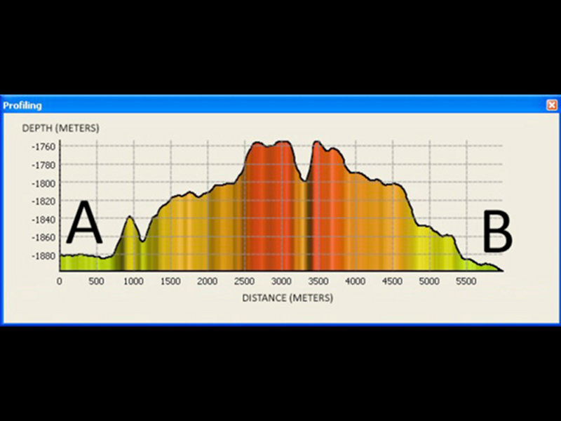
Figure 7. Depth profile corresponding to labled points A and B in Figure 6. The spreading center valley is clearly visible at the top of the ridge. Image courtesy of NOAA Office of Ocean Exploration and Research. Download larger version (jpg, 362 KB).
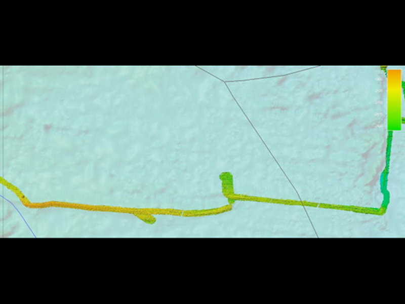
Figure 8. High resolution EM302 bathymetry collected by the Okeanos Explorer during EX1103 Leg, corresponding to the black dashed line in Figure 2. Image shown north up, grid cell resolution 50 meters. Depth color bar in meters. Background satellite-alimetry derived data courtesy of Sandwell and Smith. Image courtesy of NOAA Office of Ocean Exploration and Research. Download larger version (jpg, 1.3 MB).
The tow-yos conducted by the Okeanos Explorer during Leg 1 were some of the longest continuous tows ever conducted for hydrothermal vent detection. From the afternoon of June 23rd to the evening of June 29th, 24-hour tow-yo operations occurred over a distance of 408 kilometers (220 nautical miles). Figure 5 shows a small section of one of our tows. Near 88.56°E, the CTD began to sense an increased concentration of hydrothermal “smoke” in the water. Within about 10 km, the thickness of the plumes had more than doubled. This newly discovered area of hydrothermal plumes is a primary target of ROV operations during Leg 2.