Jeremy Potter, Expedition Coordinator - NOAA Office of Ocean Exploration and Research
Discovery of deep-sea hydrothermal vents and associated biological communities on the Galápagos Rift in 1977 (Corliss et al., 1979) profoundly and permanently changed our view of the deep sea and revolutionized the oceanographic and earth sciences. Since 1977, there have been a number of follow-on expeditions to conduct exploration and research on vents and other habitats in the vicinity of the Galápagos Islands. This cruise will be the first of two major expeditions for the Okeanos Explorer Program in 2011. The expedition will focus on water column and deep unexplored diversity of benthic environments in the Galápagos region. We expect to explore newly-discovered – black smoker plume signals, the oldest known vent fields, off-axis sulfide mounds, deep fracture zones, and seamounts.

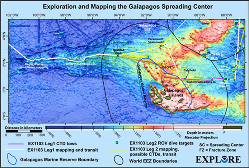
During the approximately 50-day expedition, scientists and technicians will focus on little known areas in international and Ecuador waters in the vicinity of the Galápagos Islands. This map shows the preliminary ship track and major exploration targets along the way. Given the Team’s desire to respond to information collected during the expedition, there is a strong chance the final ship track will look significantly different. Map courtesy of Susan Merle, NOAA Pacific Marine Environmental Laboratory. Download larger version (jpg, 2.7 MB).
From June to July 2011, a team of scientists and technicians both at-sea and on shore will conduct exploratory investigations on the diversity and distribution of deep-sea habitats and marine life in the vicinity of the Galápagos Islands. We hope to have a live-internet connection to allow the world public to ‘join’ the Team in making real-time discoveries from hundreds to thousands of meters below the ocean surface. The 50-day expedition is divided into two ‘legs’ and includes work in Ecuador, Costa Rica, and international waters.

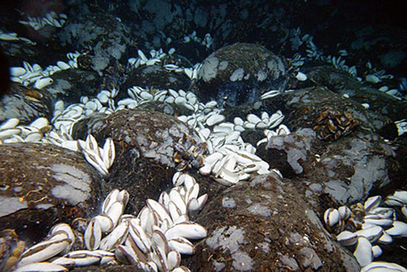
Giant clams up to 1 foot long thrive in the crevices around seafloor pillow lava, which vent hydrothermal fluids with chemical nutrients. This vent site on the Galápagos Rift, discovered in 2002, is called “Calyfield” after the clam (Calyptogena magnifica). The 2002 expedition was the first time NOAA Ocean Exploration sponsored work around the Galapagos. Image courtesy of Tim Shank, Woods Hole Oceanographic Institution. Download image (jpg, 150 KB).
Starting around June 19, scientists and technicians began mapping the seafloor using the multibeam sonar and characterizing the water column with the CTD/rosette. Starting on July 13, we will also explore seafloor habitats using the Institute for Exploration’s Little Hercules (“Little Herc”) remotely-operated vehicle (ROV). As of July 12, the tentative schedule is:
The NOAA Ship Okeanos Explorer is one of the newest additions to the NOAA fleet and was commissioned in 2008. It provides accommodations for up to 46 crew and technicians. Unique to this ship is that most of the scientists will remain ashore. Via telepresence, live images from the seafloor and other science data will flow over satellite and high-speed Internet pathways to scientists standing watches in Exploration Command Centers (ECCs). During this expedition, core scientists will work primarily from ECCs in Seattle and Newport-Oregon as well as a Remote Command Center in Woods Hole, Massachusetts. These scientists, and others on call if a discovery is made at sea, will add their expertise in real-time to operations at sea.

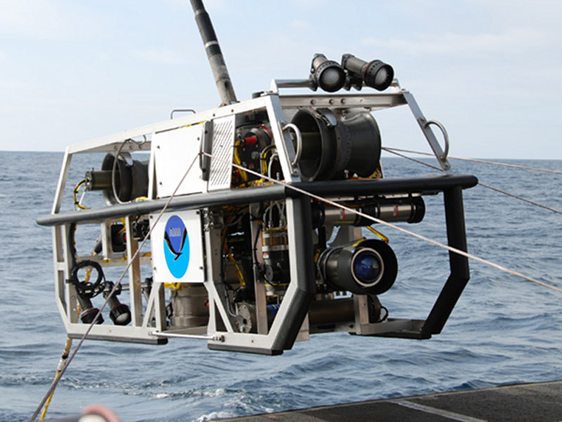
The Galápagos Rift Expedition 2011 marks the debut of a new camera and lighting platform named “Seirios”. We expect that the new and improved lighting system will markedly enhance our exploration capability. This image is from an ROV shakedown cruise off the coast of the Channel Islands, California in April 2011. Image courtesy of NOAA Okeanos Explorer Program. Image courtesy of NOAA Office of Ocean Exploration and Research. Download larger version (jpg, 3.7 MB).
One of the hallmarks of this expedition will be the high-definition video provided from the Little Hercules ROV. The Galápagos expedition also marks the debut of a new camera sled and lighting platform named Seirios. When deployed from the Okeanos Explorer, “Little Herc” and Seirios will provide scientists and the audiences onshore with the very first video footage from many of the deepwater areas around the Galápagos. All expedition participants are anxious to see the spectacular habitats and marine life we’ll discover.
NOAA's partners in this expedition include the University of Massachusetts-Amherst, Woods Hole Oceanographic Institution, University of South Carolina, Naval Oceanographic Institute-Ecuador (INOCAR), Indonesia Ministry of Marine Affairs and Fisheries, and University of Rhode Island.