BOEM Wreck Site 15377
Background
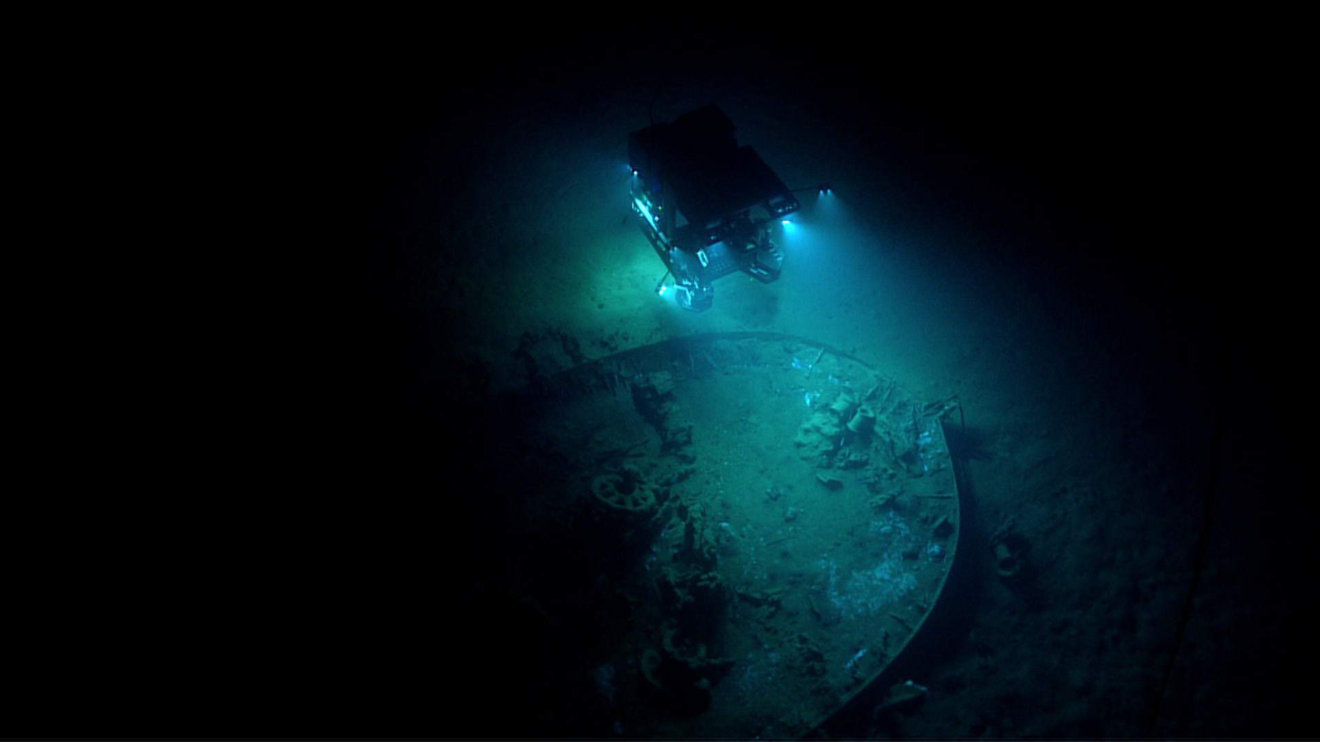
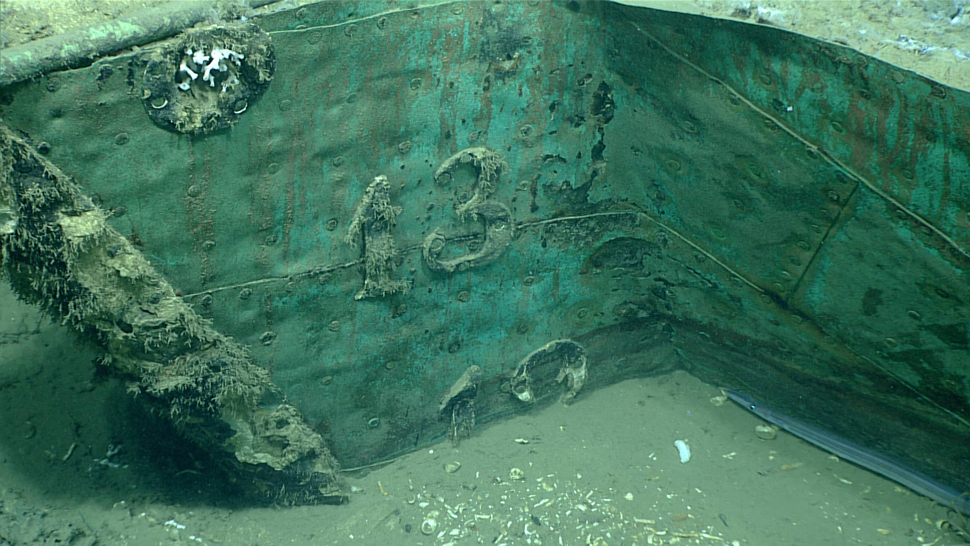
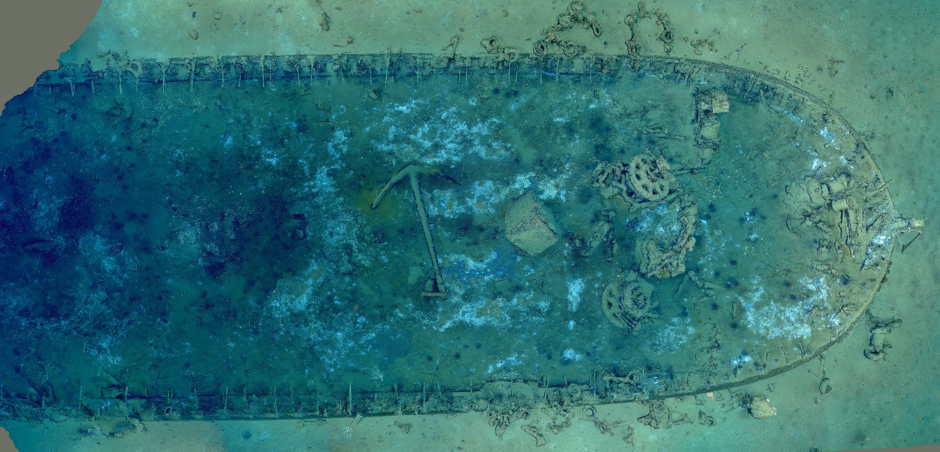
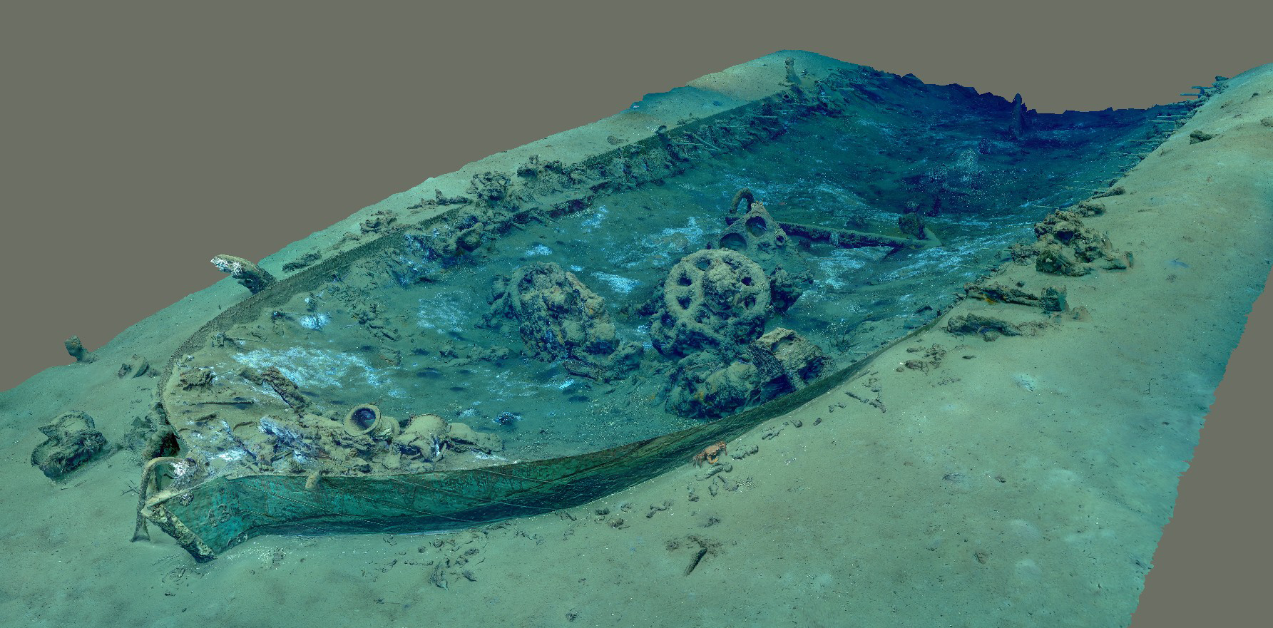
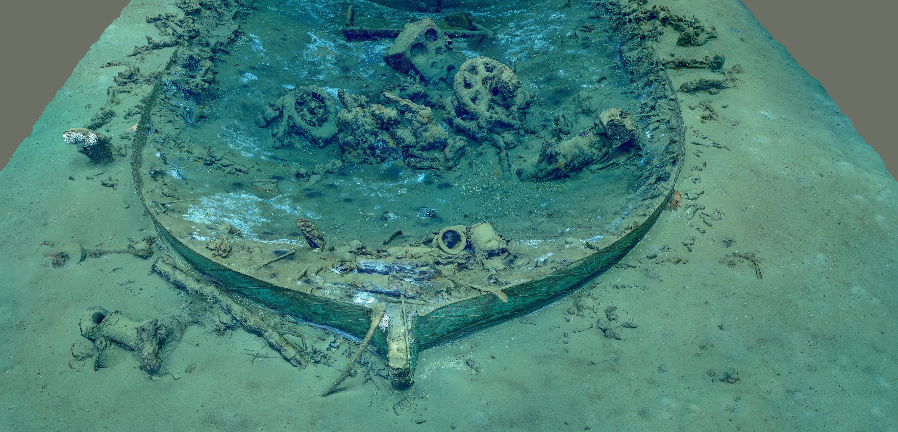
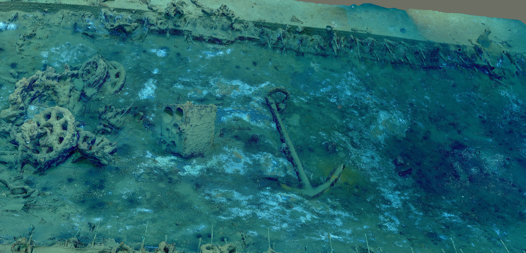
BOEM Wreck Site 15377 is a shipwreck in the Gulf of Mexico that was likely a fully-rigged ship, bark, or barkentine that was probably constructed between 1830 and the middle of the 19th century. It has copper sheathing on the hull, an assemblage of ceramics, stoneware, and blown glass containers, among other artifacts. In the center of the site is a sheet anchor, stove, and what appears to be the remains of a windlass or possible bilge pump. Judging from the layout of the hull and how boxy it is, it is likely that it was a merchant vessel designed for long ocean voyages.
Exploration
Discovered in 2005 during an oil and gas survey and identified as Site 15377 by the Bureau of Ocean Energy Management (BOEM), this wreck site was explored for the first time on December 9, 2017, during an expedition led by NOAA Ocean Exploration aboard NOAA Ship Okeanos Explorer. Remotely operated vehicle (ROV) Deep Discoverer — equipped with an Insite Pacific Zeus Plus camera capable of collecting high-definition footage — was used to document the site, which is at a depth of approximately 700 meters and is 32 meters long and 10 meters wide.
Modeling
This model of BOEM Wreck Site 15377 from NOAA Ocean Exploration is based on the ROV dive footage from timestamps 21:45 to 23:10. The footage was exported into 4,905 still images using VLC Player and color corrected in Adobe Photoshop. An additional photogrammetric model of this site is available on BOEM's Virtual Underwater Museum.
This model is best viewed on a desktop computer.
Desktop:
- To zoom in and out: Use the scroll wheel on the mouse.
- To move around: Left click on the model with the mouse and drag.
- To rotate: Right click on the model with the mouse and drag.
Mobile Devices:
- To zoom in and out and rotate: Pinch
- To move around: Tap and drag any direction.
Photogrammetry model of BOEM Wreck Site 15377 developed by Raymond Phipps, NOAA Ocean Exploration explorer-in-training, June 26, 2023. Model courtesy of NOAA Ocean Exploration, Gulf of Mexico 2017.

Published October 17, 2024