By Eric Gallimore, Scripps Institution of Oceanography
While we still use human divers and ship-based sensors when searching for artifacts, we rely heavily on autonomous underwater vehicles (AUVs) to conduct surveys to find and document archaeological sites. AUVs are robots that operate with minimal human interaction; they are programmed with a mission and not driven around using a joystick. As a result, they don’t need to be connected to a ship with a cable and can swim close to the ocean floor. Using AUVs allows us to survey vastly more area than we could if we relied solely on humans and boats, and they collect high-quality data that helps us to accurately document sites.
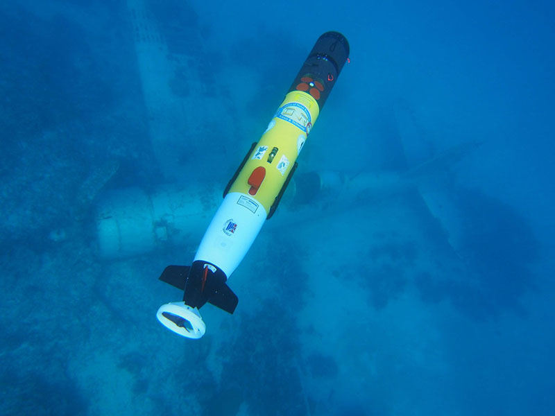
The AUVs that we typically use for archaeological surveys are torpedo-shaped and small enough to be handled by two people (Figure 1).

Figure 1: One of the project AUVs deployed over a WWII aircraft site. Image courtesy of Project Recover . Download larger version (jpg, 462 KB).
They can run for about eight hours before their batteries need to be recharged. We also have larger vehicles that are more complicated to deploy and recover but can dive deeper and run for several days. Depending on the area we are trying to survey, we may use several vehicles simultaneously.
The AUVs are versatile platforms that can carry a wide variety of sensors. The AUVs we use allow us to quickly change sensors for different missions, and it’s common for us to use the same vehicle to operate many different sensors over the course of an expedition. For archaeological surveys, we usually use a combination of sonars, magnetometers, and cameras. Sidescan sonar, which uses a narrow beam of sound to produce a two-dimensional image of the seafloor, is one of the most important tools for seabed survey. Of the sensors we use, sidescan sonar usually has the longest range, so using it allows us to survey the largest area in the shortest amount of time.
We also use a very sensitive magnetometer system when searching for wrecks. This sensor measures disturbances in the Earth’s magnetic field caused by ferrous metals (such as iron or steel). The range of this system is significantly smaller than the sidescan sonar, but it can detect targets that are buried in sediment or covered in coral, which wouldn’t be visible in a sonar image.
Once we identify a potential target using one of these methods, we examine it using additional sensors to gather more data that helps us characterize the target. This process is called reacquisition, or a “reacquire.” In many cases, the survey team identifies targets by hand in sidescan sonar images and then programs AUV missions to reacquire those targets. With our magnetometer system, a computer in the AUV can identify potential targets automatically and communicate with other vehicles to have them reacquire the target without additional human input.
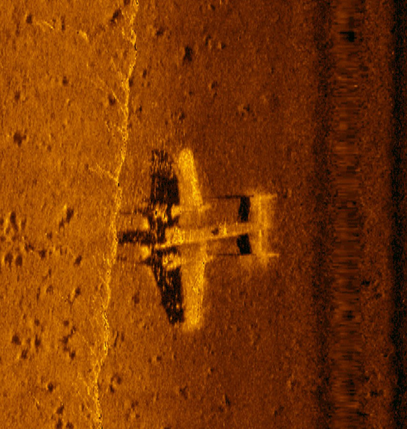
Reacquires use sensors that generally have shorter range but higher resolution than those used for search. For example, we usually collect additional sidescan sonar data over the targets. However, we adjust the sidescan sonar so that it collects higher resolution data at shorter range, and we make multiple “passes” over the target at different angles to get several images (Figure 2).

Figure 2: High resolution sidescan sonar image of a WWII B-25 discovered by members of Project Recover in 2017 in Papua New Guinea. Image courtesy of Project Recover . Download larger version (jpg, 624 KB).
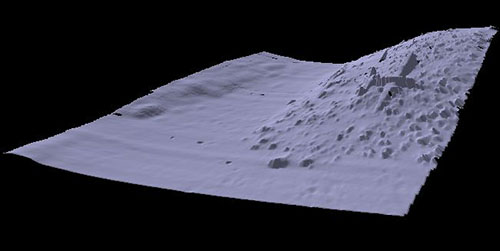
A multibeam sonar is used to generate a high-resolution three-dimensional model of the target (Figure 3).

Figure 3: High resolution multibeam sonar image of a WWII B-25 documented by members of Project Recover in 2017 in Papua New Guinea. Image courtesy of Project Recover . Download larger version (jpg, 75 KB).
The multibeam sonar effectively “scans” a small area using many tightly-focused beams of sound. We process this data to generate a point-cloud representation of the target. Unfortunately, the range of this sonar is more than an order of magnitude less than the sidescan sonar we use for search.
We also use cameras to take optical images over targets. Since water absorbs and scatters light, we typically use cameras with very good low-light sensitivity. Visibility is often limited to a few meters, so we need to operate the vehicle within a few meters of the seafloor when capturing images.
Navigation underwater is more difficult than navigating on land or in the air, since GPS signals can’t penetrate water. Fortunately, the vehicles have several methods to localize themselves. They can use acoustic transponders, which are deployed in known locations and provide navigation fixes. Additionally, the vehicles have compasses and Doppler velocity logs (or DVLs, which measure the vehicle speed over the seafloor). By combining information from these systems, we can find an accurate position for the vehicle. Since the vehicle position is known accurately, we can accurately localize targets. Therefore, we can find the same target again, which is important!
Once we’ve found and characterized a target using AUVs, we might still use divers with cameras or remotely-operated vehicles (ROVs, which are piloted by a human over a cable) to further inspect and document a wreck site. Humans are still needed throughout the survey process but using AUVs with a range of sensors drastically improves the team’s survey capabilities.