
By Chuck Meide, Director of the Lighthouse Archaeological Maritime Program - Lighthouse Archaeological Maritime Program
August 12, 2014
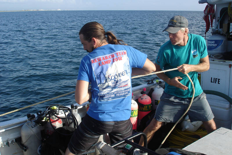
Brian McNamara, left, and Sam Turner, right, haul in on the stern anchor line. We are pulling our anchors and departing for the next target on our list. Image courtesy of Image courtesy of the Search for the Lost French Fleet of 1565 Expedition, NOAA-OER/St. Augustine Lighthouse & Museum. Download larger version (jpg, 398 KB).
We woke today with the sunrise. Our first order of business was to retrieve the stern anchor, which helped us stay over Target 1, Drop 2, during the previous day’s work. We are pulling the anchor because we are done with Target 1, Drop 2, and will be moving on to a new target, Target E3T.
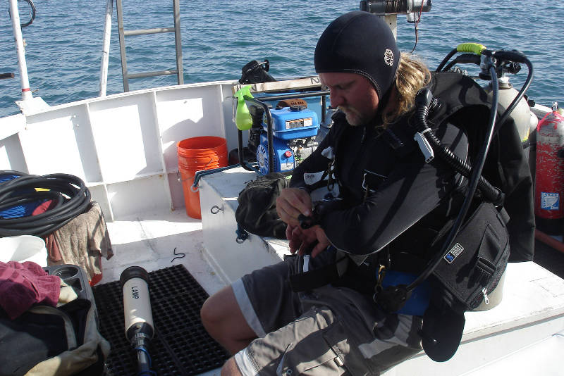
Chuck prepares to enter the water with the handheld magnetometer to see if we can better identify the exact spot of the strongest magnetism from our target. Image courtesy of Image courtesy of the Search for the Lost French Fleet of 1565 Expedition, NOAA-OER/St. Augustine Lighthouse & Museum. Download larger version (jpg, 365 KB).
Once we have our stern anchor back on board with its line nicely coiled, we pull the bow anchor and are ready to go. By 9:00 am, we are at the next target, known as E3T.
We waste no time upon arrival. Our skipper, Dave, has been given the exact coordinates of our target, and he prepares to slowly advance on that precise location. “Standing by with buoy!” yells Sam with the drop buoy, letting us know he’s ready for the drop. The next exclamation is from the boat captain, “Drop! Drop! Drop!” and the buoy weight plunges into the cool green sea, with the buoy line zipping away from the gunwale until the float and entire length of line are floating behind us, on the spot indicated by our GPS.
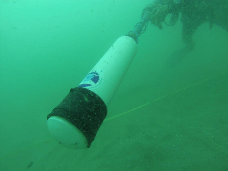
I am the diver in this picture, extending the head of the handheld magnetometer in front of my body and sweeping it along the seafloor while looking and listening for changes in readings which might signify buried iron wreckage. Image courtesy of Image courtesy of the Search for the Lost French Fleet of 1565 Expedition, NOAA-OER/St. Augustine Lighthouse & Museum. Download larger version (jpg, 163 KB).
We suit up to send divers in the water. I’ll be with the first team and the mission is to conduct a series of circular searches around our dropped buoy to see if we can identify an area of strong magnetism with our handheld magnetometer. This magnetometer is similar to our towed system except that it is carried by the diver himself, and does not record data for later analysis but displays regular readings of the Earth’s magnetic field in gammas, along with an audible signal which changes in pitch as the readings change.
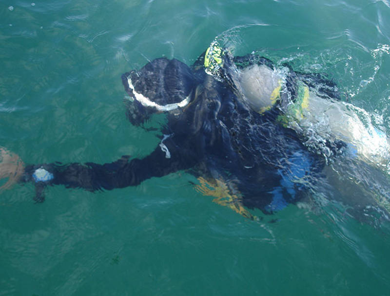
Diver Brian McNamara descending to the bottom where he and Sam will lay in a transect line and begin probing. Image courtesy of Image courtesy of the Search for the Lost French Fleet of 1565 Expedition, NOAA-OER/St. Augustine Lighthouse & Museum. Download larger version (jpg, 226 KB).
Starting at the dropped buoy weight (which is lead, so as not to distort the handheld magnetometer readings which are only affected by iron or steel), we conduct circular searches in 360 degree arcs.
Six circular searches are completed—the first 2.5 meters out from the center point, followed by searches 5 meters, 7.5 meters, 10 meters, 12.5 meters, and 14.5 meters out from center. The magnetometer readings are somewhat erratic and I am not able to pinpoint any obvious area of increased magnetic anomaly. This possibly indicates that there is a lot of material scattered throughout the entire area. So we will simply probe this area using the original buoy drop as our central starting point.
Since this will be the starting point for our probing, we take the time to send a swimmer out to the buoy from the boat to get a reliable GPS reading directly over the buoy with our highly accurate survey GPS. We can later plot this point out on the map and see to within a meter exactly where we probed.
Sam and Brian are in the water next to set up for and begin probing. They descent at 12:45 pm, and we know they have less than two hours to get as much work done as possible, since we need to depart the search area today by around 2:30 pm in order to travel to New Smyrna Beach to switch out crews for Cruise 3. But they can get a good start, and should be able to finish one 20-meter long series of probes.
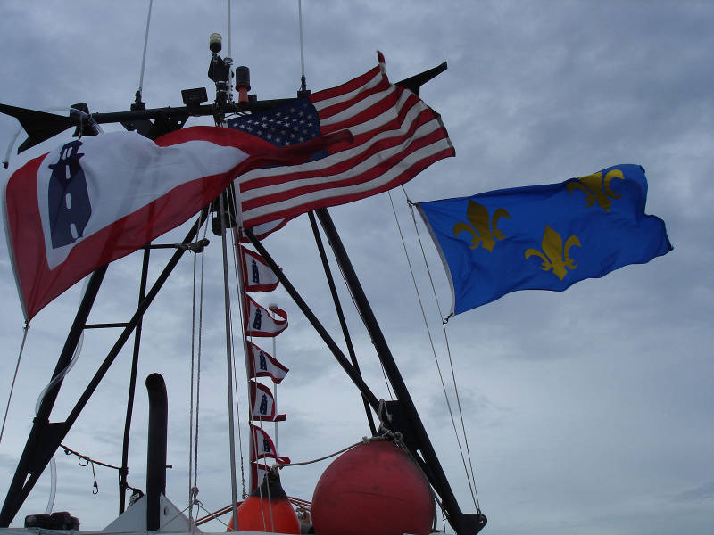
Flying the colors on the way home! The large pennant on the left, and the smaller versions in the middle, are the old flag of the U.S. Lighthouse Service, the former government agency that regulated Lighthouses. At the right is the French flag that formerly flew over Fort Caroline National Memorial. Image courtesy of Image courtesy of the Search for the Lost French Fleet of 1565 Expedition, NOAA-OER/St. Augustine Lighthouse & Museum. Download larger version (jpg, 247 KB).
They start by laying out a tape measure on the bottom oriented north-south. It is stretched out for 20 meters, with the zero mark at the north end, the 10-meter mark at the center on the drop buoy weight, and the 20-meter mark at the south end. This defines the first transect for probing.
One by one, they sink the 10-foot long steel probe, powered by a water stream from the pump on board Roper, all the way to the hilt. It is hard work, forcing the top-heavy probe 10 feet deep into the sand, crunching through resistant layers of shell along the way.
Once all the way sunk, the probe is pulled up and up and up out of the hole in the sand, which quickly caves in to leave a round divot, and moved a meter over and forced down again. In this way, the divers sink 21 probe holes in a row.
On this dive they did not get a single hard return, so we missed any wreckage that might be out there, but when the next team returns to the site tomorrow, they will conduct another series of probes running from west to east, forming a giant cross on the seafloor. If there is anything magnetic of significant size buried here, we should run into it eventually.
When the divers return to the boat, they report that the sand is finer-grained than we have seen at previous targets. They also tell us that there is a dense layer of broken shell at two meters below the bottom, which at first felt like a hard return but is, in their judgment, a natural phenomenon and not representative of historic wreckage.
Once the divers are back safely on the boat, we switch from diving mode to driving mode, and we stow away all hookah and probe hoses and other diving gear, to clear the deck for driving the boat home. The anchors are raised and we depart Target E3T for Ponce Inlet and New Smyrna Beach.
We have left our buoy marker on site as we will return here tomorrow to finish the probing. But for now our second cruise has come to a close. We have successfully tested our first few targets and we will have more to go the following cruise.
While any French shipwrecks have remained elusive for now, we still have five more working days on the site starting tomorrow, with a fresh crew, so hopes remain high.