
By Brian McNamara, Volunteer Archaeologist - Lighthouse Archaeological Maritime Program
August 11, 2014
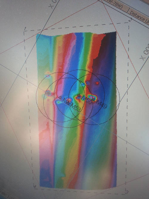
Target 1 consists of several magnetic anomalies, or variations from the Earth’s magnetic field. This is what we would expect to see of a scatter of iron artifacts buried in the sand from a historic shipwreck. Image courtesy of Image courtesy of the Search for the Lost French Fleet of 1565 Expedition, NOAA-OER/St. Augustine Lighthouse & Museum. Download larger version (jpg, 957 KB).
Nothing was found with our 10-foot probe yesterday on the eastern side, so today’s goal was to see if anything on west side, at Drop 2, will have results. While Sam was getting the Trimble GPS system up and running, the first dive mission is to collect our materials left down from the day before. Our measuring tapes and fiberglass stakes would be necessary to establish the system of measurement on the next target so we can ensure accuracy in our findings.
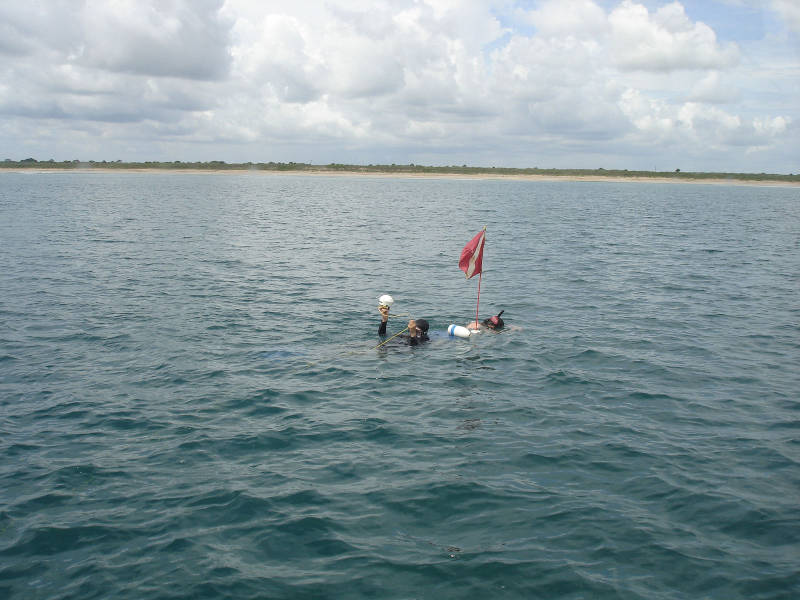
Chuck and I refine the accuracy of our drop buoy using the Trimble GPS receiver. This survey-grade satellite positioning system is accurate to within a meter. Image courtesy of Image courtesy of the Search for the Lost French Fleet of 1565 Expedition, NOAA-OER/St. Augustine Lighthouse & Museum. Download larger version (jpg, 345 KB).
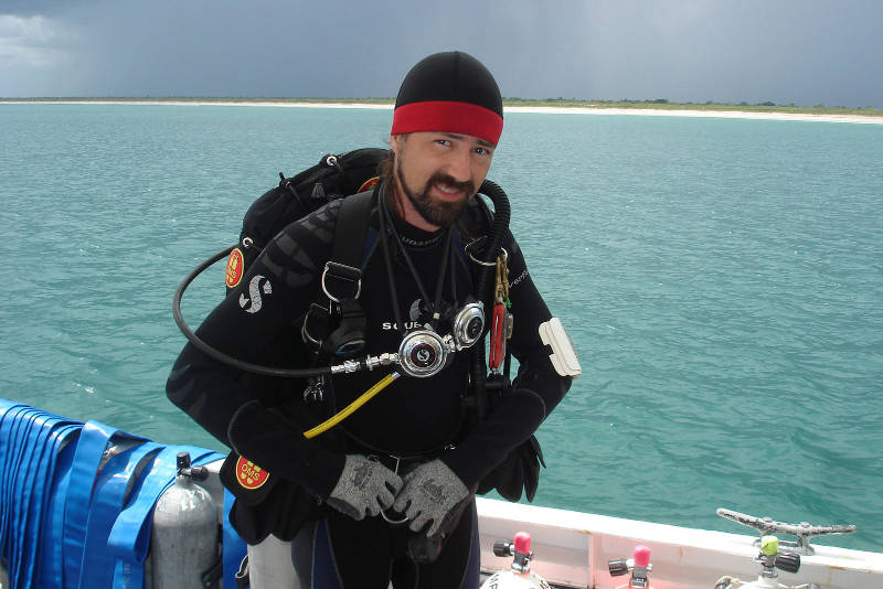
Here I am preparing to enter the water. A dark sky means we are expecting to cut the dive short due to a storm moving towards us. Image courtesy of Image courtesy of the Search for the Lost French Fleet of 1565 Expedition, NOAA-OER/St. Augustine Lighthouse & Museum. Download larger version (jpg, 305 KB).
After that we motored Roper to the western end of the target, where yesterday we left a blue and white buoy denoting Drop 2. To achieve the highest accuracy in our GPS location, Chuck and I swam the GPS receiver out to the target and fine tuned the position of our buoy anchor. By holding the buoy line tightly and vertically and holding the GPS receiver directly over it, our highly accurate survey GPS can provide the buoy's exact location to within a meter’s accuracy.
Since we have an actual location for this buoy, we change its designation from Drop 2 to Drop 2A (A for “actual”). The next dive involves using the handheld magnetometer to lay out our measuring tape baseline according to the area of highest magnetic deviation. The mag suggests a spot about 11 meters away, which we mark with a second buoy and designate Drop 2B.
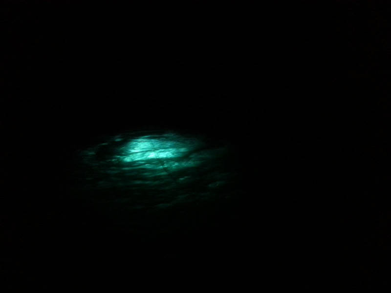
The water was clear enough that even during a night dive, the divers’ lights could be seen from Roper upon the surface. Image courtesy of Image courtesy of the Search for the Lost French Fleet of 1565 Expedition, NOAA-OER/St. Augustine Lighthouse & Museum. Download larger version (jpg, 58 KB).
Sam and I geared up and began work on the first transect line of probes to test the area, a tape measure connecting Drop 2A and Drop 2B. But after about an hour of work, we realized that we did not have enough hose rigged for the probe to reach the farthest end of the line. We made a quick return to Roper for a change of tanks and additional hose and were soon back to work.
As I did a backwards roll over the side of Roper and into the water I noted how dark and ominous the sky was starting to look.
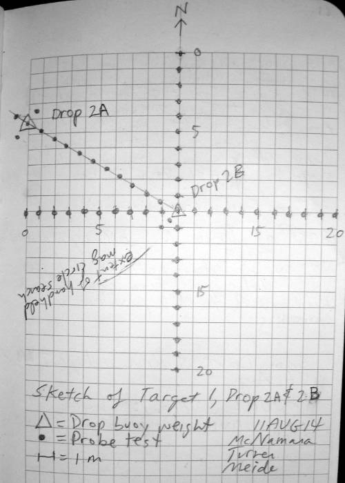
The sketch from our field notes showing the probes tested at Drop 2A and Drop 2B during today’s dives. We probed around Drop 2A, along the transect between 2A and 2B, and then 10 meters out in all four directions from 2B. We maintain notes summarizing our research each day, in addition to operational notes in the boat log, and dive times in the dive log. Image courtesy of Image courtesy of the Search for the Lost French Fleet of 1565 Expedition, NOAA-OER/St. Augustine Lighthouse & Museum. Download larger version (jpg, 493 KB).
Once we get into the rhythm of probing, time flies. We were fortunate to have a good window to complete the transect laid out between Drops 2A and 2B, as well as beginning lines running north-south and east-west from Drop 2B. It was just as we were sinking the probe down for the last hole in our north-south line that a change in wind caused Roper to swing on her moorings. The probe, Sam, and I were dragged off the site by our own air supply lines.
There was no need to sound a diver recall signal because of the oncoming storm; the boat drifting away took care of that. We returned to Roper and secured for stormy weather.
We decided not to push our luck, so we motored further offshore to ride out the storm. Armed with submersible flashlights, we planned to continue work into the night if the weather cleared and the seas laid down. Fortunately, that was just what happened; we returned to the site and Chuck and Sam completed the probing for the target as the sun dipped below the western horizon.
Chuck and I made one last night dive to retrieve all of the lines and gear on the bottom, and called it a night. We returned to the surface at 9:32 pm and were greeted by the smell of Sam cooking dinner on Roper’s galley stove. We can check Target 1 off the list, and tomorrow will be another, but first a hot meal and a few hours sleep!