By Bill Chadwick - Oregon State University and NOAA Pacific Marine Environmental Laboratory
December 14, 2014

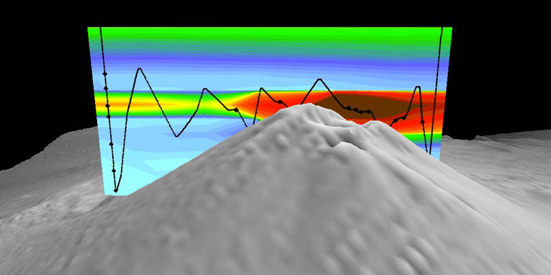
Cross-section over the top of Daikoku seamount with the results from a CTD tow (black line), showing anomalies in turbidity (warm colors indicate high particle concentrations) in the eruption plume. Image courtesy of Submarine Ring of Fire 2014 - Ironman, NOAA/PMEL, NSF. Download larger version (jpg, 216 KB).
One of the things we’re learning on this expedition is that the Mariana arc is even more dynamic than we had thought. We knew the arc seamounts were active volcanoes, but we had little way of knowing how frequently they are active and what impacts such activity might have on the ocean environment. But we’re getting a glimpse into that now.

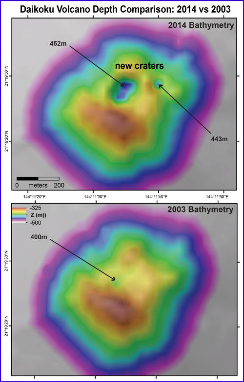
Bathymetric comparison of data collected at Daikoku summit on this 2014 expedition (top) and in 2003 (bottom). A large crater formed at the summit, and it was confirmed to be hydrothermally (and possibly volcanically) active by the CTD tow and midwater data collected on this expedition. Image courtesy of Submarine Ring of Fire 2014 - Ironman, NSF/NOAA. Download larger version (jpg, 1.7 MB).
In 2003, we traversed the entire Mariana arc, mapping over 60 seamounts with sonars and surveying the ocean above them with our CTD instrument to find out which ones were hydrothermally active. I think we assumed that what we found in 2003 would be “the way it was” – that these submarine environments were relatively stable and would not change much over a period of many years. But we’re discovering that that assumption is wrong. They are changing from year to year, and each exploration of this area is yielding new and exciting discoveries.
Sites that were previously active are now dormant, and others that were previously inactive have awakened. Seamounts that had previously shown little sign of hydrothermal venting now have very robust output. We know that South Sarigan seamount erupted in 2010, and Ahyi seamount erupted earlier this year in April/May. Earlier during this cruise, we found that eruptive activity had stopped at NW Rota seamount – the site where we had previously observed eruptions since 2004. And now, we’ve discovered that Daikoku seamount – previously found only to be hydrothermally active, now appears to be erupting!

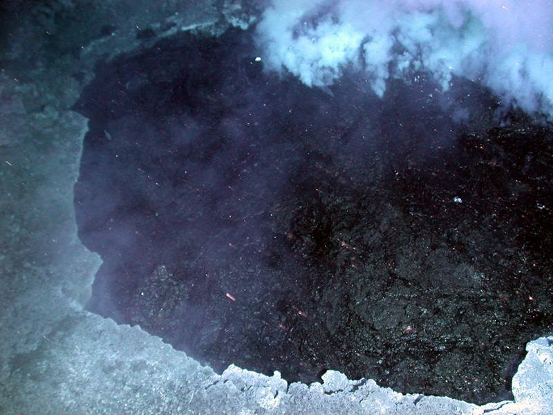
This pond of molten sulfur (approximately five meters across and black due to its high-iron content) was discovered roiling in the bottom of a small crater (from the 2006 Submarine Ring of Fire expedition). Image courtesy of Submarine Ring of Fire 2014 - Ironman, NOAA/PMEL. Download larger version (jpg, 2.4 MB).
There are two pieces of evidence that suggest Daikoku seamount is erupting. First, CTD casts and tows at Daikoku show very strong plumes coming from the top of the seamount. The plumes have high turbidity, low pH, strong anomalies in reduced chemicals – and most importantly – very high levels of hydrogen, which is a tell-tale indicator of a submarine eruption.
The other supporting evidence is that when we resurveyed Daikoku seamount with the ship’s multibeam sonar, we found that there is a large new crater at the summit of the cone. The crater is 150 meters across (500 feet) and 100 meters deep (330 feet).

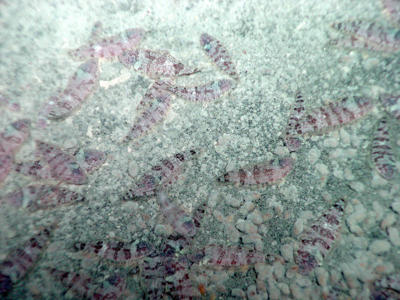
A new species of vent-endemic flatfish was previously discovered living at Daikoku seamount (from the 2004 Submarine Ring of Fire expedition). Image courtesy of Submarine Ring of Fire 2014 - Ironman, NOAA/PMEL. Download larger version (jpg, 3.6 MB).
We had hoped to make a dive with the remotely operated vehicle (ROV) Jason at Daikoku to visually confirm the CTD results and to find out what is happening on the seafloor, but the weather has not cooperated and we’ve had to move on. Previous ROV dives at Daikoku had discovered an amazing landscape including a roiling pond of molten sulfur, surrounded by an incredibly dense concentration of a new species of flatfish.
Now with the new crater on the summit and the evidence for eruptive activity, we can’t help but wonder about the fate of those flatfish. Have they been wiped out? Or are they thriving in the high-sulfur environment of submarine volcanoes to which they are adapted?
We won’t know for sure until we are able to visit this dynamic site again. By that time, there will surely be more changes and more discoveries to be made.
Daikoku Seamount – Erupting! Video courtesy of Submarine Ring of Fire 2014 - Ironman, NSF/NOAA. Video produced by Saskia Madlener. Music by Charlie Brooks. Download (mp4, 42.9 MB)