By Liz Smith, Communications Coordinator - E/V Nautilus Exploration Program, Ocean Exploration Trust
July 7 - September 5, 2012

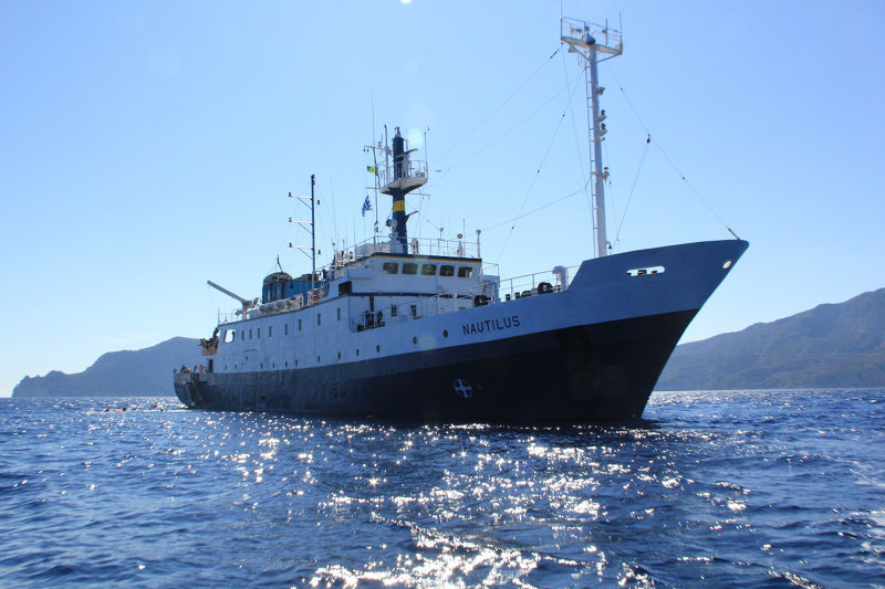
The E/V Nautilus. Image courtesy of the Ocean Exploration Trust. Download larger version (jpg, 2.7 MB).
During July and August of 2012, Exploration Vessel Nautilus explored the Black Sea, Aegean Sea, and Mediterranean Sea off the coasts of Turkey and Cyprus. The rotating Corps of Exploration aboard Nautilus herculesped the geological, biological, archaeological, and chemical aspects of these regions to depths of approximately 2,000 meters. During the expedition, we shared our discoveries live on the web via telepresence technology, putting the unexplored ocean directly in your hands.

The E/V Nautilus. Image courtesy of the Ocean Exploration Trust. Download image (jpg, 64 KB).
This project is a continuation of work conducted between 1999‐2007 focused on characterizing the oxic/anoxic (oxygen/no oxygen) boundary that exists at approximately 155 meters depth in the Black Sea near the shelf break, which has been hypothesized as a relict shoreline. The Institute for Exploration’s ROVs Hercules and Argus will be used to conduct visual surveys, to collect sediment samples, and to recover a set of redox (oxidation/reduction) experiments that were left at 325 meters depth in 2007. Side‐scan sonar surveys will be conducted in various areas to map the transition across the oxic/anoxic interface and to compare trawled versus untrawled zones.
This project is a continuation of work from 2010 in the Anaximander region off the coast of Turkey that has proven to be rich in methane fluid emissions and associated seep fauna. Objectives of this mission include returning to the area where acoustic and video imaging surveys were conducted in 2010 to collect biological and geological samples with the Institute for Exploration’s ROVs Hercules and Argus to help characterize the seamounts.
The current tectonic setting of the Eratosthenes Seamount is unusual in that it represents a continental fragment undergoing active subduction as the African plate descends beneath the Eurasian plate at the Cyprus trench, speculated to be causing both uplifting of the Eratosthenes Seamount and faulting at the trench. The objectives of this project are to return to several regions explored in 2010 and also to expand investigations to new locations. The Institute for Exploration’s ROVs Hercules and Argus will be employed to conduct visual surveys. Side‐scan sonar may be used to map specific regions.
This project is a continuation of work conducted between 2008 – 2011 focused on documentation of trawl damage to the seabed off the Bodrum and Datca peninsulas through video surveys and sonar mapping between 50 and 600 meters depth. Subsequent identification of targets included carbonate crusts from methane seeps, rock ridges, and outcrops; slope failures; and numerous shipwrecks. Objectives for 2012 include continuation of this work to move toward a comprehensive survey of the landscape between 100 and 600 meters depths in order to determine the full scope and impact of bottom trawling on the seabed. Side‐scan sonar surveys will be conducted to fill in gaps and the Institute for Exploration’s ROVs Hercules and Argus will be employed to conduct video surveys of the seabed. Geological samples will also be collected if time permits.

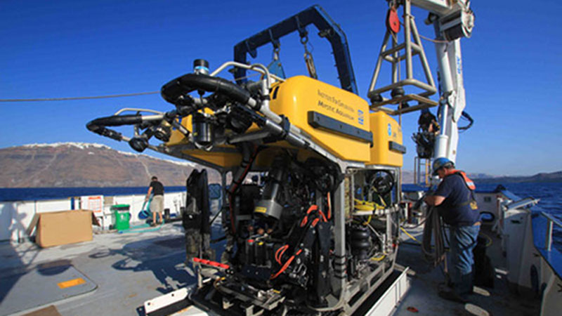
The Institute for Exploration's remotely operated vehicle, Hercules, is one of the tools being used during the E/V Nautilus 2012 field season. Image courtesy of the Institute for Exploration. Download image (jpg, 87 KB).
E/V Nautilus is a 211-foot research vessel equipped with state-of-the-art exploration and telepresence technology.
The primary remotely operated vehicles (ROVs) on board, named Hercules and Argus, will be used to view the seafloor with high-definition video, take environmental measurements, and collect geological and biological samples.
Two secondary exploration tools, the towfish named Diana and Echo, will use side-scan and sub-bottom sonar technology to explore the seafloor and seek out compelling targets for closer investigation and study.
Dr. Robert Ballard and Dr. Katherine Croff Bell of the Ocean Exploration Trust will lead the expedition, which includes a rotating team of more than 100 scientists, engineers, and educators as they explore these poorly understood regions of the world’s oceans.
Operations aboard Nautilus will be conducted by a team of engineers from the Institute for Exploration exit icon based at the Mystic Aquarium in Connecticut. All of the video and data collected will be transmitted via satellite to the Inner Space Center exit icon, located at the University of Rhode Island Graduate School of Oceanography, where Dr. Ballard is a professor of oceanography.