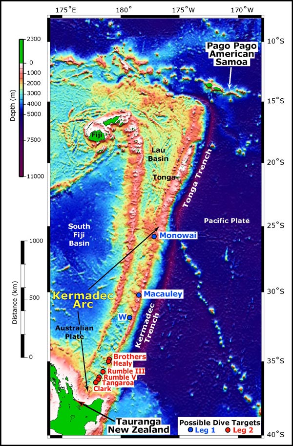
Southwest Pacific from Samoa (northeast) to New Zealand (southwest). Possible dive targets for Leg 1 and Leg 2 of the NZASRoF'05 expedition are indicated. Leg 1 sites are indicated by blue circles and blue text. Leg 2 sites are indicated by red circles and red text. Leg 1 starts in Pago Pago, ending in Tauranga. Leg 2 departs and returns from Tauranga. Bathymetry data are: satellite-derived (bottom, 3500 meter resolution); EM300 (top, along the arc, 25 meter resolution). Satellite-derived bathymetry from Sandwell and Smith. EM300 bathymetry data are courtesy of New Zealand National Institute of Water and Atmospheric Research.
Related Links
New Zealand American Submarine Ring of Fire 2005
New Zealand American Submarine Ring of Fire 2005: Mission Plan


