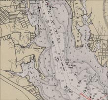
A historical U.S. Coast and Geodetic Survey chart of Rhode Island depicting Gaspee Point, named for the infamous ship. Image courtesy of the NOAA Library. Click image for larger view.
The Quest for the Gaspee 2003
August-October 2003
Dr. Rod Mather
University of Rhode Island
Dr. John Jensen
Mystic Seaport Musesum
Rhode Island waters host the largest collection of Revolutionary War shipwrecks in North America. These include the infamous HMS Gaspee and at least 12 other British warships, 16 British merchant ships, and an unknown number of late 18th-century American merchantmen, warships, and fishing vessels. This summer, Dr. Rod Mather of the University of Rhode Island Coastal Institute and Dr. John Odin Jensen of the Mystic Seaport Museum will explore the maritime archaeological landscape of Revolutionary War Rhode Island.
The Gaspee is one of the few British warships to appear in virtually every general American history textbook. The ship's burning by disgruntled colonists in 1773 ranks alongside the Boston Tea Party and the Stamp Act crisis as a galvanizing step on the road to the American Revolution. Few 18th-century shipwrecks have greater regional and national historical significance. Discovering the Gaspee would be a major archaeological find and would carry considerable iconic importance.
Researchers will conduct an intensive Quest for the Gaspee followed by searches for, and surveys of ,other significant Revolutionary War shipwrecks in Rhode Island. At least three dozen Revolutionary War vessels met their ends in Rhode Island, but only five have been positively located. Although all five require further documentation, preliminary assessments show them to be well preserved and archaeologically fertile. Documentary and cartographic evidence has enabled Drs. Mather and Jensen to identify discrete survey areas for the Gaspee and for several other important vessels.
Side-scan sonar and magnetic remote sensing tools will be used to explore, discover, and assess the Revolutionary War cultural heritage in Narragansett Bay. New sites will be documented and recorded using underwater photographic and video systems, and site information will be stored, analyzed and displayed using a GIS (geographic information system). Researchers hope to bring the exploration and resulting discoveries to the public through pages on the University of Rhode Island ![]() , Mystic Seaport
, Mystic Seaport ![]() , and NOAA Web sites, and through a museum exhibit that will open at Mystic Seaport and then travel to other regional venues. It will form a chapter in Mystic Seaport's upcoming special exhibition, "Shipwrecks!" scheduled to open in May 2004.
, and NOAA Web sites, and through a museum exhibit that will open at Mystic Seaport and then travel to other regional venues. It will form a chapter in Mystic Seaport's upcoming special exhibition, "Shipwrecks!" scheduled to open in May 2004.

