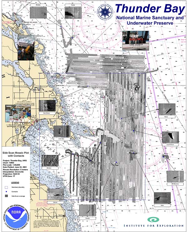
Map depicting the side scan sonar tracklines and shipwrecks found in the vicinity of the Thunder Bay National Marine Sanctuary and Underwater Preserve. Image courtesy of Thunder Bay 2001, Robert McGreevy, NOAA-OER.
NOTICE: This page is being retained for reference purposes only and is no longer being updated or maintained.


