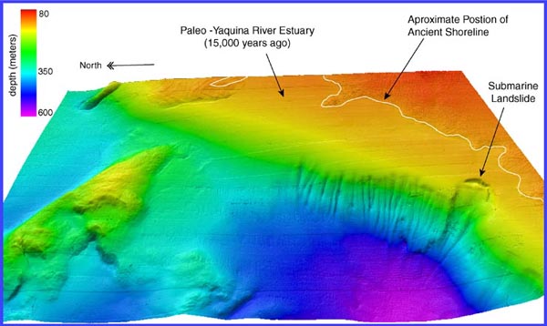
View of northeast Heceta Bank and the continental shelf break. Ancient shoreline and the Paleo Yaquina River estuary are noted, as well as a large landslide scarp. The landslide scarp extends 5000 meters downslope through depths ranging from 200 to 500 meters. The EM300 multibeam data are gridded at 20 meter grid-cell size. Image courtesy of Lewis And Clark Legacy Expedition, NOAA-OER.
NOTICE: This page is being retained for reference purposes only and is no longer being updated or maintained.


