
Date: August 30, 2019
Location: Lat: 42.86808°, Lon: -61.20375°
Dive Depth Range: 2,459 - 2,505 meters (8,073 - 8,224 feet)
Access Dive Summary and ROV Data
This anglerfish, in the genus Chaunacops, was seen during Dive 2 of the expedition. These fish have a small lure on a short stalk between their eyes that they wiggle in order to attract prey. While we often see these fish on the seafloor resting or "walking" on modified fins, as shown in this video, sometimes they also swim (albeit not that gracefully). Video courtesy of the NOAA Office of Ocean Exploration and Research, Deep Connections 2019. Download larger version (mp4, 70.7 MB).
Today’s dive took us to an intriguing step-like feature within Verrill Canyon. Surveys have previously taken place at shallower depths within the canyon, revealing soft sediment communities of cup corals, soft corals, sea pens, and anemones. However, the deeper portions of the canyon had not previously been explored. Mapping data within these deeper portions show step-like features, which are thought to have been formed by historic turbidity currents or slope failure. The steep portions of these steps were anticipated to have hard bottom that could provide suitable habitat for deep-sea corals and sponges.
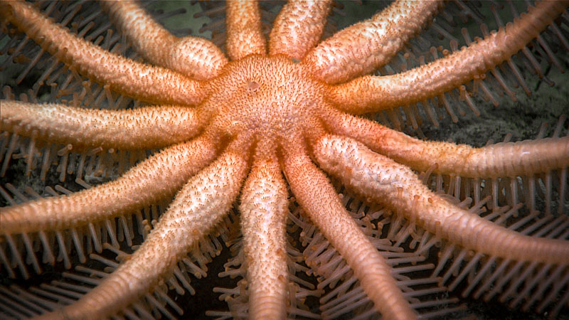
A Freyella elegans seastar imaged during the second dive of Deep Connections 2019. Image courtesy of the NOAA Office of Ocean Exploration and Research, Deep Connections 2019. Download larger version (jpg, 1.4 MB).
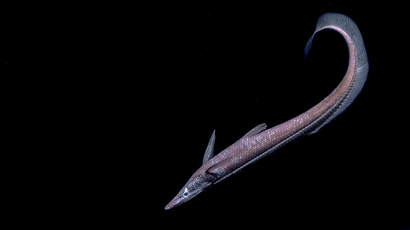
A halosaur fish swims along during the second dive of Deep Connections 2019. Image courtesy of the NOAA Office of Ocean Exploration and Research, Deep Connections 2019. Download larger version (jpg, 361 KB).
The remotely operated vehicle (ROV) survey began on a flat area of one step at around 2,505 meters (8,224 feet) and traversed up a steep slope to the next step flat at about 2,459 meters (8,073 feet) depth. Upon reaching the seafloor, we observed a soft sediment community. As we made our way up the slope, two glass sponges, which were later revealed to hold a pair of mate shrimps, were collected from a sheer wall. As the dive progressed, increasing evidence of a dynamic geological past was observed. We saw abundant evidence of past subsurface fluid flow, including “pipes” of precipitated iron-heavy sediment exiting the steep step face. Samples were collected of both consolidated clasts of clay and of one of these pipes.
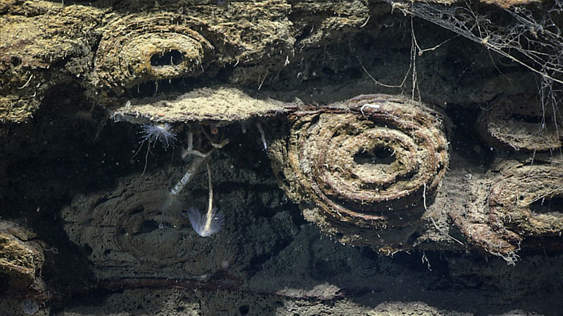
Pipe-like fluid channels on step face found during the second dive of Deep Connections 2019. One of these was sampled. Image courtesy of the NOAA Office of Ocean Exploration and Research, Deep Connections 2019. Download larger version (jpg, 1.3 MB).
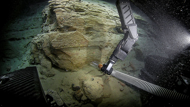
Sampling of one of the pipe-like fluid channels on a step face, found during the second dive of Deep Connections 2019. Image courtesy of the NOAA Office of Ocean Exploration and Research, Deep Connections 2019. Download larger version (jpg, 1.2 MB).
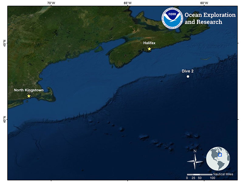
Location of Dive 2 of the Deep Connections 2019 expedition on August 30, 2019. Download larger version (jpg, 1.3 MB).
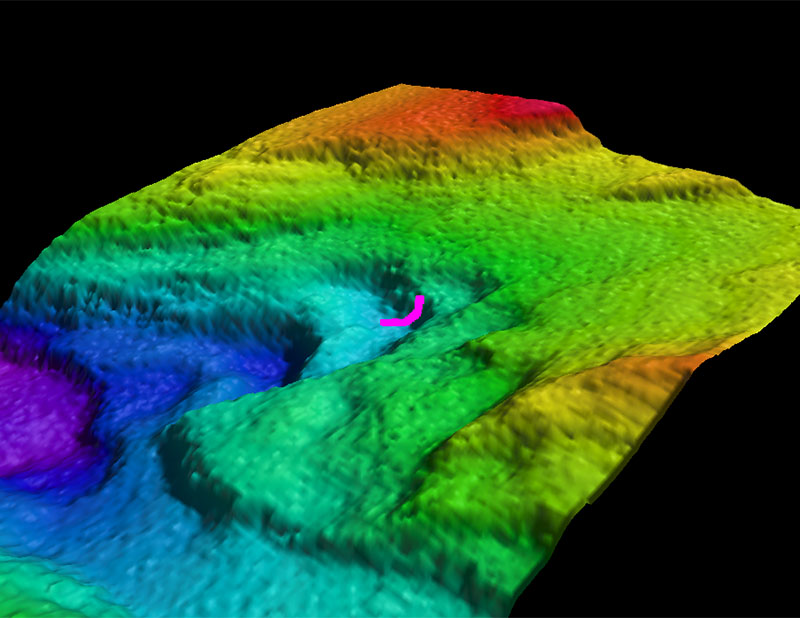
Map showing the dive track of dive 2 of the Deep Connections 2019 expedition, which explored an intriguing step-like feature inside Verrill Canyon. Download larger version (jpg, 789 KB).