by Jack Irion and Scott Sorset, Bureau of Ocean Energy Management
Amy Bowman, NOAA Office of Ocean Exploration and Research
April 21, 2018
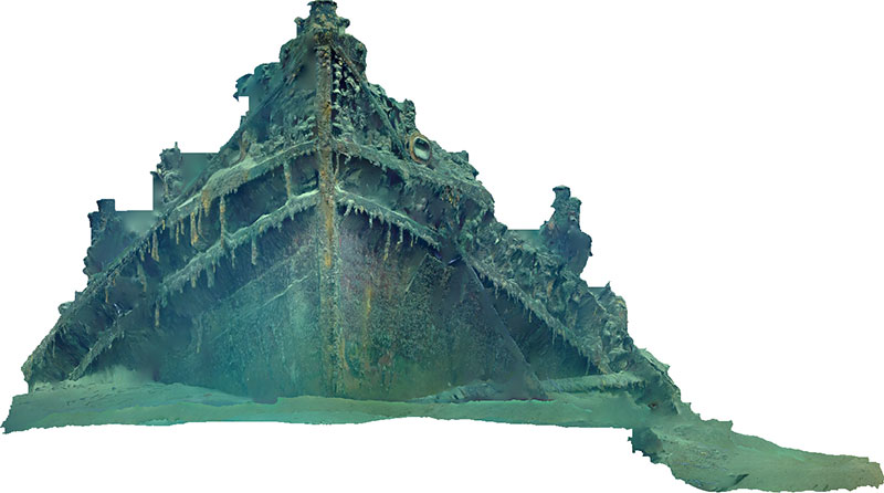
Second draft model of the low-resolution photogrammetry passes made by Deep Discoverer during Dive 01 of the Gulf of Mexico 2018 expedition. The shipwreck is tugboat New Hope, which sank in 1965 during Tropical Storm Debbie. The wreck is in ~800 meters (2,625 feet) of water. The model was developed by Bureau of Ocean Energy Management (BOEM) Marine Archaeologist Scott Sorset and features the bow section of the shipwreck.
To explore the shipwreck, click on the image to load the 3D model and use your mouse to turn the model and zoom in and out.
Model courtesy of BOEM.
Photogrammetry has become an empowering technique for documenting underwater features or sites in 3D. The combination of relatively straightforward image acquisition protocols and the ability to render both geometrically accurate and photorealistic models using readily available software has made the technique popular.
The models can be crafted from either photos or video. On NOAA Ship Okeanos Explorer, video is shot by the remotely operated vehicle (ROV), which flies over the target area in a gridded pattern. The pattern the ROV pilots use while taking video images ensures 80 percent overlap from four directions. Having this much redundancy helps to build trust in the data. The ROV pilots also get angles so that the sides of the wreck can be included in the 3D model, which is a digital surrogate, or cyber twin, of the site.

Orthophoto showing the bow of the tugboat New Hope, generated using imagery collected during Dive 01 of the expedition. This kind of orthomosaic is a series of individual photos which are matched using thousands of points to form a new 2D composite image consisting of all the smaller images, but with any distortion from perspective shift removed. Image courtesy of the Bureau of Ocean Energy Management, Gulf of Mexico 2018. Download larger version (jpg, 575 KB).
Once these video data are collected, researchers can reverse engineer it into a 3D model by running the video through photogrammetry software. In the post-processing step, it is determined how the images relate to each other. After the images have been stitched together into a point cloud using photogrammetry software, the entire landscape can be digitized and annotated so scientists can zoom in and see texture and detail – sometimes to within one centimeter.
The 3D models are used as digital surrogates in many disciplines, including for the study of shipwrecks by marine archaeologists. This tool allows them to extract enormous amounts of data from relatively short field surveys. They can then use this information to run in-depth analysis on the survey area, and learn from them in an entirely new way.

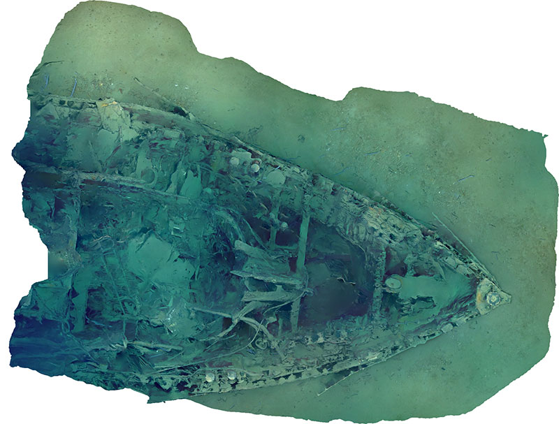
Orthophoto looking down (plan view) on the wreck of the New Hope tugboat. Image courtesy of the Bureau of Ocean Energy Management, Gulf of Mexico 2018. Download larger version (jpg, 1.7 MB).
This visualization technique has helped in terms of data acquisition, data archiving, and allowing scientists to have immersive experiences in environments like submerged archaeological sites. These models can become a baseline for understanding features like wrecks. A 3D model created with this process is a virtual wreck that scientists can take back into the lab and archive for later study, which can help answer questions they have not even thought of yet. These models can also make remote historical sites, located hundreds of meters below the surface, accessible to the general public in a way they have never been before.
Researchers can also revisit a site at a later date and repeat the process. This can be incredibly valuable for understanding change over time. They also increase the reach of these data, giving a broader audience exposure to ocean exploration.
Models generated using imagery collected during the first two dives of the Gulf of Mexico 2018 expedition are featured in this log. To view additional models generated by the Bureau of Ocean Energy Management, visit the BOEM Archaeology Sketchfab page .
First draft model of the low-resolution photogrammetry passes from Deep Discoverer of the "Thunderhawk" shipwreck explored during Dive 02 of the Gulf of Mexico 2018 expedition. The model was developed by BOEM Marine Archaeologist Scott Sorset.
To explore the shipwreck, click on the image to load the 3D model and use your mouse to turn the model and zoom in and out.
Model courtesy of BOEM.