By Meagan Putts - University of Hawaii
September 21, 2017

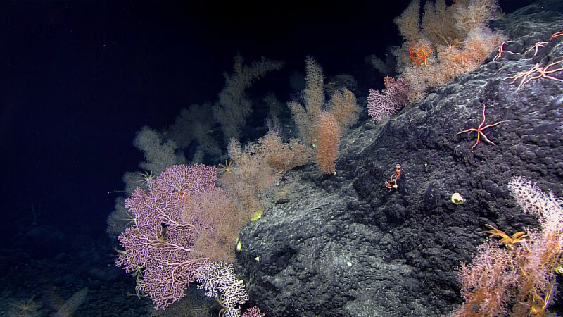
High-density coral community at Sibelius Seamount in the Musicians Seamounts. Areas like this with a large number of organisms will take a while to annotate, as every organism needs to be documented separately, and we saw hundreds, if not thousands! Image courtesy of the NOAA Office of Ocean Exploration and Research, Deep-Sea Symphony: Exploring the Musicians Seamounts. Download larger version (jpg, 2.0 MB).
With this final expedition of the Campaign to Address Pacific monument Science, Technology, and Ocean NEeds (CAPSTONE) nearly complete, you may be thinking this is the end for the science team’s participation, but it is merely the beginning. Our mission to support science and management needs in and around Pacific monuments includes quantifiably characterizing the communities we have observed. In order to do this, we need to count and identify everything that we observed on every dive and integrate these observations with the geographic and environmental data at each dive site. This is a daunting task, but with specialized video annotation software and an experienced team of annotators, the CAPSTONE data will be soon be integrated into large data set to support the mission.
The research team at the University of Hawaii, which includes me, Sarah Bingo, Virginia Moriwake, and Christopher Kelley, uses the video annotation software, the Video Annotation and Reference System (VARS), to quantify biological and habitat observations. The VARS system was developed by the Monterey Bay Aquarium and Research Institute (MBARI) for quantifying and integrating visual data sets, specifically deep-sea biological data sets.

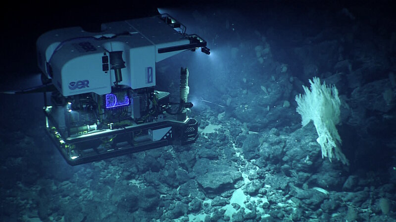
View of remotely operated vehicle Deep Discoverer investigating a large primnoid coral colony. Image courtesy of the NOAA Office of Ocean Exploration and Research, Deep-Sea Symphony: Exploring the Musicians Seamounts. Download larger version (jpg, 1.1 MB).
This system allows researchers to capture screen grab images and enter observations of any organism or sample and in its in situ habitat during the dive. Annotations are created and constrained using concepts for organism identification, like species names such as “Iridogorgia magispiralis,” or higher taxonomic classifications such as “Octocorallia.” These concepts and their taxonomic hierarchy have been entered into the VARS Knowledge Base. The knowledge database allows us to standardize our method of data collection and helps to reduce errors.

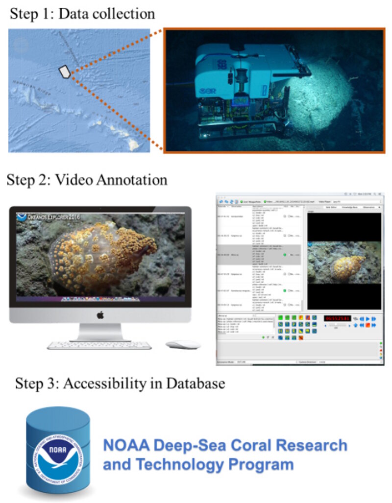
After NOAA Ship Okeanos Explorer and the remotely operated vehicles Seirios and Deep Discoverer collect video data from across the Pacific, video annotators at the University of Hawaii combine animal identifications and habitat observations using the Video Annotation and Reference System (VARS) software developed by Monterey Bay Aquarium and Research Institute (MBARI). These data will then be available in the NOAA Deep-Sea Coral Research and Technology Database. Image courtesy of the NOAA Office of Ocean Exploration and Research, Deep-Sea Symphony: Exploring the Musicians Seamounts. Download larger version (jpg, 250 KB).
To give you a sense of what goes on in a day in the life of a video annotator, it starts with opening the video file to be annotated in the VARS program. The annotator watches the video and makes a habitat observation once the bottom is in sight. Habitat observations include where the dive is taking place (i.e., a seamount slope) and the substrate or geologic composition of the bottom (i.e., basalt bedrock, boulders and sediment).
After this point, the annotator pauses the video every time an organism is observed. They will identify the organism using a concept listed in the VARS Knowledge Base, note the bottom substrate, and record where the organism was observed, such as in the water column, upon a substrate, or upon another organism. Indicating where an organism is when it is observed is important to researchers who are interested in animal behavior and their associations with other organisms.
Along a dive transect, the annotator will also take screen grabs of unique or particularly interesting organisms that can be associated with an annotation and mark all collected specimens. Once a dive has been completely annotated, the data is then extracted using the VARS Query and compiled into the NOAA Deep-Sea Coral Research and Technology database of annotations from around the world!