
This page contains photos and videos associated with the Mountains in the Deep: Exploring the Central Pacific Basin.
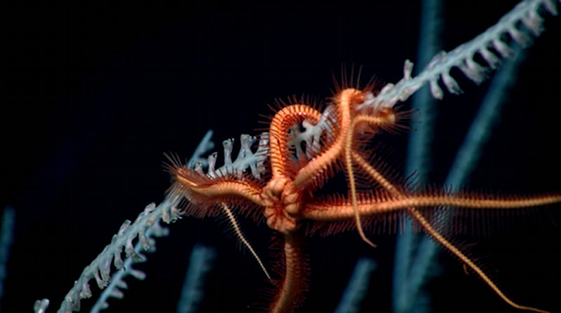
The Deep Forest Image courtesy of the NOAA Office of Ocean Exploration and Research, Mountains in the Deep: Exploring the Central Pacific Basin. Download image (jpg, 53 KB).
While exploring at a site informally called 'Te Kawhiti' on the northern edge of the Manihiki Plateau, scientists encountered a deep-sea coral forest. The hard seafloor at the site provided an ideal surface on which corals can grow and provide habitat for a range of animals, much like trees do in a forest on land.
Download video (mp4, 2.5 MB). Video courtesy of the NOAA Office of Ocean Exploration and Research, Discovering the Deep: Exploring Remote Pacific MPAs.
Date: May 2, 2017
Approximate Depth: 2,240 meters
Location: Ridge north of the Manihiki Plateau
Dive Summary
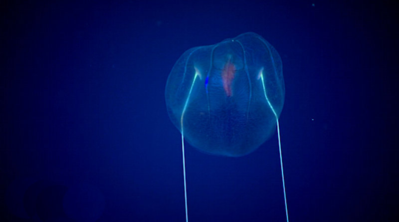
Midwater Journey Image courtesy of the NOAA Office of Ocean Exploration and Research, Mountains in the Deep: Exploring the Central Pacific Basin. Download image (jpg, 27 KB).
On May 6, we conducted a series of midwater transects from 1,400 to 300 meters. The dive took place in the Jarvis Unit of the Pacific Remote Islands Marine National Monument, now known as Pacific Islands Heritage Marine National Monument, which is one of the few units of the monument where the water column is protected in addition to the seafloor.
Download video (mp4, 2.4 MB). Video courtesy of the NOAA Office of Ocean Exploration and Research, Discovering the Deep: Exploring Remote Pacific MPAs.
Date: May 6, 2017
Approximate Depth: 1,400 - 300 meters
Location: "Keli'ihananui" Seamount
Dive Summary
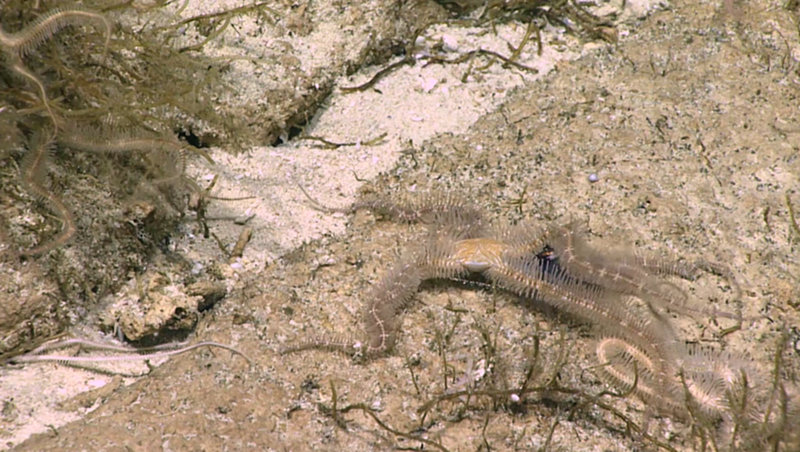
Brutal Brittlestars Image courtesy of the NOAA Office of Ocean Exploration and Research, Mountains in the Deep: Exploring the Central Pacific Basin. Download larger version (jpg, 413 KB).
A highlight of the dive at Jarvis Island was observing a group of brittlestars (ophiuroids) capture and eat a squid (Abralia sp.) that was swimming by. Our science team was shocked to see this behavior from a brittlestar.
Download video (mp4, 2.4 MB). Video courtesy of the NOAA Office of Ocean Exploration and Research, Discovering the Deep: Exploring Remote Pacific MPAs.
Date: May 5, 2017
Approximate Depth: 500 meters
Location: Jarvis Island
Dive Summary
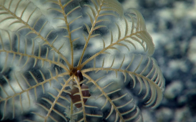
Snail-Crinoid Interaction Image courtesy of the NOAA Office of Ocean Exploration and Research, Mountains in the Deep: Exploring the Central Pacific Basin. Download larger version (jpg, 261 KB).
Scientists observed several snails on crinoids. As this behavior had not been previously seen, it was unclear as to whether the snails were eating on waste from the crinoids, eating the crinoids themselves, or engaged in mating behavior.
Download video (mp4, 2.3 MB). Video courtesy of the NOAA Office of Ocean Exploration and Research, Discovering the Deep: Exploring Remote Pacific MPAs.
Date: May 13, 2017
Approximate Depth: 2,240 meters
Location: Ridge north of the Manihiki Plateau
Dive Summary
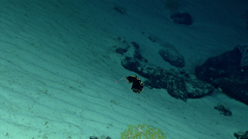
Hatchetfish Image courtesy of the NOAA Office of Ocean Exploration and Research, Mountains in the Deep: Exploring the Central Pacific Basin. Download larger version (jpg, 769 KB).
This hatchetfish was imaged within Pacific Remote Islands Marine National Monument, now known as Pacific Islands Heritage Marine National Monument. In order to be nearly invisible in the water column, hatchetfish are highly reflective, have slim profile to limit their shadows, and have photophores on their bellies to mimic downwelling light.
Download video (mp4, 1.9 MB). Video courtesy of the NOAA Office of Ocean Exploration and Research, Discovering the Deep: Exploring Remote Pacific MPAs.
Date: May 7, 2017
Approximate Depth: 3,700 meters
Location: "Whaley" Seamount
Dive Summary
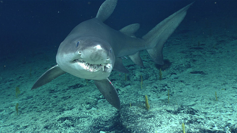
Smalltooth Sand Tiger Shark Image courtesy of the NOAA Office of Ocean Exploration and Research, Mountains in the Deep: Exploring the Central Pacific Basin. Download larger version (jpg, 1.1 MB).
The team got up close (via remotely operated vehicle, thankfully!) with this smalltooth sand tiger shark while exploring Kingman Cone at a depth of ~1,025 meters.
Download video (mp4, 2.9 MB). Video courtesy of the NOAA Office of Ocean Exploration and Research, Discovering the Deep: Exploring Remote Pacific MPAs.
Date: May 12, 2017
Approximate Depth: 1,025 meters
Location: Kingman Cone
Dive Summary
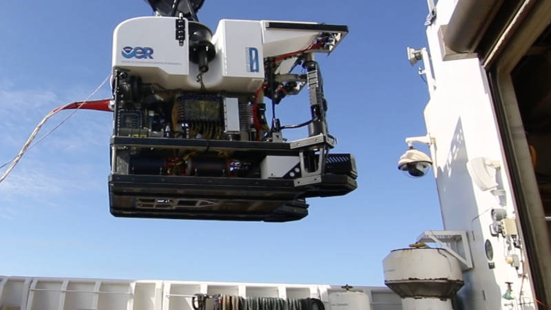
Remotely Operated Vehicle Launch Image courtesy of the NOAA Office of Ocean Exploration and Research, Mountains in the Deep: Exploring the Central Pacific Basin. Download image (jpg, 44 KB).
Video footage of remotely operated vehicles Deep Discoverer and Seirios being launched over the side of NOAA Ship Okeanos Explorer.
Download video (mp4, 122 MB). Video courtesy of the NOAA Office of Ocean Exploration and Research, Discovering the Deep: Exploring Remote Pacific MPAs.