By Amy Bowman and Adrienne Copeland
NOAA Office of Ocean Exploration and Research
March 1, 2017

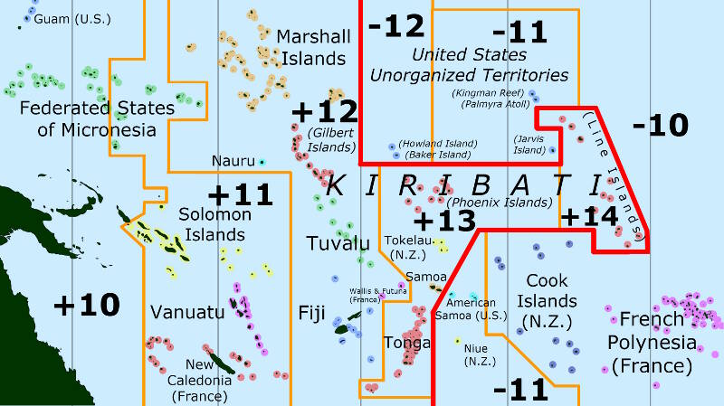
The red line on the map represents the International Date Line, an imaginary line of longitude on the Earth's surface located at about 180 degrees east (or west) of the Greenwich Meridian. Image courtesy of the NOAA Office of Ocean Exploration and Research. Download larger version (jpg, 1.4 MB).
Have you ever been on the U.S. East Coast and tried calling the U.S. West Coast, or vice versa? If so, do you remember trying to figure out what time it was – did you ever make a mistake and call too early or too late? Time and time zones on our planet can be confusing this way. Remembering the sun rises in the east and sets in the west, you can logically conclude that morning will arrive in the East Coast while it is still night on the West Coast. Once the planet has completed a single rotation, which takes 24 hours, we start a new day.

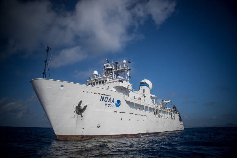
In 2017, NOAA Ship Okeanos Explorer is operating in waters around both Samoa and American Samoa. Image courtesy of the NOAA Office of Ocean Exploration and Research. Download larger version (jpg, 11.2 MB).
We set our clocks by our location relative to the Prime Meridian, based at the Royal Observatory in Greenwich, London. When it is noon in London, it is 7 am in New York and 4 am in Los Angeles. Knowing this, what happens when you get to the furthest spot away from the Prime Meridian?
Our planet is 360° around; meaning the furthest spot from London on our planet is about 180° away to the east or west, depending on the direction of travel. When you get there, you have arrived at the International Date Line – an imaginary line that creates a divide where the date changes by one day. If you cross the line moving west, you add a day, if you’re moving east, you subtract a day.
Even though the International Date Line is imaginary, it has implications that can cause interesting dilemmas when planning a cruise that will sail across it. NOAA Ship Okeanos Explorer is operating in waters around both Samoa and American Samoa this year. American Samoa is six hours behind the U.S. East Coast. However, Samoa, while on the same submerged landmass as American Samoa, is on the other side of the International Date Line, which means it is 19 hours ahead of the East Coast!
The current expedition, 2017 American Samoa Expedition: Suesuega o le Moana o Amerika Samoa, started in Pago Pago, American Samoa, and will end in Apia, Samoa. During initial planning, the team had to take this imaginary line into consideration when scheduling the expedition. To meet mission priorities and complete all the desired work, we planned to pull into port the day after our last dive, scheduled for February 28. However, because the ship crosses the International Date Line en route to Apia, we will arrive on March 2 instead of March 1. We lose an entire day when we cross the line!
Time zone differences and crossing the International Date Line can also make scheduling phone calls and interacting with shore-based participants in multiple time zones more challenging. When NOAA headquarters in Washington, DC, schedules meetings with partners from around the world as well as with the ship, not only do we need to remember the time change, we also need to remember that the day may change as well – because Friday on the East Coast is Saturday in Samoa.
Scientists are participating on different sides of the Date Line, allowing them not only to see into the past, but also to glimpse the future. You can see how that becomes very confusing indeed!