
By Brian Kennedy, Expedition Coordinator, NOAA Office of Ocean Exploration and Research
September 19, 2016

Infographic summarizing accomplishments from the 2016 Deepwater Wonders of Wake expedition. Image courtesy of the NOAA Office of Ocean Exploration and Research, Deepwater Wonders of Wake. Download larger version (pdf, 1 MB).
This expedition is part of the three-year Campaign to Address Pacific monument Science, Technology, and Ocean NEeds (CAPSTONE), an initiative to collect deepwater baseline information to support science and management decisions in and around U.S. marine protected areas in the central and western Pacific.

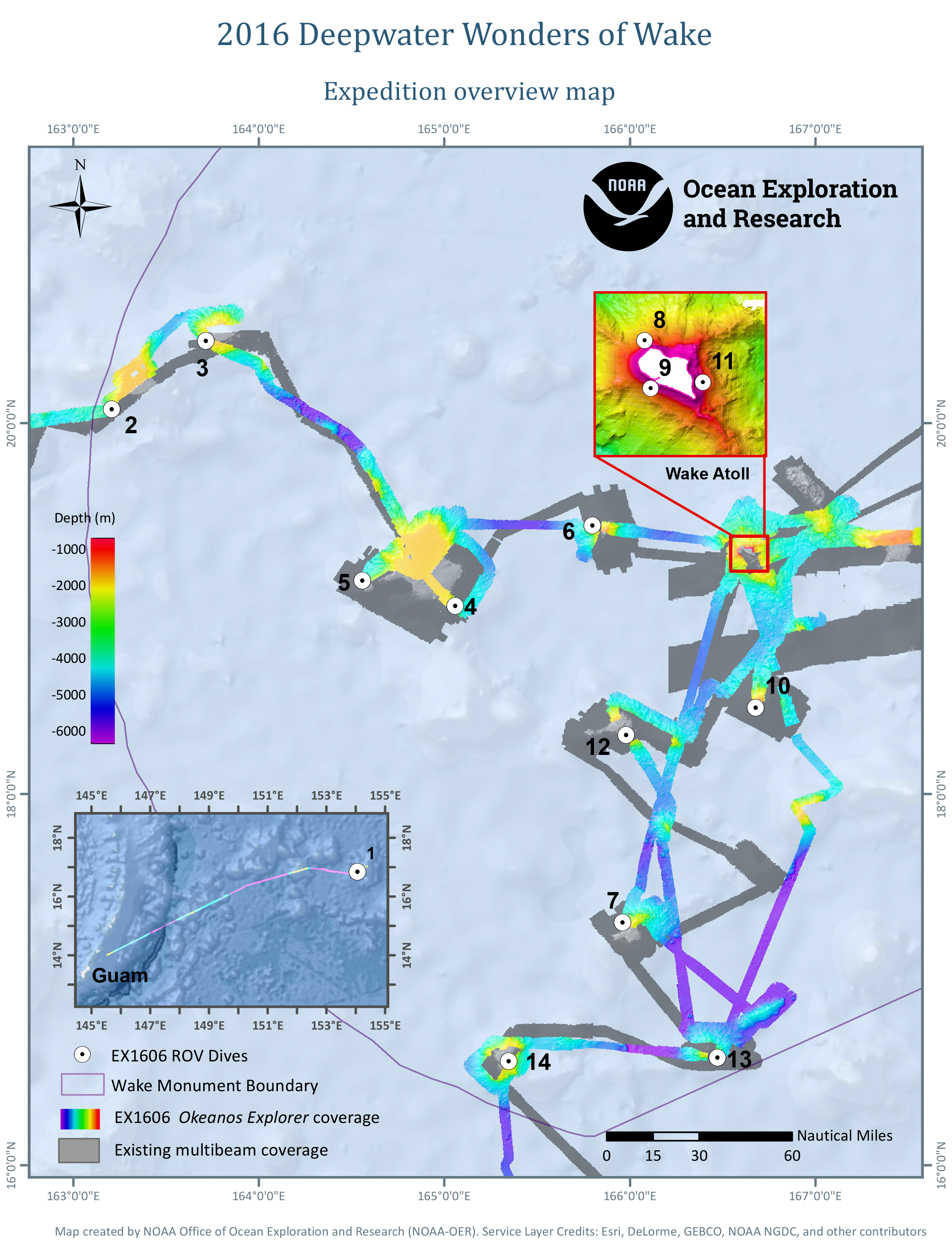
Overview map showing seafloor bathymetry collected and ROV dives conducted during the Deepwater Wonders of Wake expedition. Image courtesy of the NOAA Office of Ocean Exploration and Research, Deepwater Wonders of Wake. Download larger version (jpg, 2.3 MB).
The 24-day Deepwater Wonders of Wake: Exploring the Pacific Remote Islands Marine National Monument, now known as Pacific Islands Heritage Marine National Monument expedition addressed science themes, priority areas, and exploration targets put forward by scientists and managers across the broad ocean science community. Throughout the expedition, scientists conducted 24-hour operations consisting of remotely operated vehicle (ROV) dives and mapping. Expedition priorities included a combination of science, education, outreach, and open data objectives that will support management decisions at multiple levels. Major accomplishments from the expedition are summarized below. Download a PDF version of this summary (pdf, 4 MB).
Deep Discoverer explores a high-density coral community in the Pacific Remote Islands Marine National Monument, now known as Pacific Islands Heritage Marine National Monument. Video courtesy of the NOAA Office of Ocean Exploration and Research, Deepwater Wonders of Wake. Download larger version (mp4, 133.4 MB).
Conducted 14 ROV dives, ranging from 350 to 3,140 meters depth, to survey the diversity and distribution of bottom fish habitats and deep-sea and precious coral communities; characterize manganese-encrusted habitats on seamounts; and collect rock samples that could potentially change our understanding of the geologic history of the region as well as the tectonics of the Pacific Plate around 100 million years ago.
Dive 11 was the second of two shallower dives during the expedition that targeted the precious coral resources around Wake Island. Scientists did find the commercially valuable gold coral, Kulamanamana sp., as well as thousands of rock pens and numerous species of fish, including a large sixgill shark. Video courtesy of the NOAA Office of Ocean Exploration and Research, Deepwater Wonders of Wake. Download larger version (mp4, 133.4 MB).
Expanded mapping coverage by more than 36,000 square kilometers along the ship’s transit line and within the Pacific Remote Islands Marine National Monument.
On August 11, we set out to explore a potential shipwreck target that had been mapped during a previous Okeanos Explorer cruise. Scientists believed that the wreck might be the Japanese Imperial Naval Destroyer, Hayate, which was sunk during the Battle of Wake.HayateVideo courtesy of the NOAA Office of Ocean Exploration and Research, Deepwater Wonders of Wake. Download larger version (mp4, 246.3 MB).
Engaged a broad spectrum of the scientific community and public in telepresence-based exploration.
There was something fishy about Dive 8—it was indeed the fishiest dive of the expedition, with a variety of eels, swimmers, squatters, a big ray, and even a large shark. The dive took place north of Wake Island, on an unnamed seamount at a depth of ~1,025 meters. Video courtesy of the NOAA Office of Ocean Exploration and Research, Deepwater Wonders of Wake. Download larger version (mp4, 108.1 MB).


