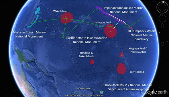

Map showing the completed 2015 operating areas (white lines), and planned operating areas (green lines) for the 2016 Campaign to Address Pacific monument Science, Technology and Ocean NEeds (CAPSTONE). Image courtesy of NOAA Office of Ocean Exploration and Research. Download (jpg, 87 KB).
NOAA Ship Okeanos Explorer explorations for 2016 began on February 18 and have thus far included work in the marine environments in and around the Papahānaumokuākea Marine National Monument (PMNM); Oahu; the big island of Hawai’i and the area south and west of Molokai, Lana’i, and Kaho’olawe; the Commonwealth of the Northern Mariana Islands (CNMI); and the Marianas Trench Marine National Monument (MTMNM).
This expedition will begin in Santa Rita, Guam, travel to the Wake Island Unit of the Pacific Remote Islands Marine National Monument, now known as Pacific Islands Heritage Marine National Monument, and conclude in Kwajalein Atoll, Marshall Islands. It is part of a three-year campaign focused on systematically collecting baseline information to support science and management needs within and around marine monuments and other protected places in the Pacific and serves as an opportunity for NOAA and the nation to highlight the uniqueness and importance of these national symbols of ocean conservation.
Wake Island is a coral atoll located in the western Pacific Ocean, 2,416 kilometers east of Guam and is one of the most isolated islands in the world. The region around the island is essentially completely unexplored, with no data yet collected below 200 meters, and our mission will reveal new information about the geology and biology in this virtually unknown region of our ocean planet.

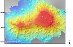
Bathymetry of a guyot within the Wake Atoll Unit of the Pacific Remote Islands Marine National Monument, now known as Pacific Islands Heritage Marine National Monument. Image courtesy of NOAA Office of Ocean Exploration and Research. Download (jpg, 18 KB).
From July 27 - August 19, 2016, expedition objectives will include exploring regions mapped as the NOAA Ship Okeanos Explorer previously traveled over the area mapping the seafloor on its way to the Mariana Islands. An interdisciplinary team of scientists will be participating in the expedition both from the ship and from shore, observing the geology of the seafloor, ocean chemistry, and organisms found in the region and collecting baseline data critical to managing and protecting vulnerable deep-sea habitats.
Additionally, dives will be executed to search for the wreck of the World War II Japanese destroyer Hayate, one of nine Kamikaze-class destroyers. Sunk during the Battle of Wake Island in December 1941, it was the first Japanese warship to be lost during the war.
During this expedition, the exploration strategy of the Okeanos Explorer will be employed: bathymetric mapping using multibeam sonar; water column exploration using a Conductivity, Temperature and Depth Profiler (CTD); and remotely operated vehicle (ROV) imaging and video. Scientists from around the world will be participating in the explorations in real time through telepresence technology and students and the general public can watch and listen to ROV dives in real time on the NOAA Ocean Explorer website.
Even as the importance of deep areas of the ocean in our everyday lives continues to increase, our knowledge of these areas remains limited. NOAA's Office of Ocean Exploration and Research is providing scientists and resource managers with access to basic information about deep-sea habitats and life forms so that they can prioritize future management and research efforts. This multi-year project will highlight the uniqueness and importance of these marine protected areas, both locally and to the world.