By Pelle Robbins - Woods Hole Oceanographic Institution
April 25, 2014

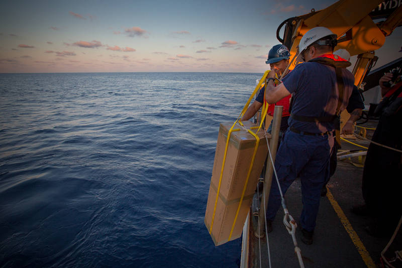
Okeanos Explorer crew members prepare to deploy the Argo float in the Gulf of Mexico. Image courtesy of the NOAA Office of Ocean Exploration and Research, Exploration of the Gulf of Mexico 2014. Download larger version (jpg, 540 KB).
During Leg 3 of the 2014 Gulf of Mexico Expedition, four Argo floats are being deployed in previously under-sampled areas of the Gulf of Mexico.

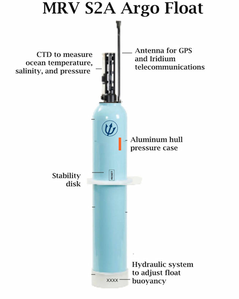
The sophisticated Argo float will collect data in the Gulf for years to come. Image courtesy of the NOAA Office of Ocean Exploration and Research, Exploration of the Gulf of Mexico 2014. Download image (jpg, 48 KB).
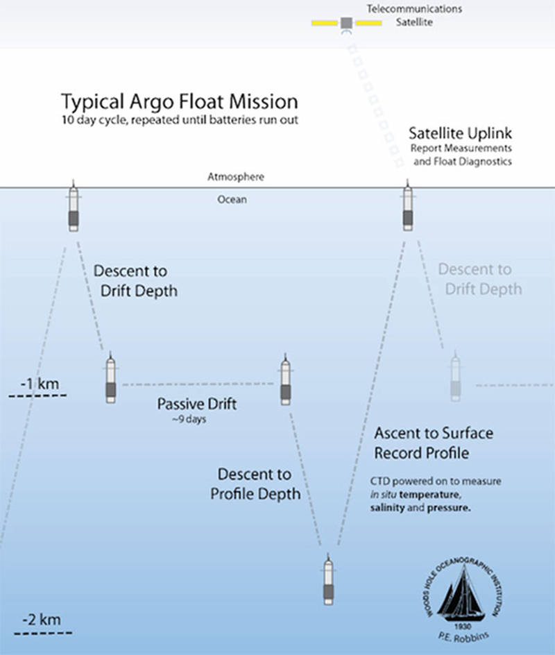
Argo floats are a type of subsurface profiling buoy designed to dive from the ocean surface to 2,000 meters depth while making measurements of ocean temperature and salinity.
The primary sensor on the Argo float is a CTD (Conductivity, Temperature, Depth) that, like the XBT, measures ocean temperature, but with the addition of the conductivity sensor that provides a measure of ocean salinity. The chief advantage of the Argo float, however, is that unlike ship-based instruments, the Argo float can repeatedly perform these measurements independently and do so for many years.
The collected data is returned to us through a satellite uplink every time the float comes to the surface. The instruments carry a lithium battery-pack with enough energy for the float to operate unaided for up to six years, providing the opportunity for making measurements in the ocean long after the ship has departed. Additionally, the floats sample through all the seasons and in all weather conditions, so we are able to get year-round data from the ocean in places and times which ships tend to avoid, such as underneath hurricanes or in the winter-time North Atlantic.
It is this year-round autonomous operation which allows the floats to measure and record ocean variability and phenomena that have never been explored from solely ship-based measurements. So while temperature and salinity might be considered routine ocean observations, the ability to collect this data from an autonomous platform is providing an unprecedented picture of the ocean.

This is a schematic figure of what the float actually does after it is deployed. Image courtesy of Pelle Robbins, Woods Hole Oceanographic Institution. Download image (jpg, 49 KB).
The International Argo Program deploys floats around the globe but until now, there have been relatively few deployed in the Gulf of Mexico or other marginal seas. The concern has been that in the smaller seas, the floats would have a greater tendency to wash up on the beach and thus not obtain the full potential lifetime provided by the lithium power pack. However, the latest generation of floats have technical advances which we hope will provide for longer lifetimes in regions like the Gulf of Mexico.
One new feature is the ability for two-way data communication with the float that enables us to reprogram the float's mission after it is has been deployed into the ocean. For example, if the float starts heading into shallower waters, we can alter the drift depth to ride in currents which could carry the float back to deeper waters.
Another recent advancement are changes in satellite communications systems that drastically shorten the amount of time the float must spend at the surface transmitting its data. Floating on the surface is the most hazardous portion of the float mission, so by shortening the communication time, we lessen the chance for things to go wrong, such as an accidental encounter with a boat.

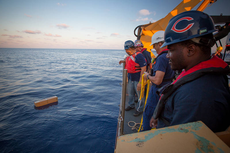
NOAA Ship Okeanos Explorer crew members watch as the Argo float drifts off into the Gulf of Mexico and begins its multi-year journey collecting valuable, constant oceanographic data. Image courtesy of the NOAA Office of Ocean Exploration and Research, Exploration of the Gulf of Mexico 2014. Download larger version (jpg, 560 KB).
In summary, our expectation is that the Argo floats deployed by NOAA Ship Okeanos Explorer will be performing autonomous measurements of ocean temperature and salinity for many years to come. These measurements offer the opportunity to explore variability of basic oceanic properties at scales never before obtained. In addition, there are practical benefits of the data, such as improved weather prediction and more accurate estimates of hurricane paths.