by Kelley Elliott, Expedition Manager, NOAA Office of Ocean Exploration and Research
Kasey Cantwell, Web Coordinator, NOAA Office of Ocean Exploration and Research
July 8, 2013

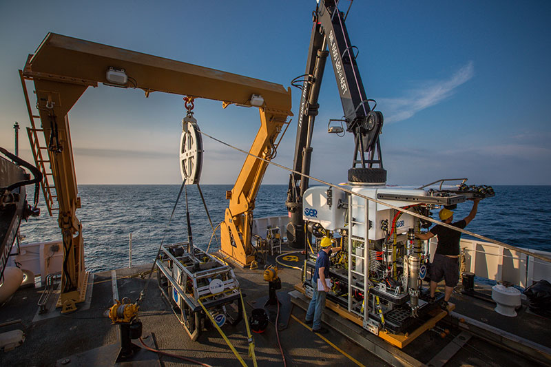
NOAA’s Office of Ocean Exploration and Research’s ROV team prepares the ROV Deep Discoverer for the first dive of the mission. Image courtesy of the NOAA Office of Ocean Exploration and Research. Download larger version (jpg, 1.6 MB).
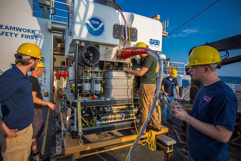
NOAA Ship Okeanos Explorer departed her homeport of North Kingstown, Rhode Island, today, kicking off the 2013 Northeast Canyons Expedition. Ship- and shore-based personnel spent the day preparing for the first dive and going over safety items and equipment checks. Science team members held dive-planning meetings and were trained on collaboration tools and remotely operated vehicle (ROV) control room protocols. The ROV team prepped ROV Deep Discoverer (D2) for its first non-shakedown dive, performed thorough pre-dive checks, daisy chained the recovery line, prepared the ROV CTDs, and made sure that vehicles were ready to go for the next morning’s dive. After getting underway, the mapping team onboard collected multibeam sonar data during transit to the first dive site of the 2013 Northeast U.S. Canyons Expedition.

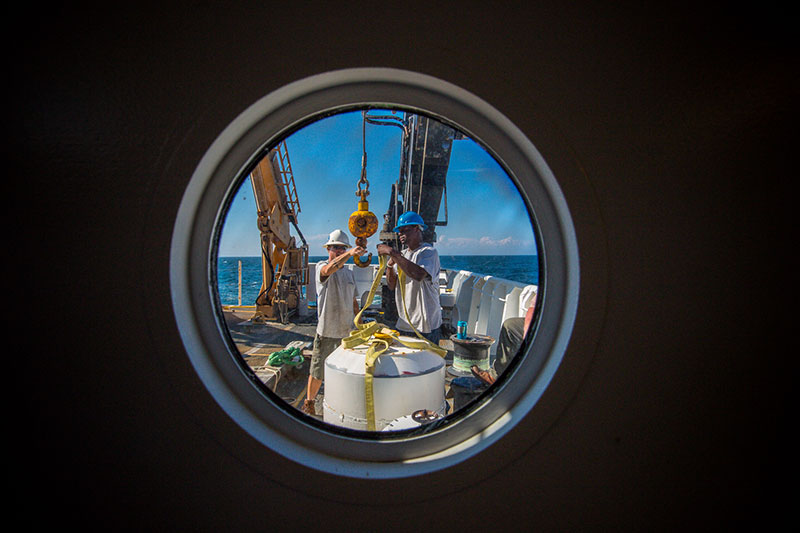
Crew aboard NOAA Ship Okeanos Explorer prepare for the 2013 Northeast U.S. Canyons Expedition. Image courtesy of the NOAA Office of Ocean Exploration and Research. Download larger version (jpg, 1.5 MB).
Commencement of this expedition represents the culmination of months of planning and preparation. Okeanos Explorer cruises take a unique, collaborative approach to cruise planning and execution – from identification of the general operating area for the expedition, to identifying specific targets for further investigation using the ships systems, and even input into the approach and measurements taken at these targets.
Efforts to identify these exploration priorities and glean community input for the Northeast U.S. Canyons Expedition began in 2011 when the NOAA Office of Ocean Exploration and Research (OER) and the Ocean Exploration Trust reached out to the ocean science community and requested white papers identifying priority areas for telepresence-enabled systematic ocean exploration. These submissions were discussed during the 2011 Atlantic Basin Planning Workshop and resulted in the identification of high-priority areas and themes for exploration in the region, including submarine canyons and seamounts.

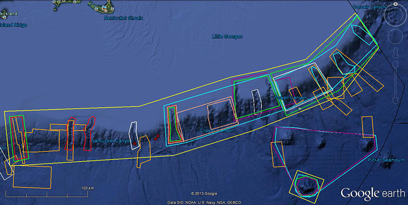
Google Earth map showing management interest in the expedition operating area. The yellow boxes represent the general expedition operating areas. Red boxes represent NOAA Deep Sea Coral Research and Technology Program priority areas. Purple boxes represent NOAA Office of National Marine Sanctuaries interests. The light blue boxes represent Northeast Fisheries Management Council interests. Green boxes represent Northeast Fisheries Science Center interests. Pink boxes represent Mid-Atlantic Regional Council on the Ocean state interests. Orange boxes represent U.S. Geological Survey areas of interest. The Northeast Regional Ocean Council also provided input. The red dots are the location of possible gas seeps detected by Okeanos Explorer’s EM302 multibeam sonar. White boxes represent recent work conducted by NOAA Ship Bigelow. The black line is the U.S. Exclusive Economic Zone. Image created in Google Earth. Image courtesy of the NOAA Office of Ocean Exploration and Research. Download larger version (jpg, 494 KB).
During the years since the Atlantic Basin Planning workshop, NOAA Ship Okeanos Explorer and partners have systematically mapped all of the continental shelf edge breaking canyons from Cape Hatteras to the U.S./Canada exclusive economic zone border, resulting in the first complete high-resolution multibeam dataset stretching across the long chain of these unique geologic features. Recently, Okeanos Explorer has begun mapping the New England Seamounts using multibeam sonar.
To refine the operating area for this expedition and commence the next steps in systematic ocean exploration, OER reached out to other NOAA programs and management groups in the region to identify priorities for exploration. OER looked at areas of overlapping input, considered recent and planned efforts to collect information, and selected the Northeast U.S. Canyons as an area of high interest to NOAA and the management community.

NOAA’s Office of Ocean Exploration and Research’s ROV team prepares the ROV Deep Discoverer for the first dive of the mission. Image courtesy of the NOAA Office of Ocean Exploration and Research. Download larger version (jpg, 1.7 MB).
With the operating area selected, OER put another call out to scientists who had expressed interests in the expedition – primarily through the identification of priority areas for management purposes or previous involvement with the Atlantic Basin Planning Workshop – requesting input on priority targets for further investigation using Okeanos Explorer’s primary capabilities. Video teleconferenced meetings were held to discuss Okeanos Explorer’s operating paradigm, core capabilities and science interests in the region. Input received by the community has since been considered, a cruise plan developed, and operations schedule identified.
We are now underway preparing to initiate the next steps in systematic exploration of the Northeast U.S. Canyons, exploring targets of interest in the region with and on behalf of the ocean science and management community. Join us by tuning into the live feeds!