
by Webb Pinner and Kelley Elliott, NOAA Office of Ocean Exploration and Research
July 31, 2013
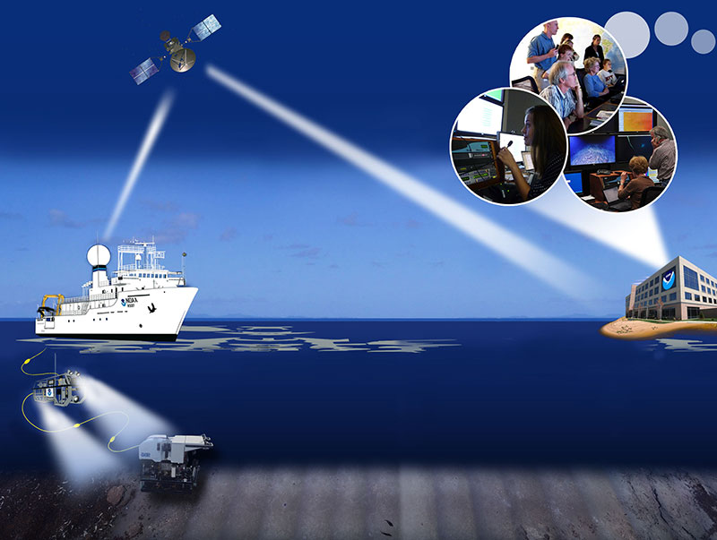
A telepresence-enabled platform, NOAA Ship Okeanos Explorer uses satellite technology to transmit data and video in real-time from the ship and ROVs working at depth, to a shore-based hub where the video is transmitted in high definition out on Internet2 to a variety of receiving stations on shore include a number of Exploration Command Centers located around the country. The University of Rhode Island's Inner Space Center receives the high definition Internet 2 video feed and makes a lower resolution version available via standard internet. Access to the video and a suite of internet-based collaboration and communication tools allows scientists located on shore to join the operation in real-time. Image courtesy of the NOAA Office of Ocean Exploration and Research. Download larger version (jpg, 1.1 MB).
Applying telepresence to an oceanographic expedition alters traditional day-to-day operations. With a science team that can span the globe, the work never stops. Live video, audio commentary, and regular data uploads provide new datasets and information to shore 24 hours a day. Shore-based teams remain in constant communication with the vessel and each other via email, instant messaging (IM), and an IP-based intercom system. All of these mechanisms are used to plan daily operations as well as to participate in the real-time discoveries.
For the Northeast U.S. Canyons 2013 Expedition, Okeanos Explorer is operating with a distributed science participation model. The core team of scientists and students regularly participating in and helping to guide operations have been located at academic institutions and several different offices and programs within both NOAA and the U.S. Geological Survey around the country, and also include scientists from the French Research Institute for Exploitation of the Sea (IFREMER) located in Brest, France.
Each day the geographically dispersed groups report to their respective conference rooms, labs, individual offices, and even home offices to participate in the exploration. So far during this cruise, we have had more than 40 scientists and students participate in ongoing cruise operations in real-time from around the country.

During the first leg of the Northeast U.S. Canyons Expedition, we have had more than 40 students and scientists engaged from two countries, three federal agencies, 15 states, and 16 universities. Image courtesy of the NOAA Office of Ocean Exploration and Research, Northeast U.S. Canyons Expedition 2013. Download larger version (jpg, 621 KB).
Time zone differences can present unique challenges. It requires that the vessel adhere to a strict schedule that both the shipboard and shore-side teams can set schedules to. At set times each day, the collective team participates in planning meetings hosted from the Okeanos Explorer.
Remotely operated vehicle (ROV) operations are conducted daily between 0800 to 1700 local ship time. After an ROV dive, the vessel begins CTD rosette or sub-bottom profiling operations as requested until 2000-2200. The mapping team operates throughout the evening hours until the vessel must end the survey and steam to the next ROV launch site.
On shore, the science team adheres to a similar schedule, adjusted to best mesh with the vessel. The first science team at arrives each day at 0800EDT. As the day progresses, participants in later time zones arrive. At its height, more than 40 ocean scientists, graduate students, and post-docs have actively participated in the exploration.
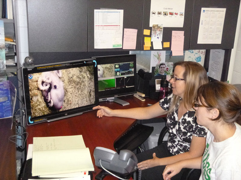
Through the distributed telepresence model used during the Northeast U.S. Canyons 2013 Expedition, the majority of scientists participated from their offices or home. U.S. Geological Survey scientists Amanda Demopoulos and Jennifer McClain-Counts participate from their office in Gainesville, Florida. Image courtesy of the NOAA Office of Ocean Exploration and Research, Northeast U.S. Canyons Expedition 2013. Download larger version (jpg, 543 KB).
The workday begins by downloading and reviewing the latest cruise data and information. This includes daily operation plans; ROV dive plans; ROV dive summary reports; and the latest maps, videos, still images, and raw datasets. The Okeanos Explorer uploads all of this data to the NOAA Office of Ocean Exploration and Research’s shore side repository site each night. As the teams review the information, they watch live high-definition video from the ROV and ship as the ROV descends to the day’s dive site.
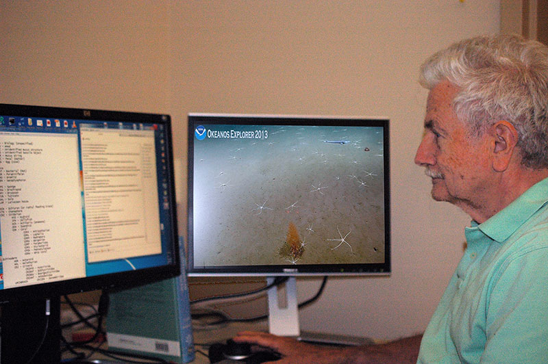
Bob Carney follows along with the expedition from his lab at Louisiana State University. Image courtesy of the NOAA Office of Ocean Exploration and Research, Northeast U.S. Canyons Expedition 2013. Download larger version (jpg, 1.1 MB).
As the ROV continues to descend towards the dive site, the shipboard and shore-side participants communicate verbally via intercom panels installed throughout the vessel and at each Exploration Command Center, and via a teleconference line bridged with the intercoms. Simultaneously, team members use the Okeanos Explorer’s dedicated instant messaging (IM) server to communicate quickly.
As the ROV nears the dive site, planning and other ancillary conversations subside and are replaced with observational comments related to the high-definition video coming from the ROV of the ocean floor.
As the science team concentrates on the dive, their audio commentary and the video from the ROV is recorded onboard. Complementing the audio/video recordings, the collective science team adds their observations to the Okeanos Explorer’s “eventlog”. The eventlog is a multi-user chatroom accessible 24/7 to any cruise participant located anywhere with an Internet connection. All observations are recorded with the same timestamp as the collected data and the timecode embedded into the recorded video. Each day at 0000 UTC, the eventlog is automatically processed and uploaded to the shoreside server for use by the science party.
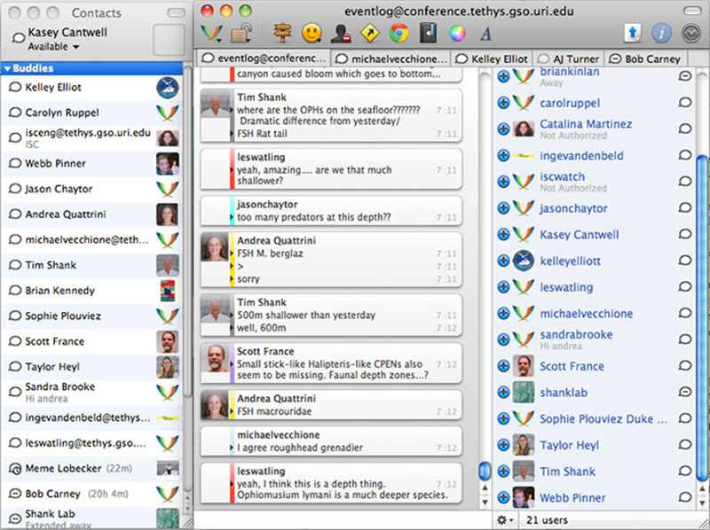
During Leg 1 of the Northeast U.S. Canyons Expedition, an average of one to two dozen scientists and students participated from shore for any one dive. The Okeanos Explorer Program uses a centralized instant messaging system to facilitate communication, and the “eventlog” group chat room (shown here) for scientists and students to discuss and document observations about ongoing operations. Image courtesy of the NOAA Office of Ocean Exploration and Research, Northeast U.S. Canyons Expedition 2013. Download image (jpg, 132).
The excitement of the exploration is not limited to just the cruise participants on the ship and at Exploration Command Centers. Viewers from all over the world are able to watch a compressed version of the live video transmitted over standard Internet which is viewable from the Ocean Explorer website. During ROV dives, over 3,000 people from all over the United States and worldwide tune in to watch the discoveries daily.
Depending on depth, the ROV leaves the seafloor each day between 1500-1600 ship local time. Once the ROV begins its ascent, the shipboard operational and science parties move to the forward lounge for the daily science meeting. The forward lounge on the Okeanos Explorer is equipped with a large, high-definition display and intercom keypanel. It is also connected to the ship’s video router and keyboard/video/mouse (KVM) matrix. This capability transforms the lounge into a telepresence-enabled conference room.
Depending on the requirements, any of the computer displays, live video, and even pre-recorded video can be streamed to the shore-side team members. This capability allows the shipboard team to tap into the full resources of the ship, including the most recent maps and datasets. The team is able to quickly review what objectives have been met and how best to plan the next day’s activities. It allows the science plan to continuously evolve to meet changing science objectives while ensuring vital information is conveyed to all parties.
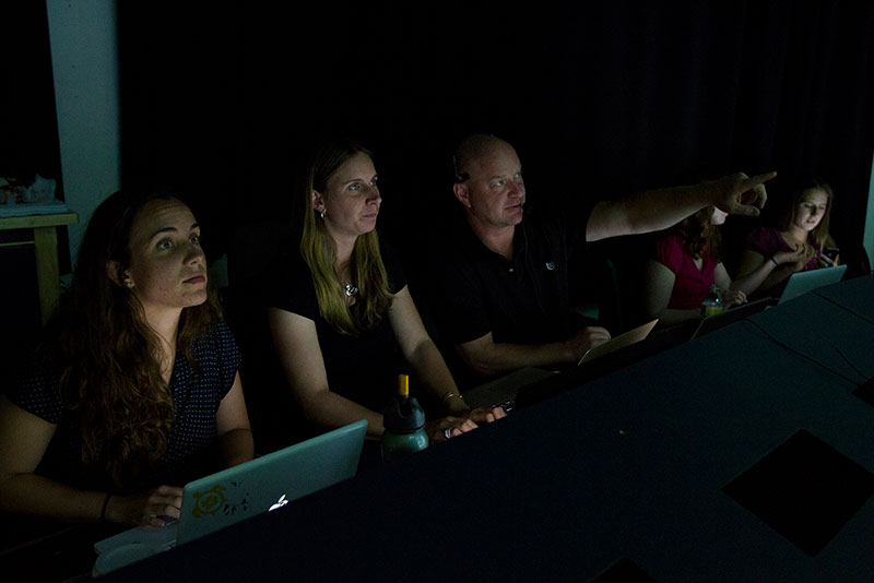
Telepresence provides many opportunities, including training the next generation of scientists. Here, Tim Shank, Co-science team lead for this cruise, and several of his students join the expedition from the Inner Space Center. Image courtesy of the NOAA Office of Ocean Exploration and Research, Northeast U.S. Canyons Expedition 2013. Download larger version (jpg, 1.7 MB).
Once the vehicles are secured on the aft deck, the evening shift begins. The CTD/Mapping teams take over the control room to conduct CTD casts and continue mapping the seafloor. The ROV team performs their post-dive checks and readies the vehicles for the next day. Other members of the ROV team work with the expedition coordinator, lead scientist, and operations officer to identify tomorrow’s ROV launch site, landing site, and dive waypoints. All of this is conveyed to the bridge to help plan the evening’s mapping survey plan. They also process the ROV’s navigation files and write the technical portions of the dive summary report, which is handed over to the Science Team Lead to be added to the final ROV dive summary report. The expedition coordinator writes the situation report (SITREP) summarizing the day’s events and the operations officer finishes the next day’s plan of the day (PoD). The video engineers process all of the collected video, extract video stills and reset the video capture system for the next ROV dive. Throughout the night various servers onboard will automatically collate all of the data, maps, reports, images, and video and transmit everything to the FTP Server on shore so that it is ready for the shore-side team in the morning.
CTD and Mapping operations commence throughout the night. Typically any CTD operations are done first. During CTD operations, the displays from the CTD acquisition workstation are transmitted as video streams to shore, and so are the cameras looking at over-the-side equipment and CTD operators. This provides shore-side participants and public audiences with real-time feedback about current operations and sustains the telepresence connection between the ship and shore. Scientists on shore can watch the live feeds and communicate with the onboard scientists and survey tech using the Okeanos Explorer’s IM server, helping to make decisions such as when to collect water samples during the cast. As with all the data collected by the ROV, all of the CTD and water sample analysis data is uploaded to the FTP site where it can be downloaded for additional processing.
Mapping operations begin once the CTD is on deck. The mapping team works through the night to acquire high-resolution multibeam bathymetry and backscatter data of the seafloor at key areas of interest. Almost as soon as the data is collected the team starts processing it. From each survey, the team builds a standard suite of bathymetry products. These include 3-D Fledermaus objects, geotiffs, Google Earth files (.kmz), and ASCii XYZ text. This suite of products provides an appropriate dataset that can be used by a wide range of GIS tools. All products are uploaded to the FTP site and made available as quickly as possible. In most cases, they are ready for review prior to the next day’s pre-dive meeting.
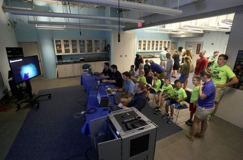
Telepresence allows a variety of institutions to use the live feeds from the ship in their educational and outreach programming. Here the South Carolina Aquarium hosted NOAA scientists as well as aquarium visitors during part of the expedition. Scientists were able to engage with the public and answer questions as they joined the expedition together. Image courtesy of the NOAA Office of Ocean Exploration and Research, Northeast U.S. Canyons Expedition 2013. Download image (jpg, 76 KB).