By Michael Ford - NOAA National Marine Fisheries Service,
Lora Clarke - NOAA National Marine Fisheries Service,
and Stephanie Oakes - NOAA National Marine Fisheries Service
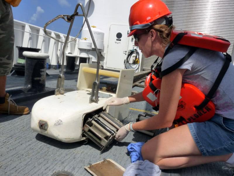
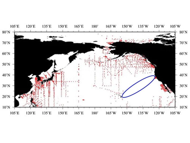
While the NOAA Ship Okeanos Explorer makes its way from Hawaii, mapping the deep ocean, it will have a shadow. A small, towed vehicle (Figure 1) called a Continuous Plankton Recorder (CPR) will always be about 70m behind the ship and just 10m below the waves – for more than 2000 nm. While moving, seawater enters the nose of the CPR and is filtered through a slowly advancing strip of silk mesh, which captures plankton. This will be the second time the Okeanos has towed this CPR. Just a month ago, the CPR was towed for 3146 nm from Guam to Honolulu. The global range of the Okeanos Explorer provides a unique opportunity to constantly sample across large portions of the Pacific. A good source of plankton data from previous surveys shows that this transect will cut across a rarely sampled region (Figure 2).

Figure 1: Lora Clarke (NMFS) loads a cassette containing silk mesh into the body of the Continuous Plankton Recorder on the deck of the NOAA Ship Okeanos Explorer during the trip from Guam to Hawaii last month. The metal fitting on the nose allows water and plankton to be strained through the silk mesh in the cartridge. Image courtesy of NOAA Okeanos Explorer Program and NMFS. Download image (jpg, 106 KB).
Data on the density and species diversity of plankton will provide insights on how this open ocean system works. Of special interest is the trend in these quantities as the transect moves from island to island and then approaches the US west coast. How many changes will there be in species composition? Will we see distinct ranges for certain species? Will we find any new species? Also, looking at the background physical oceanography of the Pacific, more could be learned about the relationship between physics and plankton. Right now, this part of the Pacific Ocean is experiencing sea surface temperatures of about 0.5 – 1.0 C below the average for the region – consistent with a developing La Nina.

Figure 2. Map of locations of plankton collections in the North Pacific from the COPEPOD Database. The ellipse highlights a region that has been historically under sampled – until now. Image courtesy of NOAA National Marine Fisheries Service, COPEPOD Database. Download larger version (jpg, 79 KB).
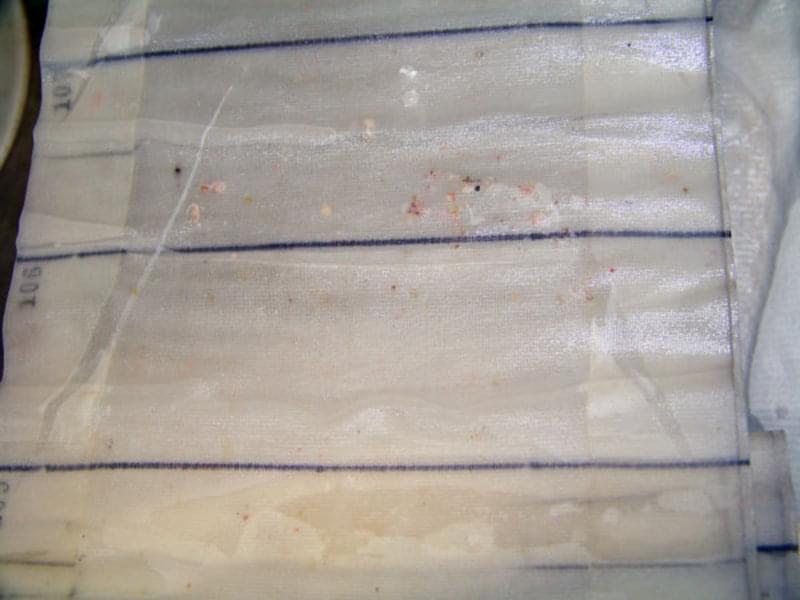
The collection of plankton from over 5100 nm of the Pacific is only half the work. Once the plankton-impregnated silk mesh strips (Figure3) are taken off the ship, they are sent to the laboratory to identify and count the plankton. The quality of this step is just as important as the care that is taken in running the CPR. Once fully quantified, hundreds of tables of species data will be used to reconstruct the entire transect, describing the number and species of plankton along a line from Guam to the US West Coast.

Figure 3. While moving, seawater enters the nose of the CPR and is filtered through a slowly advancing strip of silk mesh that captures plankton. Once the plankton-impregnated silk mesh strips are taken off the ship, they are sent to the laboratory to identify and count the plankton. The silk mesh is removed from the CPR cartridge in this image; the many dots visible in the mesh are zooplankton captured during a CPR tow. Image courtesy of NOAA Okeanos Explorer Program. Download image (jpg, 72 KB).

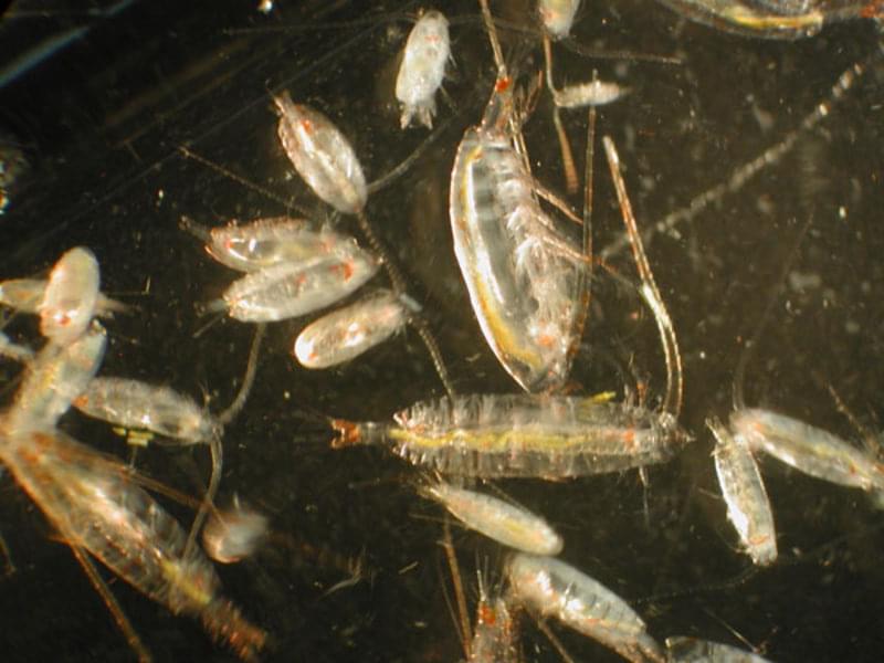
Figure 4. The tiny dots in Figure 3 are tiny zooplankton, difficult to see with the naked eye. Here some zooplankton are imaged under the microscope. Image courtesy of M. Wilson, J. Clark, NOAA NMFS AFSC. Download image (jpg, 103 KB).
The ship's course to the US West Coast will take it through an area from 150 W to 130 W, commonly referred to as the ‘garbage patch’ or the ‘plastic gyre’. Towing the CPR through this feature will allow us to begin to understand the nature of the plankton community that lives there (Figure 4). Once the species are known, connections between the presence of plankton and possible consumption of plastic micro-particles can be made. These connections will allow a better description of the impact that the plastic has on the open ocean food chain, including fish eaten by humans.