by The ACUMEN Team, Various NOAA, State, and Regional Partners

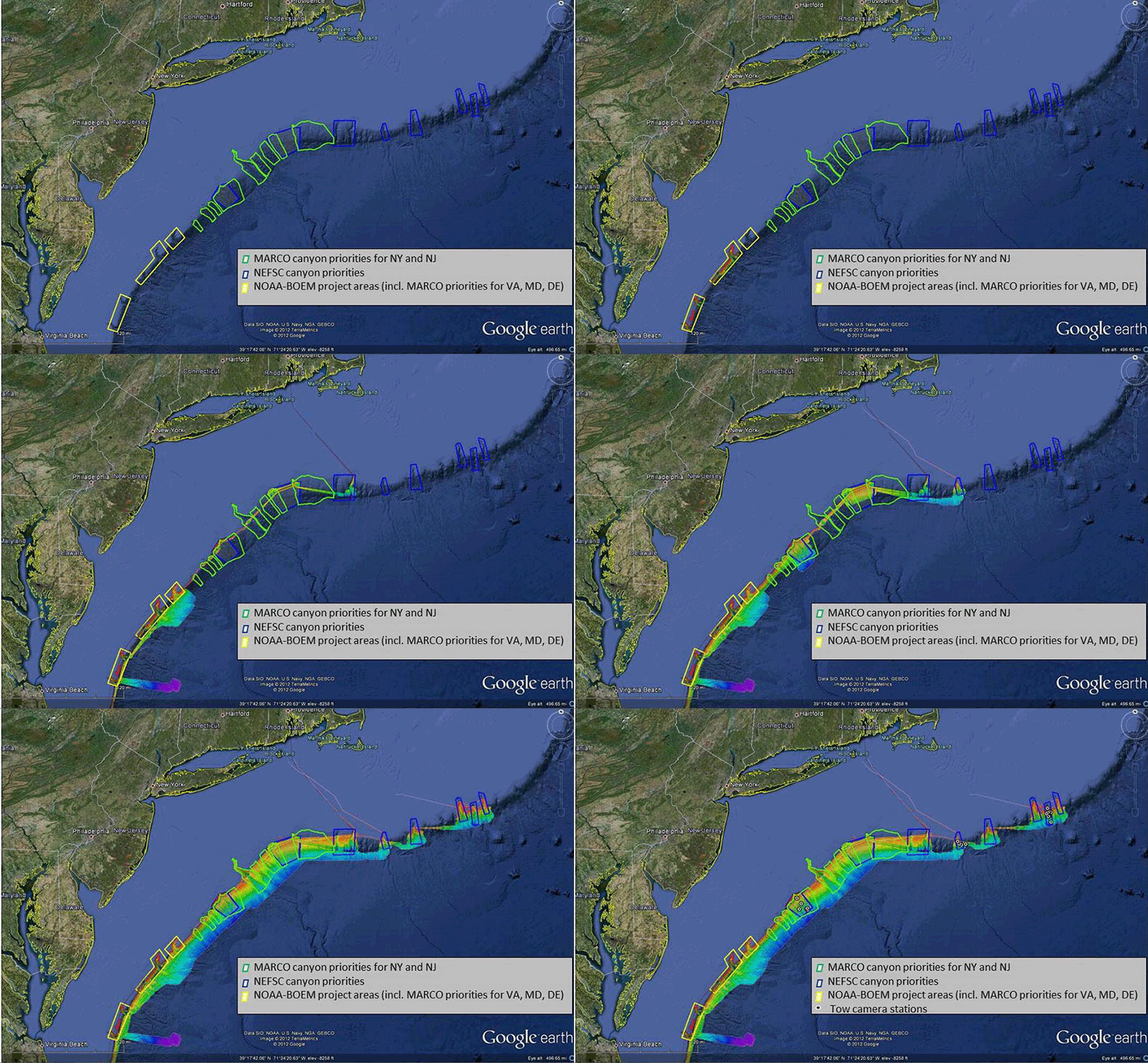
This slideshow of Google Earth images shows the progressing of high-resolution mapping efforts focused on the North Atlantic canyons between the summer of 2011 and summer of 2012. Blue and green areas outline ACUMEN mapping priorities. Yellow boxes outline areas included in a complementary joint NOAA-BOEM project. Slideshow includes high-resolution bathymetry acquired by NOAA Ships Okeanos Explorer, Ferdinand R Hassler, and Nancy Foster. NOAA Ship Bigelow used a towed camera system to groundtruth areas mapped by Okeanos Explorer and Hassler. Mid-Atlantic Regional Council on the Ocean and NOAA priorities are addressed by both the ACUMEN and NOAA-BOEM projects. Images courtesy of ACUMEN 2012, NOAA. To view or download individual images, visit the Image Gallery.
What began as informal dialogue among NOAA and external colleagues early this year quickly evolved into a major field campaign focused on surveying the deepwater canyons along the break of the continental shelf between Virginia and New England. Between February and August 2012, we completed all five component cruises of the Atlantic Canyons Undersea Mapping Expeditions (ACUMEN) project.
In May and June 2012 alone, NOAA Ships Ferdinand R. Hassler and Okeanos Explorer spent approximately 27 days at sea collecting high-resolution bathymetry in deepwater canyons off New York and New Jersey. Shipboard personnel quickly processed the raw data into mapping products to inform the NOAA Ship Henry B. Bigelow ground-truthing mission just two weeks later. Scientists aboard Bigelow used these maps to identify likely habitat for deep-sea corals, and deployed Woods Hole Oceanographic Institution’s towed camera system in a subset of the canyons to directly image these sites. National Marine Fisheries Service and academic scientists are now analyzing the seafloor images to determine species diversity, geographic and bathymetric distributions, and density of corals and other associated fauna.
The complementary joint NOAA-Bureau of Ocean Energy Management (BOEM) expedition on canyons off of Virginia, Maryland, and Delaware is scheduled for August and September.

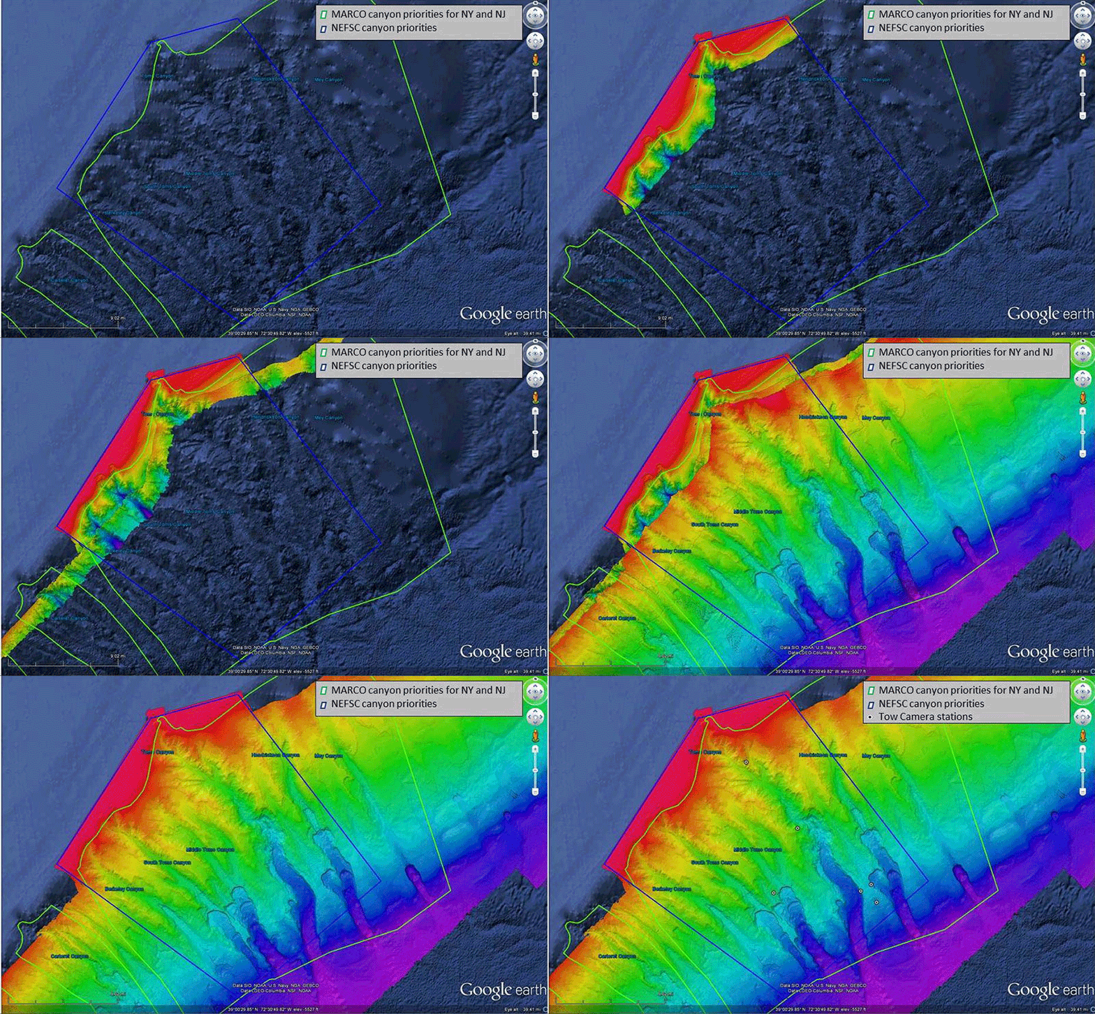
Scientists and managers identified this five-canyon area, the Tom's Canyons complex, as a high-geographic priority. The map displays bathymetry collected by NOAA Ships Okeanos Explorer and Hassler. Yellow dots show the locations of towed camera operations from NOAA Ship Bigelow. Images courtesy of ACUMEN 2012, NOAA. To view or download individual images, visit the Image Gallery.
We have either fully met – or are on track to meet – all of the science, education, and outreach objectives described in the Mission Plan:

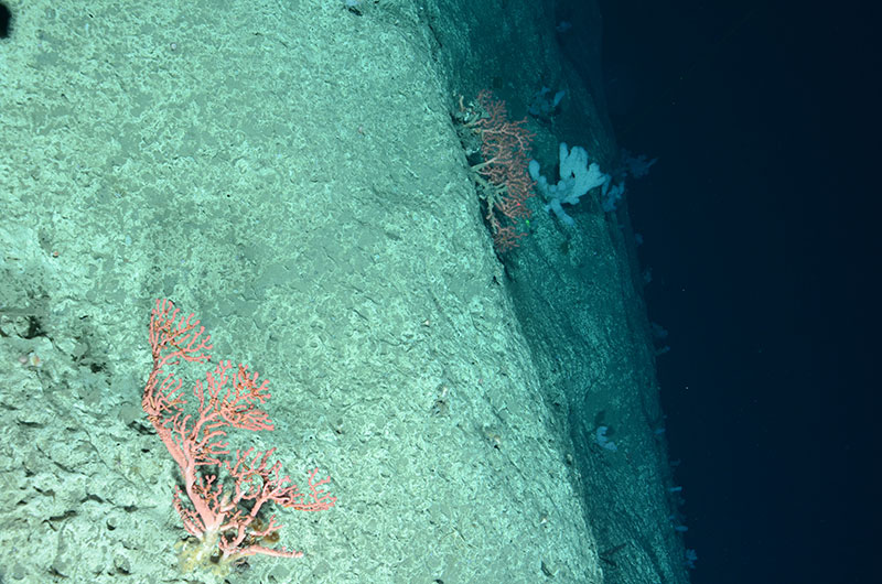
Scientists on the NOAA Ship Henry B. Bigelow used a towed camera system to ground-truth areas previously mapped by NOAA Ships Okeanos Explorer and Ferdinand R. Hassler. The camera imaged this deep-sea coral, Paragorgia arborea, on the edge of Hendrickson Canyon (ca. 1,775 meters) in the Toms Canyon complex. Image courtesy of Nizinski et al. NOAA/NMFS/NEFSC, WHOI 2012. Download larger version (jpg, 9.0 MB).

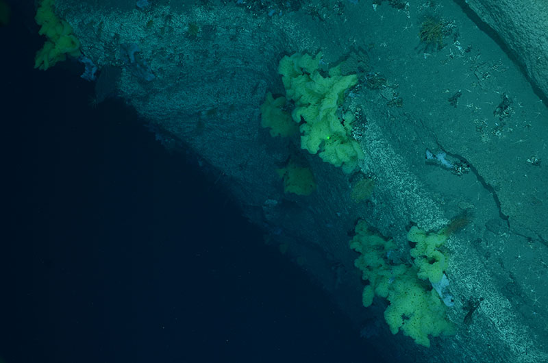
Image taken by Woods Hole Oceanographic Instution’s TowCam aboard the Henry B. Bigelow shows yellow sponges and deep-sea corals on the edge of Middle Tom’s Canyon (ca. 1,600 meters). Image courtesy of Nizinski et al. NOAA/NMFS/NEFSC, WHOI 2012. Download larger version (jpg, 7.6 MB).
Due to this year’s successes, there are growing calls for NOAA and our external partners to leverage this work with an ACUMEN 2013 follow-on campaign. If we can follow through on the preliminary discussions , we will use the information collected this year to fine-tune our criteria and methods to identify likely canyon habitat locations and make plans to explore and characterize additional target sites with a remotely operated vehicle.
Next year, we hope to make it possible for anyone with an Internet connection to become a ‘citizen explorer,’ sharing in real-time exploration and discovery hundreds, even thousands, or meters beneath the sea surface.
Everyone involved in ACUMEN 2012 is optimistic that a major field effort in the summer of 2013 will become a reality. We’ll keep you posted.