What is Hydrography?
Hydrography is the science of measuring and describing the physical features of bodies of water, including the ocean, coastal zones, rivers, and lakes.

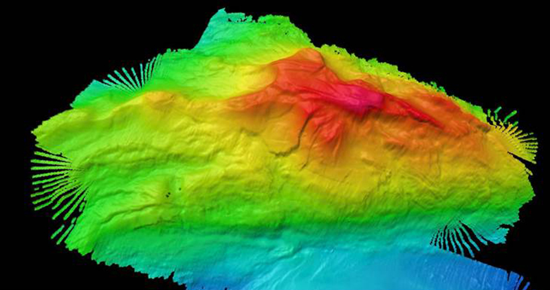
This image of Mona Seamount was generated using data collected from NOAA Ship Okeanos Explorer. Image courtesy of the NOAA Office of Ocean Exploration and Research, Océano Profundo 2015: Exploring Puerto Rico’s Seamounts, Trenches, and Troughs. Download image (jpg, 266 KB).
At NOAA Ocean Exploration, hydrographers are specifically interested in the bathymetry — or underwater topography — of the ocean floor. They use multibeam sonar and other instruments to collect bathymetric data, gridding millions of data points, or soundings, to generate high-resolution maps of the seafloor.
The maps that modern-day hydrographers create are part of a long tradition of use in navigating the ocean for fishing and commerce, transportation, and exploration. Today, hydrographic maps are also important in informing ocean resource management policies, predicting geohazards, and characterizing habitats.
Aboard exploration vessels such as NOAA Ship Okeanos Explorer, deep-sea mapping work is also essential for selecting remotely operated vehicle dive sites, and lays the groundwork for future scientific research and inquiry.
Beyond NOAA Ocean Exploration, some hydrographers also study the physical and chemical properties of the sea and other waters, such as temperature, dissolved oxygen, and salinity.