By Max Woolsey, Undersea Systems Engineer, University of Southern Mississippi
July 1, 2019
This morning we deployed another set of microbial recruitment experiments and collected more photos and core samples to finish our work at the unknown shipwreck at Site 15711. Now we are travelling to the next and final shipwreck site. Currently, the R/V Point Sur is steaming 106 nautical miles due south of the intersection of Highway 614 and Old River Road in Vancleave, MS.
I am an unmanned maritime systems engineer at the University of Southern Mississippi. During my ten years of working with seafloor landers and marine vehicles, one challenge I’ve faced involves localization of undersea systems. In the context of our work, the position reference given above is, “absolutely correct but completely useless,” as an adviser of mine might describe it. At sea, we typically define a location by latitude and longitude—essentially a spherical grid that covers the globe. For us, these coordinates are as useful as a street address on land. Above the water, people rely daily on global navigation systems like GPS, but this resource is not directly applicable to undersea systems since the electrical signals from the satellites cannot be received through the expanse of seawater. Instead we depend on acoustic signals—various pings, chirps, and sweeps—to track devices, communicate with them, and perform measurements of distances and water current.

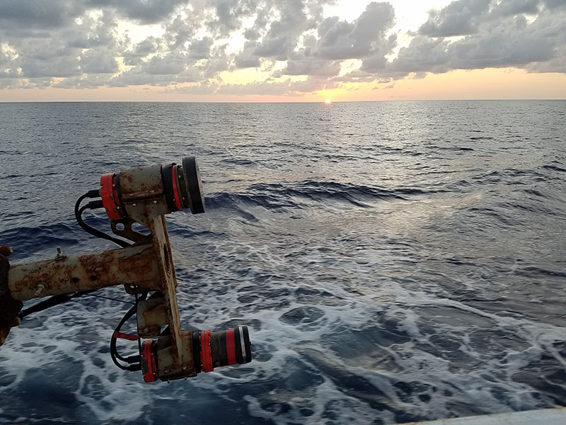
USBL directional receiver (top) and interrogation transmitter (bottom), lifted out of the water for inspection and transit between sites. Image courtesy of Microbial Stowaways. Download larger version (jpg, 3.8 MB).
One such acoustic tool is the ultra-short baseline (USBL) system used to track the position of the remotely operated vehicle (ROV) while it is submerged. The acoustic tracking is combined with the coordinates of the ship to provide estimated latitude and longitude of the ROV, which is displayed on a map of the area where we have marked points of interest. We use the tracking system to guide us towards the shipwrecks and the lander deployment sites selected during mission planning. From this position estimate, the ROV uses its scanning sonar to locate the structure of the wreck itself and proceed until we get a visual on the wreck. Monitoring the scanning sonar informs the ROV pilot and scientists about the relative positioning with respect to the outline of the shipwreck and the experiments that we place nearby.

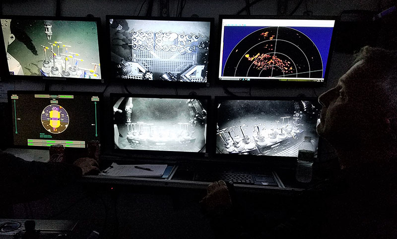
Structure of shipwreck visible on scanning sonar (display at top right) while ROV operator Paul Sanacore prepares to collect a sediment core with the manipulator arm. Image courtesy of Microbial Stowaways. Download larger version (jpg, 1.6 MB).
Two of the landers are equipped with yet another acoustic instrument, a current meter known as an acoustic doppler current profiler (ADCP). These units will record water speed and direction around the wreck sites for the next few months to provide additional information about their environment which could affect microbial movement. Other acoustic devices are used for data and signaling. On each lander, a burn-wire release mechanism awaits an acoustic message commanding it to the surface. When the message is received, a current is sent through the wire causing it to dissolve, thus releasing a latch holding the lander to the bottom. In November, at the conclusion of the sampling period, each lander with its attached array of microbial recruitment experiments will return to the surface after being sent an acoustic command. During recovery, the individual experiment systems containing biofilms will seal themselves for the ride to the surface, ready to be reeled up aboard the ship and sampled by the Hamdan Lab.

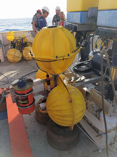
Lander mounted on Odysseus ROV, showing the tangerine-colored ADCP at left and microbial recruitment experiments with rigging secured under the rear platform of the ROV. Image courtesy of Microbial Stowaways. Download larger version (jpg, 2.9 MB).