
By Curt Whitmire
October 16, 2019
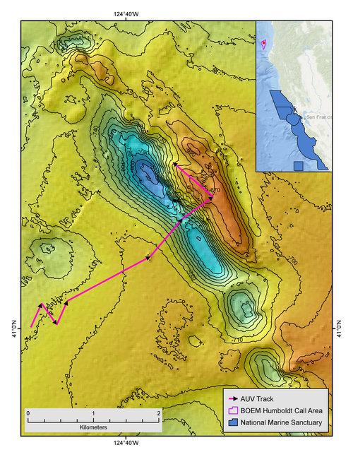
Figure. 1. Location of AUV Dive #7 at Bureau of Ocean Energy Management Humboldt Call Area off Eureka, CA. Image courtesy of the Surveying Deep-sea Corals, Sponges, and Fish Habitat Off the U.S. West Coast expedition. Download larger version (jpg, 3.2 MB).
Just after breakfast each day on NOAA Ship Reuben Lasker, the Autonoumous Underwater Vehicle (AUV) Team heads up to the bridge for a safety meeting with Commanding Officer Chad Cary and officers and deck crew currently on watch. They review the day’s planned AUV mission, discuss the current and forecasted weather, vessel traffic, etc., and assess whether or not it is safe to deploy AUV Popoki. On this particular day, the seas and winds are favorable, and it looks to be the last dive before the ship will head south to San Francisco ahead of large swells forecast for the northern California coast. The AUV will be surveying a potential wind farm lease area off Eureka, California, designated by the Bureau of Ocean Energy Management (BOEM ).
The SeaBED AUV is a hover-capable vehicle designed and built by Seabed Technologies, Inc. in Falmouth, Massachusetts. It is ideally suited to collect photographic imagery of the seafloor, for a variety of purposes including reconnaissance, habitat characterization, and quantitative transects. For this cruise, Popoki, is outfitted with three, machine vision cameras – one that provides an oblique perspective for fish identification and the other two mounted vertically as a stereo pair to provide precise linear and areal measurements. Other sensors include a CTD for temperature-salinity profiles, an oxygen optode to measure dissolved oxygen, and a miniature autonomous plume recorder (MAPR) to detect hydrothermal plumes.
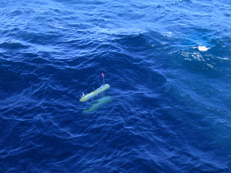
Figure 2. AUV Popoki at the surface after completing a dive. Image courtesy of the Surveying Deep-sea Corals, Sponges, and Fish Habitat Off the U.S. West Coast expedition. Download larger version (jpg, 6.2 MB).
Popoki is launched from the ship around 8:30 am where it descends for about 50 minutes until it reaches a target altitude above the seafloor of 2.5 meters (8.2 feet). Over the next 1.5 hours, it cuts a sawtooth pattern over flat, muddy seafloor at 700 meters (2,300 feet) depth (Figure 1), snapping images every eight seconds.
Unlike the remotely operated vehicles, which transmit video via a tether almost instantaneously to the control room on the ship, the AUV stores her images, along with all other sensor data, on onboard computers until they can be retrieved after the AUV is recovered at the end of the dive. The only indication the AUV Team has that Popoki is operating as planned is through regular telemetry messages transmitted via an acoustic modem. Those messages sound vaguely similar to a fax machine and are parsed by computers in the AUV control room into human readable messages that relay information on where the AUV is along its programmed track, its depth, altitude and heading, how many photos it has captured, and its current battery state.
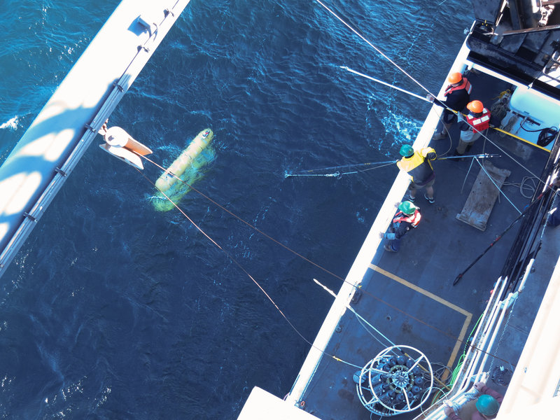
Figure 3. AUV Popoki being recovered to the ship after completing a dive. Image courtesy of the Surveying Deep-sea Corals, Sponges, and Fish Habitat Off the U.S. West Coast expedition. Download larger version (jpg, 6.7 MB).
After finishing the programmed sawtooth pattern, Popoki transits east towards a large ridge feature identified in the bathymetry imagery. Although we cannot see what Popoki sees during the dive, the AUV Team tracks her progress over various features via those telemetry messages. Sometimes, there are tense moments when those messages tell us she isn’t making forward progress along her track, but this dive progresses as planned and after five hours, she begins her ascent to the surface. The AUV Team tracks her ascent and provides regular updates to the bridge on her depth, time to surface, and relative location to the ship.
As Popoki breeches the surface, the bridge spots her orange flag and yellow “skins” and positions the ship for recovery (Figure 2). Members of the AUV Team and deck crew prepare long poles to snag lines on Popoki so she can be safely lifted out of the water and brought aboard (Figure 3).
After she is secured in her cradle, the AUV Team connects power and ethernet cables to the AUV so data and images can be downloaded. Depending on the length of dive, the download process can take 30 minutes or more, and then data and images are processed into various post-dive products, including a dive track (Figure 4a), profile (Figure 4b), T-S plot (Figure 4c) and thousands of color-corrected photographs of the seafloor.
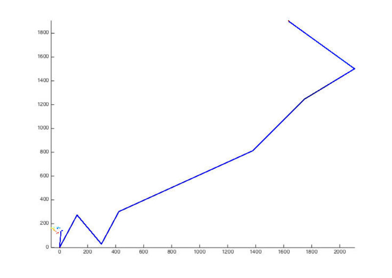
Figure 4a: Example AUV post-dive products including XY plot. Image courtesy of the Surveying Deep-sea Corals, Sponges, and Fish Habitat Off the U.S. West Coast expedition. Download larger version (jpg, 71 KB).
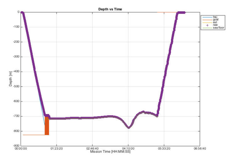
Figure 4b: Example AUV post-dive products including depth profile. Image courtesy of the Surveying Deep-sea Corals, Sponges, and Fish Habitat Off the U.S. West Coast expedition. Download larger version (jpg, 2.8 MB).
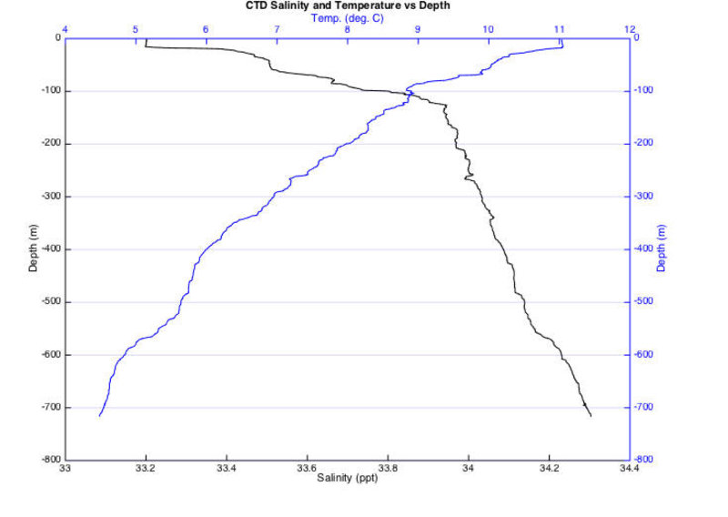
Figure 4c: Example AUV post-dive products including T-S profile. Image courtesy of the Surveying Deep-sea Corals, Sponges, and Fish Habitat Off the U.S. West Coast expedition. Download larger version (jpg, 101 KB).
For this dive in the wind farm lease area, the seafloor is mostly muddy with a common complement of animals, including thornyheads, sea pens and brittle stars (Figure 5a). At the ridge feature, the habitat changes to higher coverage of exposed rock and a slightly different community of animals, including sablefish, crabs, and hydroids (Figure 5b). At the end of the cruise, the AUV Team will package all of the data and images collected during the dive and share it with our BOEM collaborators in order for them to make more informed leasing decisions on wind energy projects. This operation is a great example of how the EXPRESS campaign is changing the traditional model of offshore research and exploration, as we can address the science needs of multiple agencies during a single cruise.
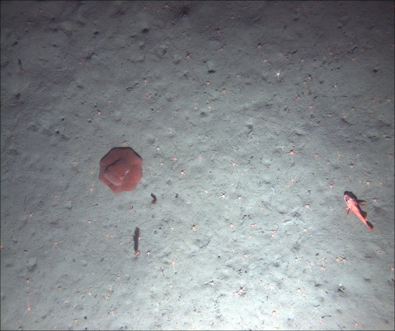
Figure 5a: Example seafloor images from AUV Dive #7 at BOEM Humboldt Call Area off Eureka, California. The first image (a) shows a muddy seafloor with soft-bottom animals, including a flapjack devilfish (Opisthoteuthis californiana), longspine thornyhead (Sebastolobus altivelis), two sea pens (Halipteris sp.), and several brittle stars. Image courtesy of the Surveying Deep-sea Corals, Sponges, and Fish Habitat Off the U.S. West Coast expedition. Download larger version (jpg, 2.7 MB).
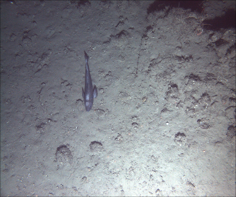
Figure 5b: Low relief, mixed rocky and muddy habitat on a large ridge feature towards the end of the dive, with a sablefish (Anoplopoma fimbria), a decorator crab (Chorilia sp.), several brittle stars, and hydroids. Image courtesy of the Surveying Deep-sea Corals, Sponges, and Fish Habitat Off the U.S. West Coast expedition. Download larger version (jpg, 3.0 MB).